Download
3D Flyover
Add to list
More
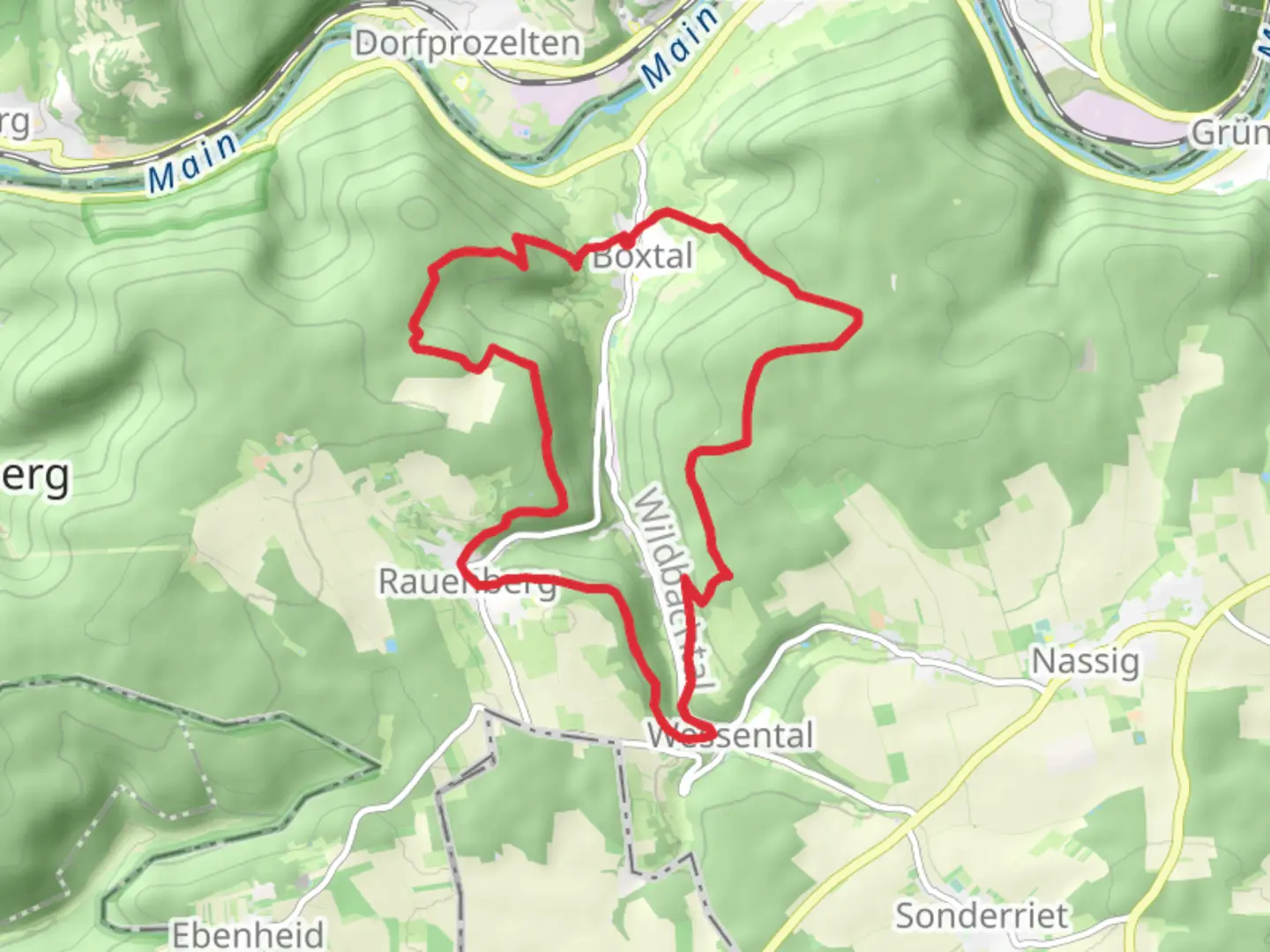
16.7 km
~4 hrs 11 min
512 m
Loop
“Explore the enchanting Tauber Valley trail, offering lush landscapes, historical sites, and rewarding vistas.”
Nestled in the picturesque region of Main-Tauber-Kreis, Germany, this loop trail offers a delightful journey through the serene landscapes of the Tauber Valley. Spanning approximately 17 kilometers (about 10.5 miles) with an elevation gain of around 500 meters (approximately 1,640 feet), this medium-difficulty trail is perfect for those seeking a moderately challenging hike with rewarding views and historical insights.
Getting There
The trailhead is conveniently located near the charming town of Wertheim, which is accessible by both car and public transport. If you're driving, you can reach Wertheim via the A3 motorway, taking the exit towards Wertheim/Lengfurt. For those relying on public transport, Wertheim is well-connected by train, with regular services from major cities like Frankfurt and Würzburg. From Wertheim, local buses or a short taxi ride can take you to the trailhead.
Trail Highlights
As you embark on this loop, you'll be greeted by the lush greenery and rolling hills characteristic of the Tauber Valley. The trail meanders through dense forests and open meadows, offering a diverse range of flora and fauna. Keep an eye out for native wildlife such as deer and various bird species that inhabit the area.
Historical Significance
The region is steeped in history, with several landmarks along the trail that hark back to its storied past. One notable site is the ruins of the Wertheim Castle, perched atop a hill overlooking the town. Although not directly on the trail, a short detour will reward you with panoramic views of the Main and Tauber rivers. The castle dates back to the 12th century and offers a glimpse into the medieval history of the region.
Further along the trail, you'll encounter remnants of ancient settlements and traditional half-timbered houses that dot the landscape, providing a window into the architectural heritage of the area.
Navigating the Trail
The Boxtal and Wessental Loop is well-marked, but it's always wise to have a reliable navigation tool at hand. The HiiKER app is an excellent resource for real-time trail maps and updates, ensuring you stay on course throughout your hike.
Nature and Scenery
The trail's varied terrain includes gentle ascents and descents, with the highest points offering breathtaking vistas of the surrounding countryside. In spring and summer, the meadows burst into color with wildflowers, while autumn transforms the forests into a tapestry of reds and golds. The trail also passes by several small streams and brooks, providing tranquil spots to rest and enjoy the natural beauty.
Practical Tips
Given the moderate difficulty of the trail, it's advisable to wear sturdy hiking boots and bring plenty of water, especially during warmer months. Weather in the region can be unpredictable, so packing a light rain jacket is recommended. The loop can typically be completed in 4 to 6 hours, depending on your pace and the number of stops you make to soak in the scenery.
Whether you're a seasoned hiker or a nature enthusiast, this trail offers a perfect blend of natural beauty, historical intrigue, and a satisfying physical challenge.

Comments and Reviews
User comments, reviews and discussions about the Boxtal and Wessental Loop, Germany.
average rating out of 5
0 rating(s)