
Download
3D Flyover
Add to list
More
3.8 km
~57 min
111 m
Point to Point
“Embark on a scenic, moderately challenging 4-km hike through Spessart's lush forests from Obersfeld to Effelbach.”
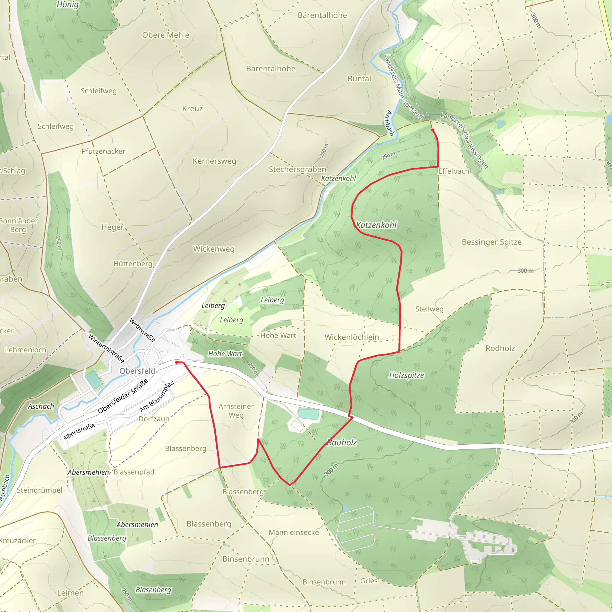
Starting your hike near Main-Spessart, Germany, the trail from Obersfeld to Effelbach via Katzenkohl offers a delightful journey through the scenic Spessart region. This point-to-point trail spans approximately 4 kilometers (2.5 miles) with an elevation gain of around 100 meters (328 feet), making it a moderately challenging hike suitable for those with some hiking experience.
Getting There
To reach the trailhead, you can either drive or use public transport. If driving, head towards the village of Obersfeld, which is easily accessible from the A3 motorway. Parking is available near the trailhead. For those using public transport, take a train to the nearest major station in Gemünden am Main, and from there, a local bus can take you to Obersfeld.
Trail Overview
The trail begins in the quaint village of Obersfeld, nestled in the heart of the Spessart forest. As you set off, you'll be greeted by a mix of deciduous and coniferous trees, providing a lush canopy overhead. The initial part of the trail is relatively flat, allowing you to ease into the hike.
Key Landmarks and Nature
At around the 1-kilometer (0.6-mile) mark, you'll come across the Katzenkohl, a small but picturesque stream that meanders through the forest. This is a great spot to take a short break and enjoy the serene surroundings. The trail then begins a gentle ascent, gaining approximately 50 meters (164 feet) in elevation over the next kilometer (0.6 miles).
As you continue, keep an eye out for the diverse wildlife that inhabits the Spessart region. Deer, foxes, and a variety of bird species are commonly spotted along this trail. The forest floor is often carpeted with wildflowers in the spring and summer months, adding a splash of color to your hike.
Historical Significance
The Spessart region is steeped in history, with its dense forests once serving as a hideout for bandits and outlaws in the Middle Ages. The trail itself passes near several ancient trade routes that were vital for merchants traveling between Frankfurt and Würzburg. While the trail does not directly intersect with these routes, the historical significance of the area adds an intriguing layer to your hike.
Navigation and Safety
The trail is well-marked, but it's always a good idea to have a reliable navigation tool. HiiKER is an excellent app for this purpose, providing detailed maps and real-time tracking to ensure you stay on course. The trail can be muddy and slippery after rain, so sturdy hiking boots are recommended. Additionally, bring plenty of water and snacks, as there are no facilities along the trail.
Final Stretch
The final stretch of the hike involves a descent into the village of Effelbach. This section is relatively steep, dropping about 50 meters (164 feet) over the last kilometer (0.6 miles). Take your time and watch your footing, especially if the trail is wet.
Upon reaching Effelbach, you'll find a charming village with traditional German architecture. There are a few local eateries where you can enjoy a well-deserved meal and perhaps a refreshing drink to celebrate the completion of your hike.
This trail offers a perfect blend of natural beauty, historical intrigue, and moderate physical challenge, making it a rewarding experience for any hiker.
What to expect?
Activity types
Comments and Reviews
User comments, reviews and discussions about the Obersfeld to Effelbach via Katzenkohl, Germany.
average rating out of 5
0 rating(s)
