
Download
3D Flyover
Add to list
More
10.0 km
~2 hrs 29 min
294 m
Loop
“Explore the scenic 10km Gelnhaeuser Rundweg 6, blending nature, history, and moderate hiking challenges.”
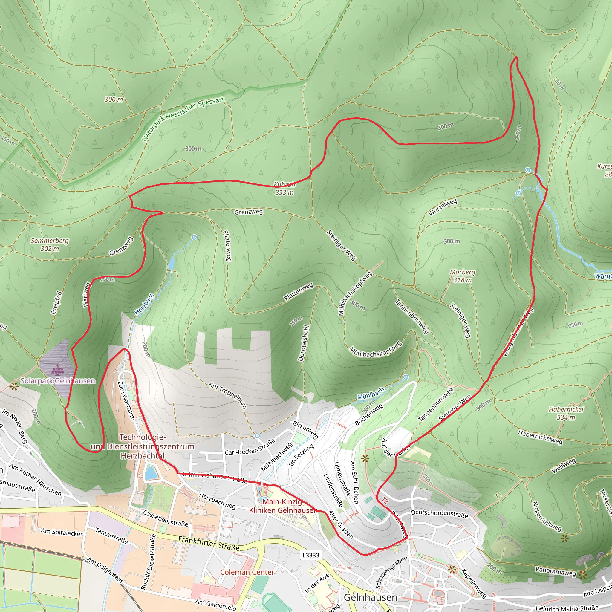
Starting near Main-Kinzig-Kreis, Germany, the Gelnhaeuser Rundweg 6 is a scenic loop trail that spans approximately 10 kilometers (6.2 miles) with an elevation gain of around 200 meters (656 feet). This trail is rated as medium difficulty, making it suitable for moderately experienced hikers.
Getting There
To reach the trailhead, you can either drive or use public transport. If driving, set your GPS to Gelnhausen, a town in the Main-Kinzig-Kreis district. There are several parking options available in the town center. For those using public transport, Gelnhausen is well-connected by train. The Gelnhausen train station is a convenient starting point, and from there, it's a short walk to the trailhead.
Trail Navigation
For navigation, it's highly recommended to use the HiiKER app, which provides detailed maps and real-time updates. The trail is well-marked, but having a reliable navigation tool can enhance your hiking experience.
Trail Highlights
As you embark on the Gelnhaeuser Rundweg 6, you'll traverse a variety of landscapes, including dense forests, open meadows, and charming rural areas. The trail offers a mix of natural beauty and historical landmarks, making it a rich experience for hikers.
Historical Significance
Gelnhausen is known for its medieval architecture and historical significance. One of the key landmarks you'll encounter is the Marienkirche, a stunning Gothic church dating back to the 13th century. Approximately 3 kilometers (1.9 miles) into the hike, you'll come across the ruins of the Imperial Palace of Barbarossa, a significant historical site that offers a glimpse into the region's past.
Nature and Wildlife
The trail is abundant with diverse flora and fauna. In the spring and summer months, the meadows are adorned with wildflowers, and the forests are lush with greenery. Keep an eye out for local wildlife such as deer, foxes, and a variety of bird species. The trail also passes by several small streams, providing a serene backdrop and opportunities for spotting aquatic life.
Elevation and Terrain
The elevation gain of 200 meters (656 feet) is spread out over the course of the trail, with a few moderate ascents and descents. The terrain is varied, ranging from well-trodden paths to rocky sections, so sturdy hiking boots are recommended. The highest point of the trail offers panoramic views of the surrounding countryside, making the climb well worth the effort.
Practical Tips
- Water and Snacks: There are no facilities along the trail, so bring enough water and snacks to sustain you for the duration of the hike.
- Weather: Check the weather forecast before you set out. The trail can be muddy and slippery after rain, so appropriate footwear is essential.
- Clothing: Dress in layers, as the weather can change rapidly, especially in the forested areas.
Points of Interest
- Marienkirche: Located near the start of the trail, this Gothic church is a must-see.
- Imperial Palace of Barbarossa: Approximately 3 kilometers (1.9 miles) in, these ruins offer a historical detour.
- Panoramic Viewpoint: Around the halfway mark, this spot provides breathtaking views of the Main-Kinzig-Kreis region.
By following these guidelines and using the HiiKER app for navigation, you'll be well-prepared to enjoy the Gelnhaeuser Rundweg 6.
Comments and Reviews
User comments, reviews and discussions about the Gelnhaeuser Rundweg 6, Germany.
4.0
average rating out of 5
1 rating(s)
