
Download
3D Flyover
Add to list
More
11.4 km
~2 hrs 59 min
426 m
Loop
“Explore a scenic Black Forest loop with historical charm and rewarding panoramic views near Lörrach.”
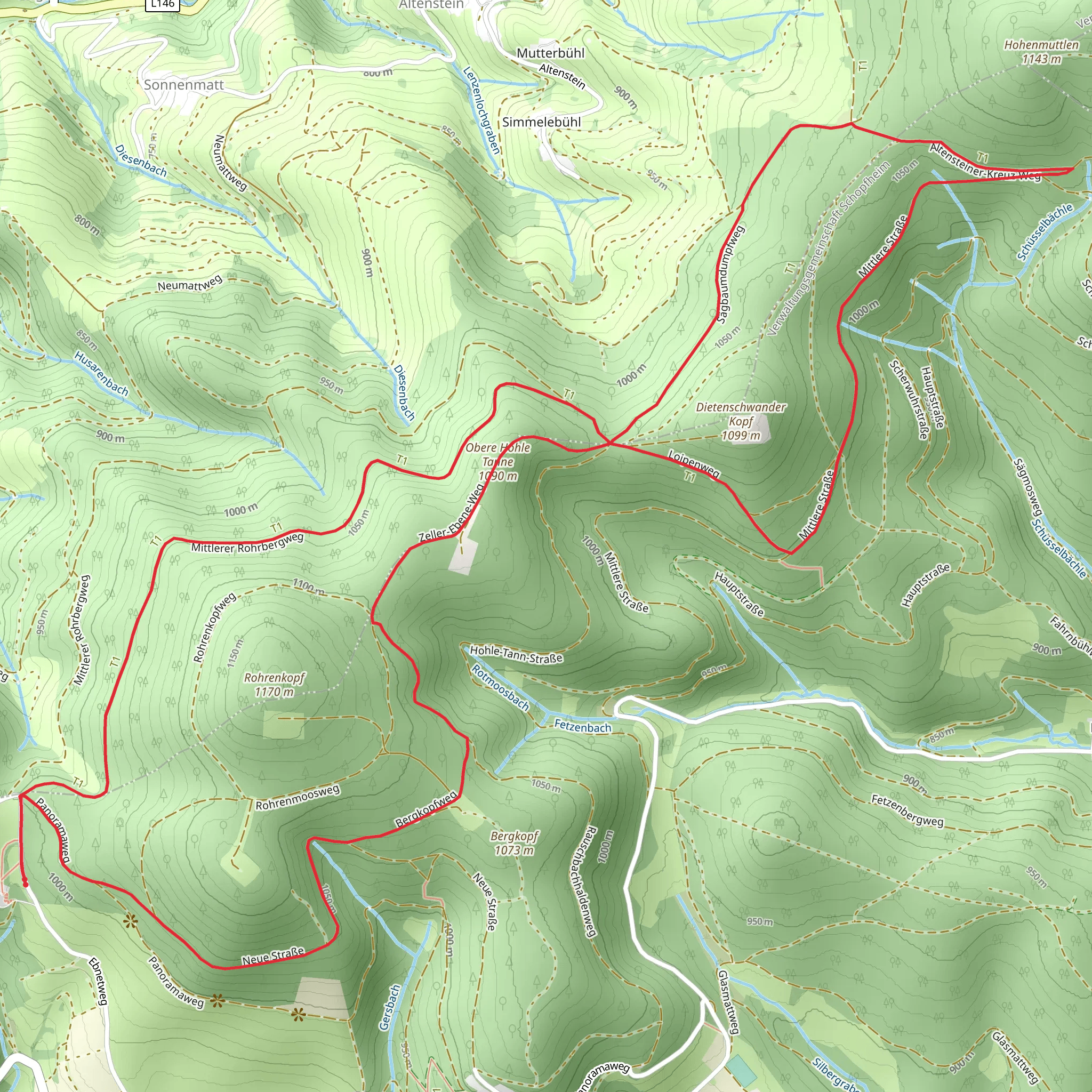
Nestled in the picturesque Black Forest region of Germany, the Obere Hohle Tanne via Westweg and Laipen Weg trail offers a delightful loop hike of approximately 11 kilometers (about 6.8 miles) with an elevation gain of around 400 meters (approximately 1,312 feet). This medium-difficulty trail begins near the charming town of Lörrach, making it accessible for both locals and visitors.
Getting There
To reach the trailhead, you can travel by car or public transport. If driving, Lörrach is well-connected via the A98 motorway, and there are parking facilities available near the trailhead. For those using public transport, Lörrach is accessible by train, with regular services from major cities like Basel and Freiburg. From the Lörrach Hauptbahnhof (main train station), local buses can take you closer to the starting point of the hike.
Trail Highlights
Westweg Section
The trail initially follows a segment of the renowned Westweg, one of Germany's oldest and most famous long-distance hiking routes. As you embark on this journey, you'll be greeted by dense forests typical of the Black Forest, with towering pines and spruces creating a serene canopy overhead. This section of the trail is relatively gentle, allowing you to ease into the hike while enjoying the tranquil surroundings.
Laipen Weg and Scenic Views
As you transition onto the Laipen Weg, the trail begins to ascend more steeply, offering a moderate challenge. This part of the hike is particularly rewarding, as it provides stunning panoramic views of the surrounding valleys and hills. On clear days, you might even catch a glimpse of the distant Swiss Alps. Keep an eye out for the diverse flora and fauna that inhabit this region, including deer, foxes, and a variety of bird species.
Historical Significance
The Black Forest is steeped in history and folklore, and this trail is no exception. The area around Lörrach has been inhabited since Roman times, and remnants of ancient settlements can still be found in the region. The Westweg itself has historical significance, having been established in 1900 as one of the first long-distance hiking trails in Germany. As you hike, you may encounter old boundary stones and markers that tell stories of the past.
Navigation and Safety
While the trail is well-marked, it's always wise to have a reliable navigation tool at hand. The HiiKER app is an excellent resource for this trail, providing detailed maps and real-time navigation assistance. Ensure you wear sturdy hiking boots, as some sections can be rocky and uneven, especially after rain. Carry sufficient water and snacks, and be prepared for changing weather conditions, typical of the Black Forest region.
This loop trail offers a perfect blend of natural beauty, historical intrigue, and a satisfying physical challenge, making it a must-visit for any hiking enthusiast exploring the Black Forest.
Comments and Reviews
User comments, reviews and discussions about the Obere Hohle Tanne via Westweg and Laipen Weg, Germany.
4.0
average rating out of 5
3 rating(s)
