Download
3D Flyover
Add to list
More
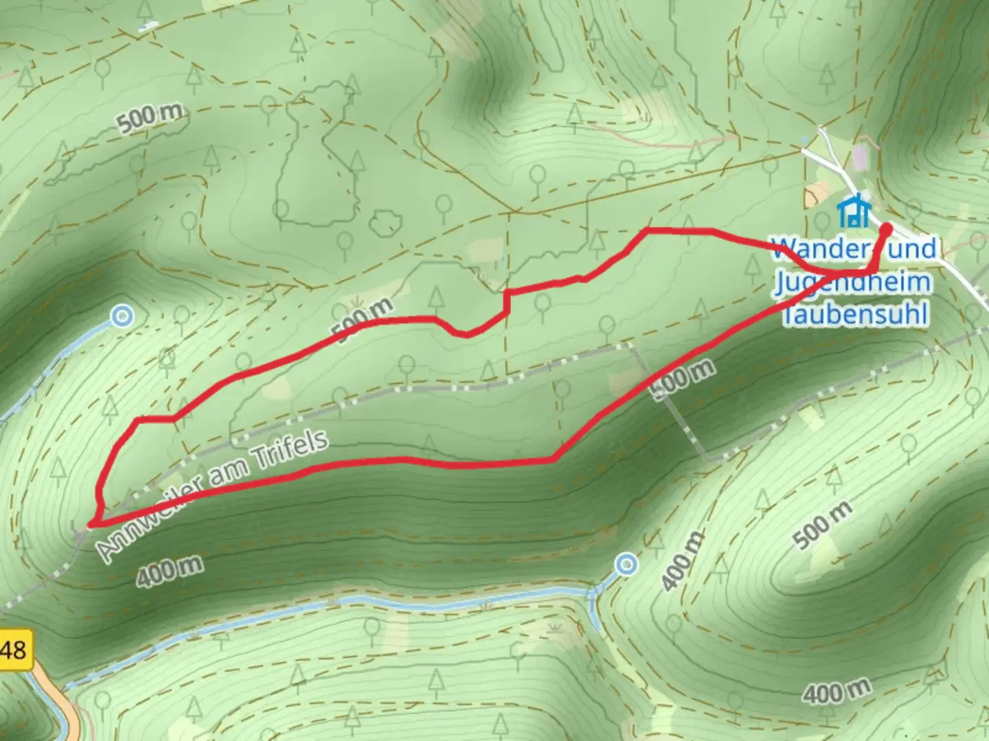
4.7 km
~1 hrs 7 min
106 m
Loop
“Explore the enchanting 5 km Rundwanderweg Taubensuhl Loop, a moderately challenging trail through the lush Palatinate Forest.”
Starting near Landau in der Pfalz, Germany, the Rundwanderweg Taubensuhl Loop is a delightful 5 km (approximately 3.1 miles) trail with an elevation gain of around 100 meters (328 feet). This loop trail is rated as medium difficulty, making it suitable for moderately experienced hikers.
Getting There
To reach the trailhead, you can drive or use public transport. If driving, head towards Landau in der Pfalz and follow signs to the Taubensuhl area. For those using public transport, take a train to Landau in der Pfalz and then a local bus towards Taubensuhl. The nearest significant landmark to the trailhead is the Taubensuhl Forsthaus, a well-known forest lodge.
Trail Navigation
The trail is well-marked, but it's always a good idea to have a reliable navigation tool like HiiKER to ensure you stay on track. The loop begins and ends near the Taubensuhl Forsthaus, making it easy to navigate.
What to Expect
The trail meanders through the lush Palatinate Forest, offering a mix of dense woodlands and open clearings. Early in the hike, you'll encounter a gentle ascent, gaining about 50 meters (164 feet) in the first 1.5 km (0.9 miles). This section is shaded by towering pine and beech trees, providing a cool and serene environment.
Landmarks and Points of Interest
Around the 2 km (1.2 miles) mark, you'll come across the historic Taubensuhl Forsthaus. This forest lodge has been a part of the region's history for centuries, serving as a resting point for travelers and a hub for forest management. Take a moment to appreciate the rustic architecture and perhaps snap a few photos.
Continuing on, the trail levels out and offers stunning views of the surrounding forest. Keep an eye out for local wildlife, including deer, foxes, and a variety of bird species. The Palatinate Forest is known for its biodiversity, so you might even spot some rare plants and fungi along the way.
Midpoint and Elevation Gain
At approximately 3 km (1.9 miles), you'll reach the highest point of the trail, with an elevation gain of around 100 meters (328 feet). This section provides panoramic views of the forest canopy and the distant hills. It's a great spot to take a break, hydrate, and enjoy a snack.
Descent and Return
The final 2 km (1.2 miles) of the trail involve a gentle descent back towards the trailhead. This part of the hike is relatively easy, allowing you to relax and enjoy the surroundings. The path winds through a mix of deciduous and coniferous trees, offering a variety of sights and sounds.
Practical Tips
- Wear sturdy hiking boots, as the trail can be uneven in places.
- Bring plenty of water, especially during the warmer months.
- A light snack or packed lunch can be enjoyable at the midpoint.
- Use HiiKER for navigation to ensure you stay on the correct path.
The Rundwanderweg Taubensuhl Loop offers a perfect blend of natural beauty, historical significance, and moderate physical challenge, making it a rewarding experience for any hiker.

What to expect?
Activity types
Comments and Reviews
User comments, reviews and discussions about the Rundwanderweg Taubensuhl Loop, Germany.
4.0
average rating out of 5
1 rating(s)