Download
Preview
Add to list
More
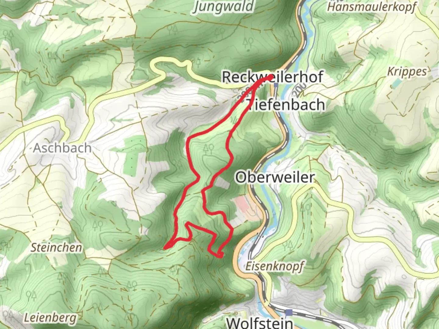
6.7 km
~1 hrs 53 min
331 m
Loop
“The Koenigsbachweg trail near Kusel, Germany, offers a scenic 7 km hike rich in natural beauty and history.”
Starting near the charming town of Kusel, Germany, the Koenigsbachweg trail offers a delightful 7 km (approximately 4.3 miles) loop with an elevation gain of around 300 meters (984 feet). This medium-difficulty trail is perfect for those looking to immerse themselves in the natural beauty and historical richness of the region.
Getting There
To reach the trailhead, you can either drive or use public transport. If you're driving, set your GPS to Kusel, and you will find ample parking options near the town center. For those using public transport, Kusel is well-connected by train and bus services. The nearest train station is Kusel Bahnhof, from where you can either walk or take a short bus ride to the trailhead.
Trail Overview
The Koenigsbachweg trail begins near the outskirts of Kusel, leading you through a diverse landscape of dense forests, open meadows, and serene streams. The trail is well-marked, but it's always a good idea to have a reliable navigation tool like HiiKER to ensure you stay on track.
Key Landmarks and Nature
As you embark on the trail, you'll first encounter a lush forest area, home to a variety of flora and fauna. Keep an eye out for native wildlife such as deer, foxes, and a plethora of bird species. About 2 km (1.2 miles) into the hike, you'll come across the picturesque Koenigsbach stream. This is a great spot to take a short break and enjoy the tranquil sounds of flowing water.
Historical Significance
Approximately 3 km (1.9 miles) into the trail, you'll reach the ruins of an old mill, a testament to the region's rich history. This mill once played a crucial role in the local economy, grinding grain for the surrounding villages. Take a moment to explore the ruins and imagine the bustling activity that once took place here.
Elevation and Terrain
The trail features a steady climb, with the most significant elevation gain occurring in the first half of the hike. As you ascend, you'll be rewarded with stunning views of the Kusel valley and the surrounding hills. The highest point of the trail is around 4 km (2.5 miles) in, offering panoramic vistas that are perfect for photography enthusiasts.
Final Stretch
The descent begins after you reach the highest point, leading you through more forested areas and eventually looping back towards Kusel. The final 2 km (1.2 miles) are relatively flat, allowing for a leisurely walk back to the trailhead.
Practical Tips
- Wear sturdy hiking boots, as the terrain can be uneven and slippery, especially after rain.
- Bring sufficient water and snacks, as there are no facilities along the trail.
- Check the weather forecast before heading out, as conditions can change rapidly in this region.
- Use HiiKER for real-time navigation and updates on trail conditions.
This trail offers a perfect blend of natural beauty, wildlife, and historical intrigue, making it a must-visit for any hiking enthusiast exploring the Kusel area.

Comments and Reviews
User comments, reviews and discussions about the Koenigsbachweg, Germany.
4.71
average rating out of 5
7 rating(s)