Download
Preview
Add to list
More
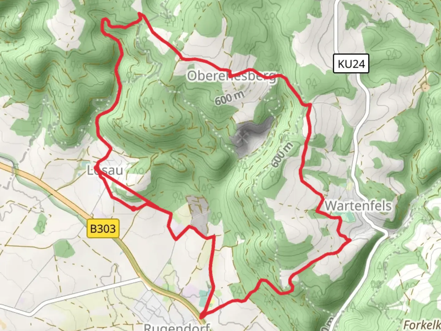
12.5 km
~3 hrs 5 min
350 m
Point-to-Point
“Explore Bavaria's heart on a scenic trail blending nature, history, and moderate hiking challenges.”
Nestled in the picturesque region near Kulmbach, Germany, the Katzbach Weg and Hoehenweg trail offers a delightful journey through the heart of Bavaria. This point-to-point trail stretches approximately 13 kilometers (about 8 miles) with an elevation gain of around 300 meters (approximately 984 feet), making it a moderately challenging hike suitable for those with some hiking experience.
Getting There
To reach the trailhead, travelers can opt for public transport or drive. If you're using public transport, Kulmbach is well-connected by train, with regular services from major cities like Nuremberg and Bamberg. From the Kulmbach train station, local buses or a short taxi ride can take you to the trail's starting point. For those driving, Kulmbach is accessible via the A70 and A9 highways, with ample parking available near the trailhead.
Trail Highlights
The trail begins near the charming town of Kulmbach, known for its rich brewing history and the imposing Plassenburg Castle, which is worth a visit before or after your hike. As you set off, the path meanders through lush forests and open meadows, offering a serene escape into nature. The initial section of the trail is relatively gentle, allowing hikers to ease into the journey.
Nature and Wildlife
As you progress, the trail ascends gradually, providing stunning views of the surrounding Bavarian countryside. The area is home to diverse flora and fauna, with opportunities to spot deer, foxes, and a variety of bird species. In spring and summer, the meadows burst into color with wildflowers, creating a picturesque backdrop for your hike.
Historical Significance
The region around Kulmbach is steeped in history, with the trail itself passing through areas that have been inhabited for centuries. The nearby Plassenburg Castle, visible from various points along the trail, dates back to the 12th century and played a significant role in the region's history. As you hike, you may encounter remnants of old fortifications and historical markers that provide insight into the area's past.
Navigation and Safety
While the trail is well-marked, it's advisable to use the HiiKER app for navigation to ensure you stay on track. The app provides detailed maps and real-time updates, which can be particularly useful in the more remote sections of the trail. Be prepared for varying weather conditions, as the trail can be muddy and slippery after rain. Sturdy hiking boots and appropriate clothing are recommended.
Final Stretch
The trail concludes with a descent into a picturesque valley, where you'll find a peaceful stream and opportunities to rest and reflect on your journey. The endpoint is accessible by local transport, allowing for an easy return to Kulmbach or onward travel.
This hike offers a perfect blend of natural beauty, historical intrigue, and moderate physical challenge, making it a rewarding experience for those looking to explore the Bavarian landscape.

What to expect?
Activity types
Comments and Reviews
User comments, reviews and discussions about the Katzbach Weg and Hoehenweg, Germany.
average rating out of 5
0 rating(s)