Download
3D Flyover
Add to list
More
7.7 km
~1 hrs 40 min
87 m
Loop
“Explore the serene Franconian Forest on an 8 km trail near Kulmbach, featuring scenic waterways and historical landmarks.”
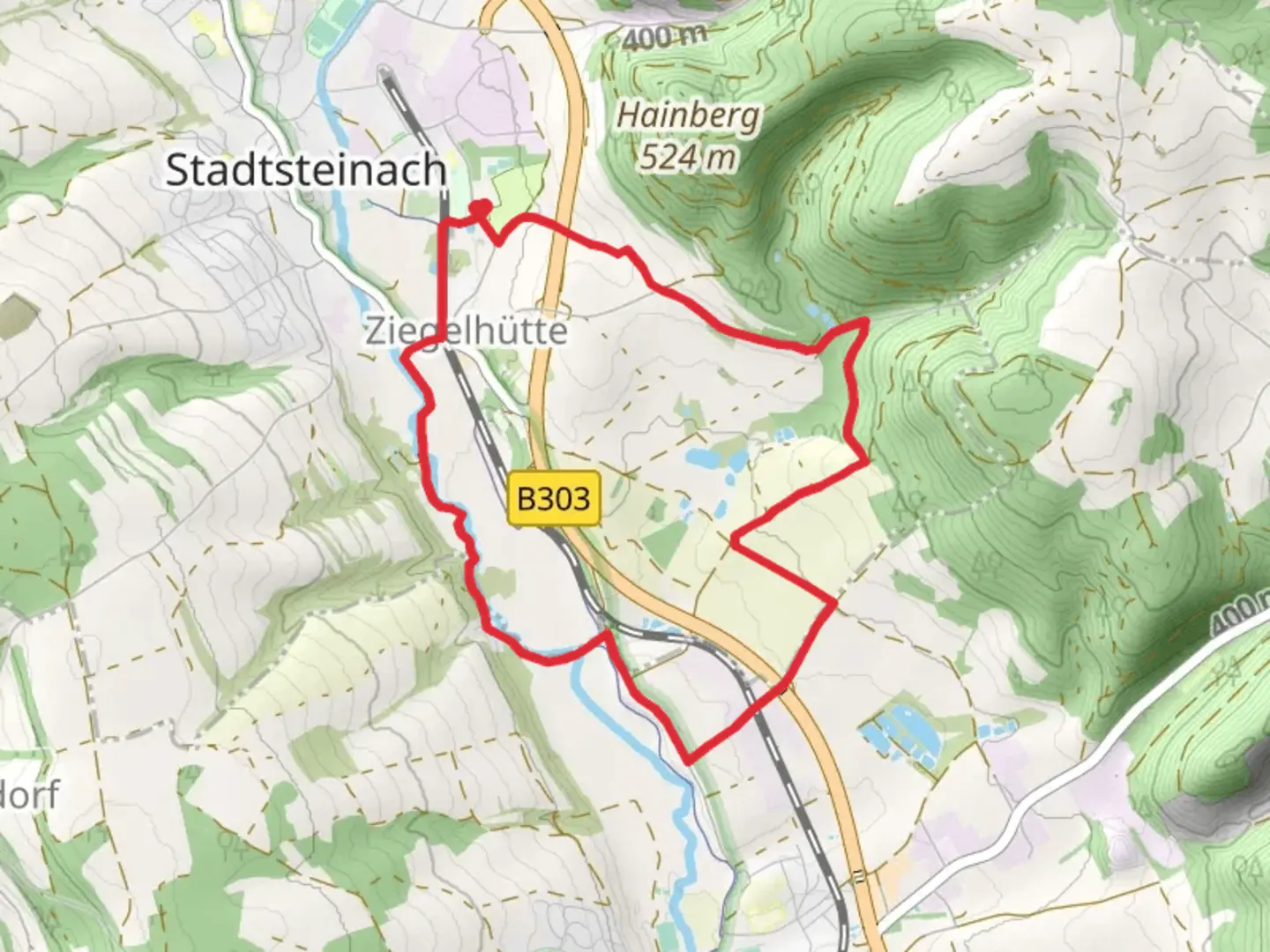
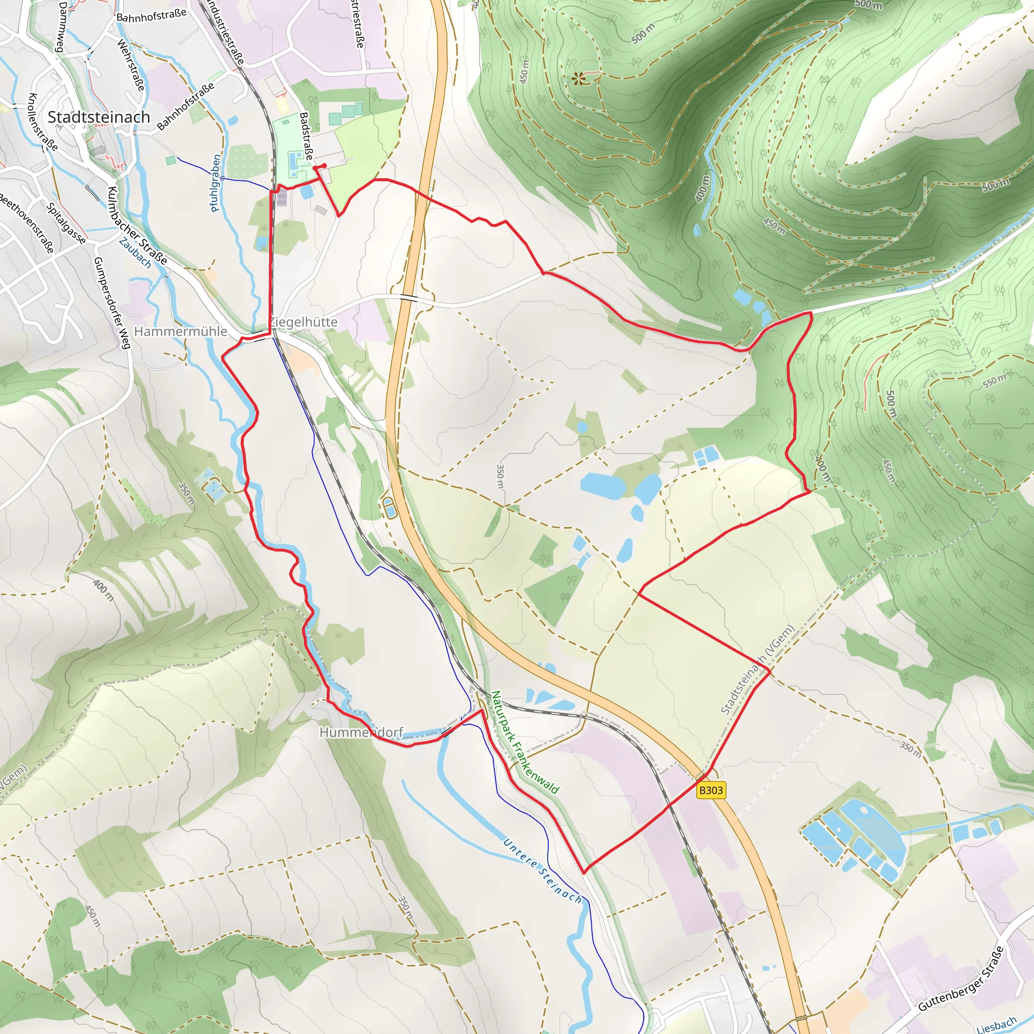
Starting near the charming town of Kulmbach, Germany, the Fluss-und Teichufer Weg and Frankenwaldsteig trail offers an 8 km (approximately 5 miles) loop with virtually no elevation gain, making it accessible to a wide range of hikers. This medium-difficulty trail is perfect for those looking to explore the serene landscapes of the Franconian Forest without the challenge of steep climbs.
Getting There
To reach the trailhead, you can either drive or use public transport. If driving, set your GPS to Kulmbach, a town well-connected by major roads. For those opting for public transport, Kulmbach is accessible via regional trains from major cities like Nuremberg and Bamberg. From the Kulmbach train station, local buses or a short taxi ride will get you to the trailhead.
Trail Highlights
Scenic Waterways
The trail meanders along the banks of the Main River and several picturesque ponds, offering stunning water views throughout. Early morning or late afternoon hikes provide the best light for photography, capturing the reflections of the surrounding trees and sky on the water's surface.
Flora and Fauna
The trail is rich in biodiversity. Keep an eye out for native bird species such as the European kingfisher and various types of waterfowl. The forested sections are home to deer, foxes, and a variety of smaller mammals. In spring and summer, the trail is adorned with wildflowers, adding a splash of color to the verdant landscape.
Historical Significance
Kulmbach and its surrounding areas are steeped in history. The town itself is known for the Plassenburg Castle, a Renaissance fortress that overlooks the region. While the castle is not directly on the trail, it's worth a visit either before or after your hike. The trail also passes by several old mills and farmhouses, offering a glimpse into the region's agricultural past.
Navigation
For navigation, HiiKER is an excellent tool to use. The app provides detailed maps and real-time GPS tracking, ensuring you stay on course. The trail is well-marked, but having a reliable navigation tool can enhance your hiking experience.
Points of Interest
Teichufer (Pond Shores)
Around the 3 km (1.8 miles) mark, you'll encounter a series of tranquil ponds. These are perfect spots for a short break or a picnic. The calm waters and surrounding greenery create a peaceful atmosphere, ideal for relaxation.
River Main
At approximately 5 km (3.1 miles), the trail runs parallel to the Main River. This section offers expansive views of the river and the opportunity to spot various aquatic wildlife. The gentle flow of the river adds a soothing soundtrack to your hike.
Practical Tips
- Footwear: Given the flat terrain, comfortable walking shoes are sufficient. However, waterproof footwear is advisable during wetter months.
- Weather: The trail is accessible year-round, but spring and autumn offer the most pleasant weather conditions. Summer can be warm, so bring plenty of water.
- Facilities: There are limited facilities along the trail, so plan accordingly. Kulmbach has several shops and restaurants where you can stock up on supplies before starting your hike.
This trail offers a delightful mix of natural beauty, historical landmarks, and peaceful waterways, making it a rewarding experience for any hiker.
Comments and Reviews
User comments, reviews and discussions about the Fluss-und Teichufer Weg and Frankenwaldsteig, Germany.
4.0
average rating out of 5
1 rating(s)
