Download
3D Flyover
Add to list
More
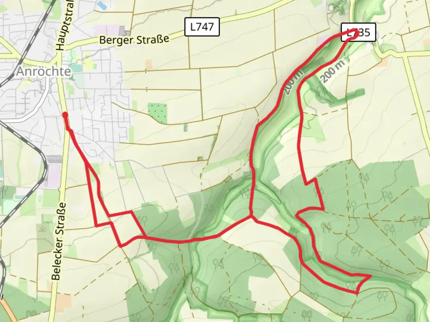
14.9 km
~3 hrs 19 min
200 m
Loop
“The Pöppelsche in Kirschenberg trail blends natural beauty, historical landmarks, and moderate challenges for adventurous hikers.”
Starting near Kreis Soest, Germany, the Pöppelsche in Kirschenberg trail is a delightful 15 km (approximately 9.3 miles) loop with an elevation gain of around 200 meters (656 feet). This medium-difficulty trail offers a blend of natural beauty, historical landmarks, and a moderate challenge suitable for most hikers.
Getting There
To reach the trailhead, you can drive or use public transport. If driving, set your GPS to Kreis Soest, Germany, and look for parking options near the trailhead. For those using public transport, the nearest significant landmark is the Soest train station. From there, you can take a local bus or taxi to the trailhead.
Trail Overview
The trail begins with a gentle ascent, allowing you to ease into the hike. As you progress, you'll encounter a mix of forested areas and open meadows, providing a variety of landscapes to enjoy. The initial 3 km (1.9 miles) offer a gradual climb, gaining about 100 meters (328 feet) in elevation.
Nature and Wildlife
The Pöppelsche in Kirschenberg trail is rich in biodiversity. Keep an eye out for native wildlife such as deer, foxes, and a variety of bird species. The forested sections are home to ancient oak and beech trees, offering a serene canopy that provides shade and a sense of tranquility.
Historical Significance
Around the 7 km (4.3 miles) mark, you'll come across the remnants of medieval structures, hinting at the region's historical significance. These ruins are believed to date back to the 12th century and offer a fascinating glimpse into the past. Take a moment to explore and imagine the lives of those who once inhabited this area.
Midpoint and Elevation
At approximately the halfway point, the trail reaches its highest elevation, offering panoramic views of the surrounding countryside. This is an excellent spot to take a break, enjoy a snack, and soak in the scenery. The elevation gain here is about 200 meters (656 feet) from the starting point.
Navigation and Safety
For navigation, it's highly recommended to use the HiiKER app, which provides detailed maps and real-time updates. The trail is well-marked, but having a reliable navigation tool ensures you stay on track and can enjoy your hike without any worries.
Final Stretch
The descent begins after the midpoint, leading you through more open meadows and eventually back into the forest. The last 5 km (3.1 miles) are relatively flat, making for a pleasant and leisurely end to your hike. As you approach the trailhead, you'll pass by a small stream, adding a soothing soundtrack to your final steps.
Practical Tips
- Wear sturdy hiking boots, as some sections can be rocky and uneven.
- Bring enough water and snacks, especially if you plan to take breaks and enjoy the scenery.
- Check the weather forecast before heading out, as conditions can change rapidly.
- Be mindful of local wildlife and respect their habitat.
This trail offers a perfect blend of natural beauty, historical intrigue, and moderate physical challenge, making it a rewarding experience for any hiker.

What to expect?
Activity types
Comments and Reviews
User comments, reviews and discussions about the Pöppelsche in Kirschenberg, Germany.
5.0
average rating out of 5
1 rating(s)