Download
Preview
Add to list
More
13.5 km
~3 hrs 15 min
340 m
Loop
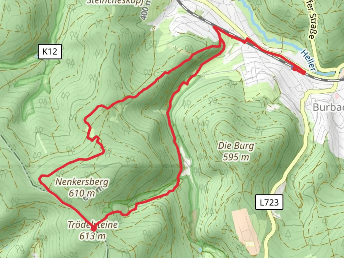
“Discover the Trödelsteinepfad: a 13 km loop of natural beauty, historical landmarks, and diverse wildlife.”
Starting near Kreis Siegen-Wittgenstein, Germany, the Trödelsteinepfad is a captivating 13 km (8 miles) loop trail with an elevation gain of approximately 300 meters (984 feet). This medium-difficulty trail offers a blend of natural beauty, historical landmarks, and diverse wildlife, making it a rewarding experience for hikers.
Getting There
To reach the trailhead, you can drive or use public transport. If driving, set your GPS to the nearest known address: "Kreis Siegen-Wittgenstein, Germany." For those using public transport, the nearest significant landmark is the town of Burbach. From Burbach, local buses or taxis can take you to the trailhead.
Trail Overview
The trail begins with a gentle ascent through dense forests, where you’ll be greeted by the soothing sounds of birds and rustling leaves. As you progress, the path becomes steeper, leading you to the first significant landmark, the Trödelsteine rock formations. These impressive geological structures are around 3 km (1.8 miles) from the start and offer a perfect spot for a short break and some photography.
Historical Significance
The region around Kreis Siegen-Wittgenstein is steeped in history. During your hike, you’ll come across remnants of ancient settlements and old mining sites. These historical markers are a testament to the area's rich cultural heritage. Approximately 5 km (3.1 miles) into the trail, you’ll find an old watchtower that dates back to medieval times, offering panoramic views of the surrounding landscape.
Flora and Fauna
The trail is a haven for nature enthusiasts. The diverse flora includes oak, beech, and pine trees, along with a variety of wildflowers that bloom in the spring and summer months. Wildlife is abundant, with chances to spot deer, foxes, and a variety of bird species. Keep an eye out for the rare black woodpecker, a highlight for bird watchers.
Navigation and Safety
Navigating the Trödelsteinepfad is straightforward, but it’s always wise to have a reliable navigation tool. The HiiKER app is highly recommended for its detailed maps and real-time updates. The trail is well-marked, but weather conditions can change rapidly, so be prepared with appropriate gear, including sturdy hiking boots and weatherproof clothing.
Key Points of Interest
- Trödelsteine Rock Formations: Located 3 km (1.8 miles) from the start, these natural rock formations are a must-see.
- Medieval Watchtower: Found around 5 km (3.1 miles) into the hike, offering historical insights and stunning views.
- Scenic Overlook: At approximately 8 km (5 miles), you’ll reach a scenic overlook that provides breathtaking views of the surrounding valleys and forests.
Final Stretch
The last segment of the trail descends gently back towards the starting point, passing through open meadows and small streams. This part of the hike is particularly picturesque, especially in the late afternoon when the sunlight casts a golden hue over the landscape.
By the time you complete the loop, you’ll have experienced a rich tapestry of natural beauty, historical intrigue, and diverse wildlife, making the Trödelsteinepfad a memorable hiking adventure.

Comments and Reviews
User comments, reviews and discussions about the Trödelsteinepfad, Germany.
4.0
average rating out of 5
1 rating(s)