Download
3D Flyover
Add to list
More
9.3 km
~2 hrs 8 min
163 m
Loop
“"Experience natural beauty, historical intrigue, and moderate challenge on Germany's Jagdberg via Talsperrenweg and Rothaarweg trail."”
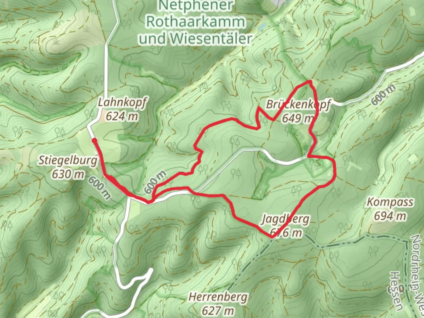
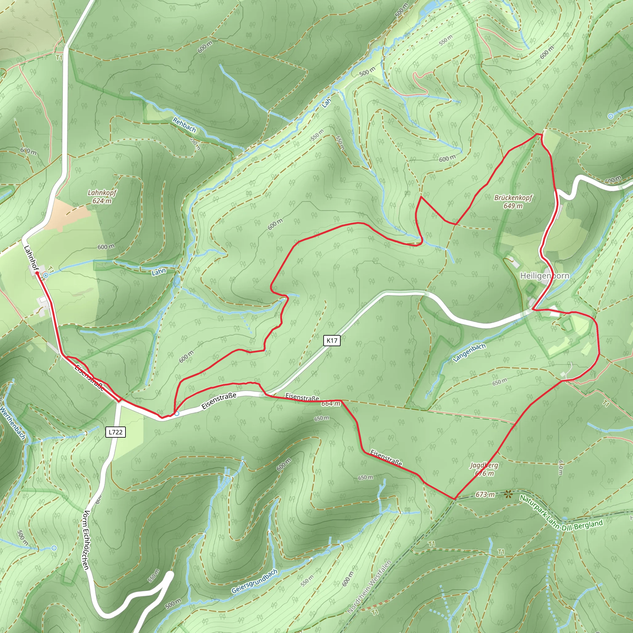
Starting your hike near Kreis Siegen-Wittgenstein, Germany, the Jagdberg via Talsperrenweg and Rothaarweg trail offers a delightful 9 km (approximately 5.6 miles) loop with an elevation gain of around 100 meters (328 feet). This medium-difficulty trail is perfect for those looking to experience the natural beauty and historical richness of the region.
Getting There
To reach the trailhead, you can either drive or use public transport. If driving, set your GPS to Kreis Siegen-Wittgenstein, Germany. For those using public transport, the nearest significant landmark is the Siegen Hauptbahnhof (Siegen Main Station). From there, local buses or taxis can take you closer to the trailhead.
Trail Overview
The trail begins with a gentle ascent, offering a gradual introduction to the terrain. As you start, you'll be walking through dense forests typical of the Rothaargebirge mountain range. The first section of the trail, Talsperrenweg, is well-marked and provides a serene environment with the sounds of rustling leaves and chirping birds.
Key Landmarks and Nature
Around the 2 km (1.2 miles) mark, you'll encounter the Obernau Dam, a significant landmark in the area. This dam is not only a crucial water reservoir but also a picturesque spot for photography. The trail then transitions into the Rothaarweg, where you'll notice a change in the landscape. The forest opens up to reveal rolling hills and expansive meadows.
Wildlife and Flora
Keep an eye out for local wildlife, including deer, foxes, and a variety of bird species. The flora is equally diverse, with oak, beech, and spruce trees dominating the landscape. During spring and summer, the meadows are adorned with wildflowers, adding a splash of color to your hike.
Historical Significance
The region has a rich history dating back to medieval times. The Rothaargebirge mountain range was historically significant for its iron ore deposits, which played a crucial role in the development of the local economy. As you hike, you might come across remnants of old mining operations, adding a historical layer to your adventure.
Navigation and Safety
For navigation, it's highly recommended to use the HiiKER app, which provides detailed maps and real-time updates. The trail is generally well-marked, but having a reliable navigation tool ensures you stay on track.
Final Stretch
As you approach the final 2 km (1.2 miles) of the loop, the trail descends gently back towards the starting point. This section offers panoramic views of the surrounding countryside, making it a perfect spot to pause and take in the scenery.
Practical Tips
- Wear sturdy hiking boots, as some sections can be uneven.
- Carry enough water and snacks, especially if you plan to take breaks.
- Check the weather forecast before heading out, as conditions can change rapidly.
This 9 km loop offers a balanced mix of natural beauty, historical intrigue, and moderate physical challenge, making it a rewarding experience for hikers of all levels.
Comments and Reviews
User comments, reviews and discussions about the Jagdberg via Talsperrenweg and Rothaarweg, Germany.
average rating out of 5
0 rating(s)
