Download
3D Flyover
Add to list
More
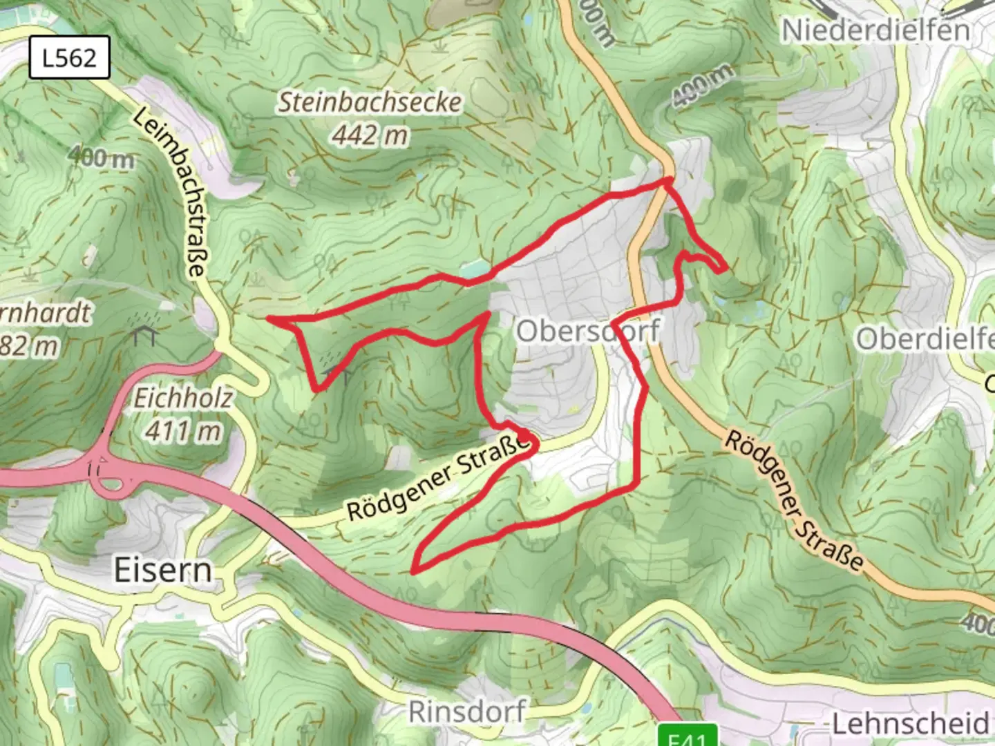
8.9 km
~2 hrs 3 min
167 m
Loop
“Explore a 9 km loop of lush forests, historical landmarks, and stunning views in Kreis Siegen-Wittgenstein.”
Starting near Kreis Siegen-Wittgenstein in Germany, this 9 km (approximately 5.6 miles) loop trail offers a delightful mix of natural beauty and historical intrigue. With an elevation gain of around 100 meters (328 feet), it is rated as a medium difficulty hike, making it accessible to most hikers with a moderate level of fitness.
Getting There
To reach the trailhead, you can drive or use public transport. If driving, set your GPS to Kreis Siegen-Wittgenstein, Germany. For those using public transport, the nearest significant landmark is the Siegen Hauptbahnhof (Siegen Main Train Station). From there, you can take a local bus or taxi to the trailhead.
Trail Overview
The trail begins with a gentle ascent through lush forests, offering a serene start to your hike. As you progress, you'll encounter a variety of landscapes, including open meadows and dense woodlands. The initial 2 km (1.2 miles) are relatively easy, with a gradual elevation gain of about 30 meters (98 feet).
Significant Landmarks
Around the 3 km (1.9 miles) mark, you'll come across the historic Obersdorfer Rundweg. This area is rich in history, dating back to medieval times. The remnants of old stone structures and ancient pathways give you a glimpse into the past. Take a moment to appreciate the historical significance of this region, which has been a crossroads for travelers and traders for centuries.
Nature and Wildlife
As you continue, the trail meanders through a diverse ecosystem. Keep an eye out for local wildlife such as deer, foxes, and a variety of bird species. The flora is equally impressive, with seasonal wildflowers adding bursts of color to the landscape. The forested sections are home to towering oak and beech trees, providing ample shade and a cool respite during warmer months.
Midpoint and Elevation Gain
By the time you reach the midpoint of the trail, you'll have gained approximately 60 meters (197 feet) in elevation. This section offers some of the most stunning views of the surrounding countryside. On a clear day, you can see for miles, making it an ideal spot for a short break and some photography.
Navigation and Safety
Navigating the trail is straightforward, but it's always a good idea to have a reliable navigation tool. HiiKER is an excellent app for this purpose, providing detailed maps and real-time updates. The trail is well-marked, but having an additional layer of navigation can enhance your hiking experience.
Final Stretch
The last 3 km (1.9 miles) of the trail are mostly downhill, making for a pleasant and easy finish. You'll pass through more open fields and small streams, eventually looping back to the starting point. This section is particularly beautiful in the late afternoon when the sun casts a golden hue over the landscape.
Practical Tips
- Wear sturdy hiking boots, as some sections can be rocky and uneven.
- Bring plenty of water and snacks, especially if you plan to take your time exploring the historical sites.
- Check the weather forecast before heading out, as conditions can change rapidly.
- If you're hiking in the fall or winter, be prepared for muddy sections and dress in layers.
This trail offers a perfect blend of natural beauty, historical significance, and moderate physical challenge, making it a rewarding experience for any hiker.

What to expect?
Activity types
Comments and Reviews
User comments, reviews and discussions about the Homberg via Obersdorfer Rundweg, Germany.
4.5
average rating out of 5
4 rating(s)