Download
Preview
Add to list
More
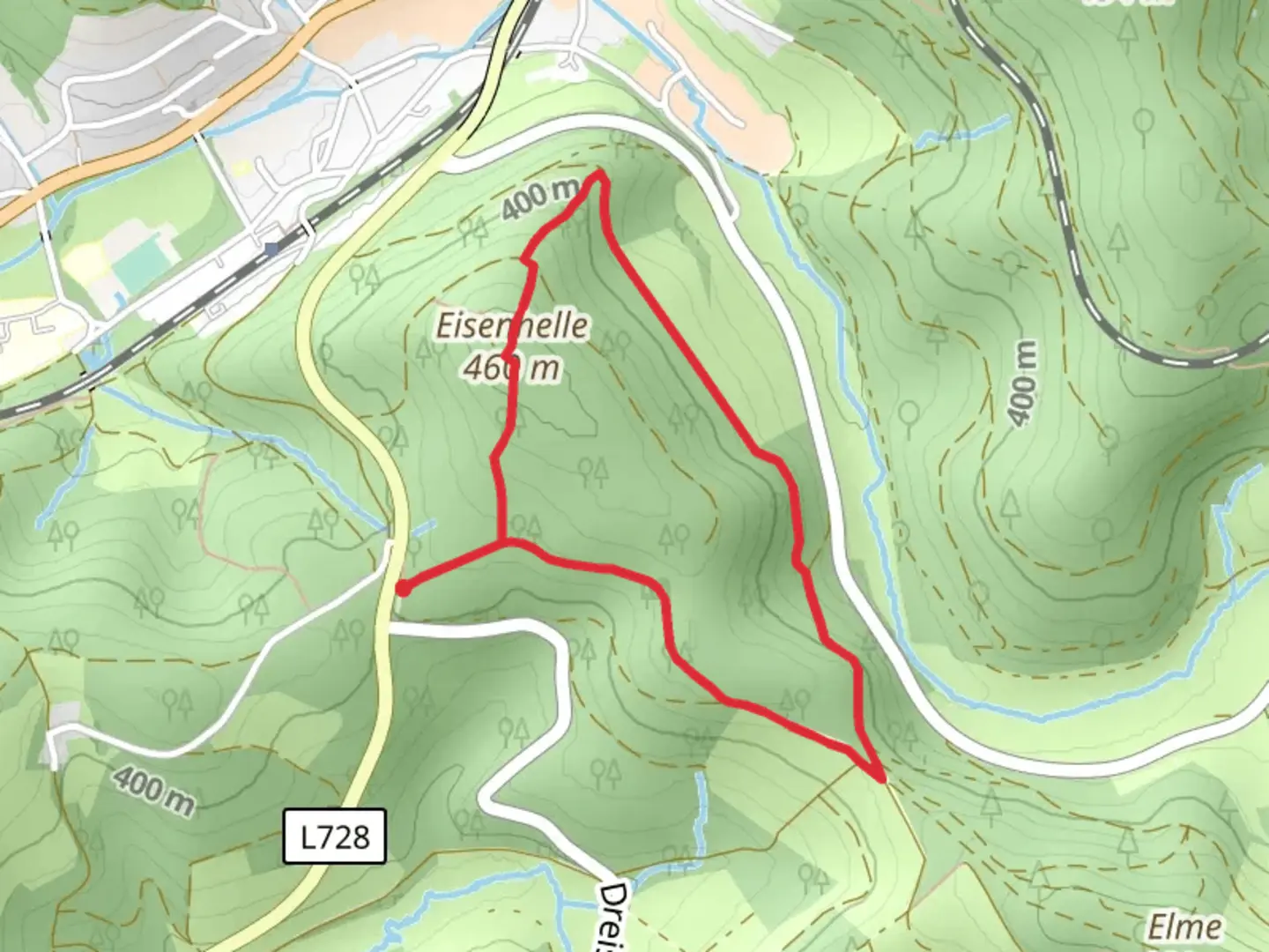
3.5 km
~52 min
106 m
Loop
“Explore the Eisenhelle and Kaspareiche Loop: a 3 km trail offering scenic views, history, and moderate challenge.”
Starting near Kreis Siegen-Wittgenstein, Germany, the Eisenhelle and Kaspareiche Loop is a delightful 3 km (1.86 miles) trail with an elevation gain of approximately 100 meters (328 feet). This loop trail is rated as medium difficulty, making it suitable for hikers with some experience.
Getting There
To reach the trailhead, you can drive or use public transportation. If driving, set your GPS to Kreis Siegen-Wittgenstein, and look for parking near the trailhead. For those using public transport, the nearest significant landmark is the town of Siegen. From Siegen, you can take a local bus to the vicinity of the trailhead. Check local bus schedules for the most accurate and up-to-date information.
Trail Navigation
For navigation, it’s highly recommended to use HiiKER, which provides detailed maps and real-time updates. This will help you stay on track and make the most of your hike.
Trail Highlights
The trail begins with a gentle ascent through a mixed forest, offering a serene environment filled with the sounds of nature. As you progress, you’ll encounter the first significant landmark, the Eisenhelle, a rocky outcrop that provides a fantastic vantage point. This spot is perfect for a short break and some photography.
Flora and Fauna
The trail is rich in biodiversity. You’ll pass through sections of dense beech and oak trees, interspersed with patches of wildflowers during the spring and summer months. Keep an eye out for local wildlife, including deer, foxes, and a variety of bird species. The area is particularly known for its population of woodpeckers, so listen for their distinctive drumming sounds.
Historical Significance
The region around Kreis Siegen-Wittgenstein has a deep historical significance. The trail itself passes near several ancient boundary stones, known locally as "Kaspareiche." These stones date back to medieval times and were used to demarcate land ownership. The area was historically significant for its iron ore mining, which is reflected in the name "Eisenhelle" (Iron Hill).
Midpoint and Return
At approximately the halfway point, you’ll reach the highest elevation of the trail. Here, the path levels out, offering a more relaxed descent back towards the starting point. The return journey provides different scenic views, including open meadows and small streams, making it a varied and enjoyable loop.
Final Stretch
As you near the end of the loop, the trail winds back through the forest, eventually leading you back to the trailhead. This final stretch is relatively easy, allowing you to cool down and reflect on the hike.
Practical Tips
- Wear sturdy hiking boots, as the trail can be rocky in places.
- Bring water and snacks, especially if you plan to take breaks at the scenic spots.
- Check the weather forecast before heading out, as the trail can become slippery in wet conditions.
- Use HiiKER for real-time navigation and updates.
This trail offers a perfect blend of natural beauty, historical intrigue, and moderate physical challenge, making it a rewarding experience for any hiker.

What to expect?
Activity types
Comments and Reviews
User comments, reviews and discussions about the Eisenhelle and Kaspareiche Loop, Germany.
average rating out of 5
0 rating(s)