Büscher Weiher and Wendinger See via Wendener Rundweg
Download
Preview
Add to list
More
12.7 km
~2 hrs 53 min
212 m
Loop
“Discover the Büscher Weiher and Wendinger See loop: a 13 km hike of scenic beauty and historical charm.”
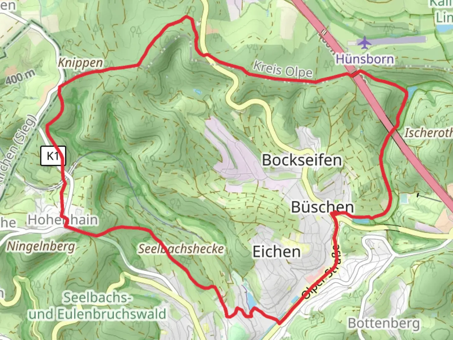
Starting near Kreis Siegen-Wittgenstein, Germany, the Büscher Weiher and Wendinger See via Wendener Rundweg is a picturesque loop trail that spans approximately 13 kilometers (8 miles) with an elevation gain of around 200 meters (656 feet). This medium-difficulty trail offers a delightful mix of natural beauty, historical landmarks, and serene water bodies, making it a rewarding experience for hikers.
Getting There
To reach the trailhead, you can either drive or use public transport. If driving, set your GPS to the vicinity of Kreis Siegen-Wittgenstein. For those using public transport, the nearest significant landmark is the town of Wenden. From Wenden, local buses or a short taxi ride can take you to the trailhead.
Trail Highlights
Büscher Weiher
Approximately 3 kilometers (1.9 miles) into the hike, you'll encounter Büscher Weiher, a tranquil pond surrounded by lush greenery. This spot is perfect for a short break, allowing you to soak in the serene atmosphere and perhaps spot some local wildlife, such as ducks and herons.
Wendinger See
Continuing along the trail, around the 7-kilometer (4.3 miles) mark, you'll reach Wendinger See. This larger lake is a popular spot for both locals and visitors. The clear waters and surrounding forest create a picturesque setting, ideal for photography or a peaceful picnic.
Historical Significance
The region around Kreis Siegen-Wittgenstein has a rich history dating back to medieval times. As you hike, you'll come across several historical markers and old structures, including remnants of ancient settlements and traditional German architecture. These landmarks offer a glimpse into the area's past and add an educational element to your hike.
Flora and Fauna
The trail is abundant with diverse flora and fauna. Depending on the season, you might see wildflowers, dense forests of oak and beech trees, and a variety of bird species. Keep an eye out for deer and other small mammals that inhabit the area.
Navigation
For navigation, it's highly recommended to use HiiKER, which provides detailed maps and real-time updates to ensure you stay on the right path. The trail is well-marked, but having a reliable navigation tool can enhance your hiking experience.
Elevation and Terrain
The trail features a moderate elevation gain of around 200 meters (656 feet), with a mix of gentle slopes and steeper sections. The terrain varies from well-maintained paths to more rugged, natural trails. Good hiking boots are recommended to navigate the diverse surfaces comfortably.
Practical Information
- Water and Snacks: There are no facilities along the trail, so bring enough water and snacks to keep you energized.
- Weather: Check the weather forecast before heading out, as conditions can change rapidly.
- Wildlife: While the wildlife is generally harmless, it's always good practice to maintain a respectful distance from any animals you encounter.
This trail offers a perfect blend of natural beauty, historical intrigue, and moderate physical challenge, making it an excellent choice for a day hike in the German countryside.

What to expect?
Activity types
Comments and Reviews
User comments, reviews and discussions about the Büscher Weiher and Wendinger See via Wendener Rundweg, Germany.
4.67
average rating out of 5
3 rating(s)