Download
3D Flyover
Add to list
More
5.9 km
~1 hrs 19 min
79 m
Loop
“The Breitenbachtalsperre Loop is a scenic, accessible 6 km trail rich in natural beauty and history.”
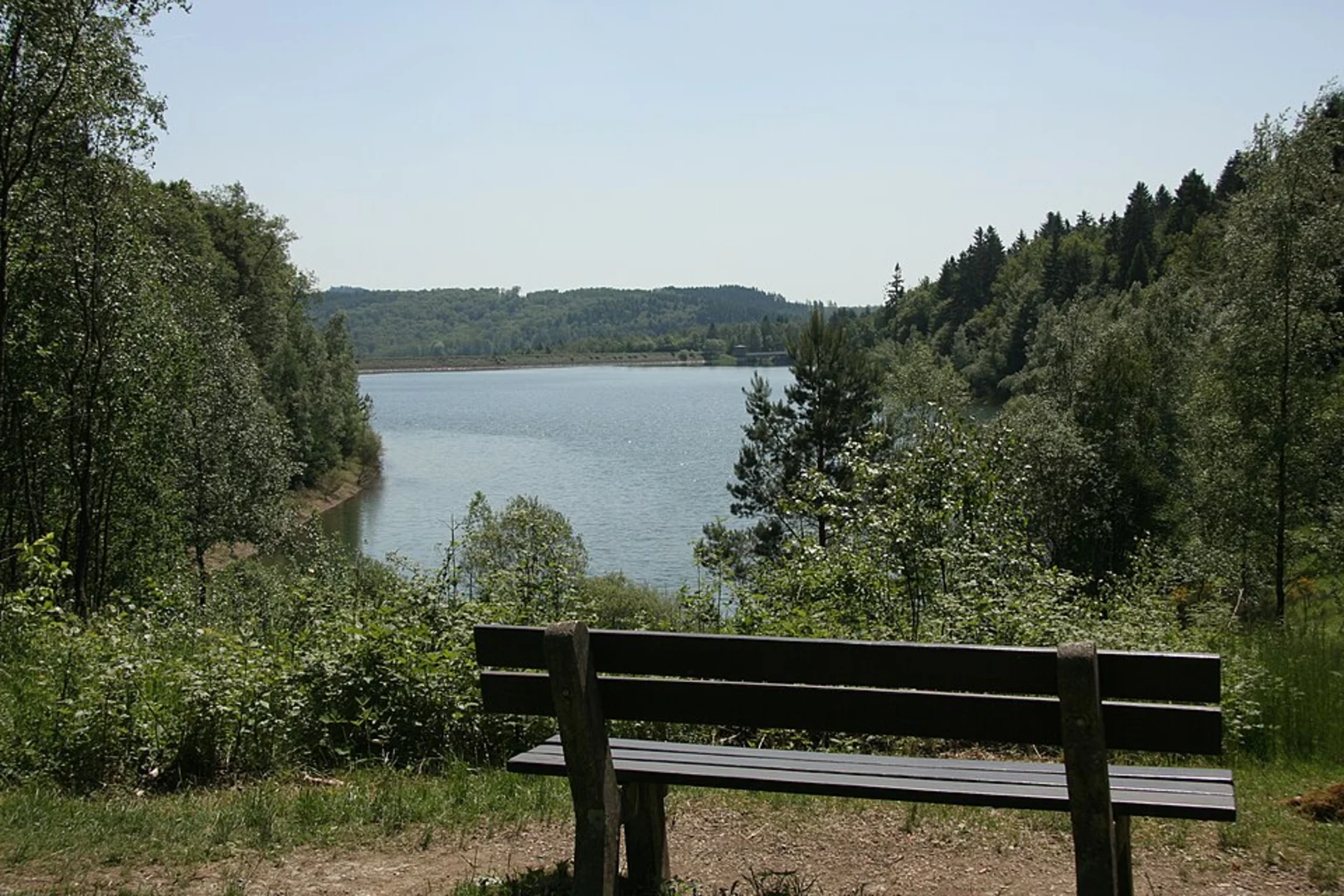
Starting near Kreis Siegen-Wittgenstein, Germany, the Breitenbachtalsperre Loop is a scenic 6 km (approximately 3.7 miles) trail with no significant elevation gain, making it accessible for a wide range of hikers. The trailhead is conveniently located near the Breitenbachtalsperre reservoir, a significant landmark in the region.
Getting There
To reach the trailhead, you can drive or use public transport. If driving, set your GPS to Breitenbachtalsperre, 57223 Kreuztal, Germany. There is ample parking available near the reservoir. For those using public transport, take a train to Kreuztal station. From there, you can catch a local bus or taxi to the reservoir, which is about 10 km (6.2 miles) away.
Trail Overview
The loop trail is well-marked and primarily follows the perimeter of the Breitenbachtalsperre reservoir. The path is mostly flat, making it suitable for families and casual hikers. Despite the lack of elevation gain, the trail is rated as medium difficulty due to its length and some uneven terrain.
Points of Interest
- Breitenbachtalsperre Reservoir: The reservoir itself is a highlight, offering stunning views of the water and surrounding forest. It's a popular spot for birdwatching, so bring your binoculars.
- Flora and Fauna: The area is rich in biodiversity. Look out for various species of birds, including herons and kingfishers. The forested sections of the trail are home to deer and other small mammals.
- Historical Significance: The Breitenbachtalsperre reservoir was constructed in the early 20th century to provide water to the surrounding communities. The dam and its engineering are points of historical interest, reflecting the industrial advancements of the time.
Navigation
For navigation, it is recommended to use the HiiKER app, which provides detailed maps and real-time updates. The trail is well-marked, but having a reliable navigation tool can enhance your hiking experience.
Trail Sections
- Start to 2 km (1.2 miles): The initial section of the trail is a gentle walk along the reservoir's edge. The path is wide and well-maintained, making it easy to follow.
- 2 km to 4 km (1.2 to 2.5 miles): This section takes you through denser forest areas. The terrain becomes slightly uneven, so watch your step. The forest canopy provides ample shade, making it a pleasant walk even on warmer days.
- 4 km to 6 km (2.5 to 3.7 miles): The final stretch brings you back towards the reservoir. The path opens up, offering panoramic views of the water. This is a great spot to take a break and enjoy the scenery before completing the loop.
Practical Tips
- Footwear: Wear sturdy hiking boots, as some sections of the trail can be uneven.
- Weather: Check the weather forecast before you go. The trail can become muddy after rain.
- Supplies: Bring enough water and snacks. There are no facilities along the trail, so be prepared.
- Wildlife: Keep an eye out for wildlife, but remember to maintain a respectful distance.
This trail offers a blend of natural beauty and historical significance, making it a rewarding hike for those who venture out to explore it.

What to expect?
Activity types
Comments and Reviews
User comments, reviews and discussions about the Breitenbachtalsperre Loop, Germany.
4.25
average rating out of 5
4 rating(s)