
Download
3D Flyover
Add to list
More
12.3 km
~2 hrs 57 min
300 m
Loop
“Discover the Rundwanderweg Ostentrop: a 12 km trail blending natural beauty, history, and wildlife spotting.”
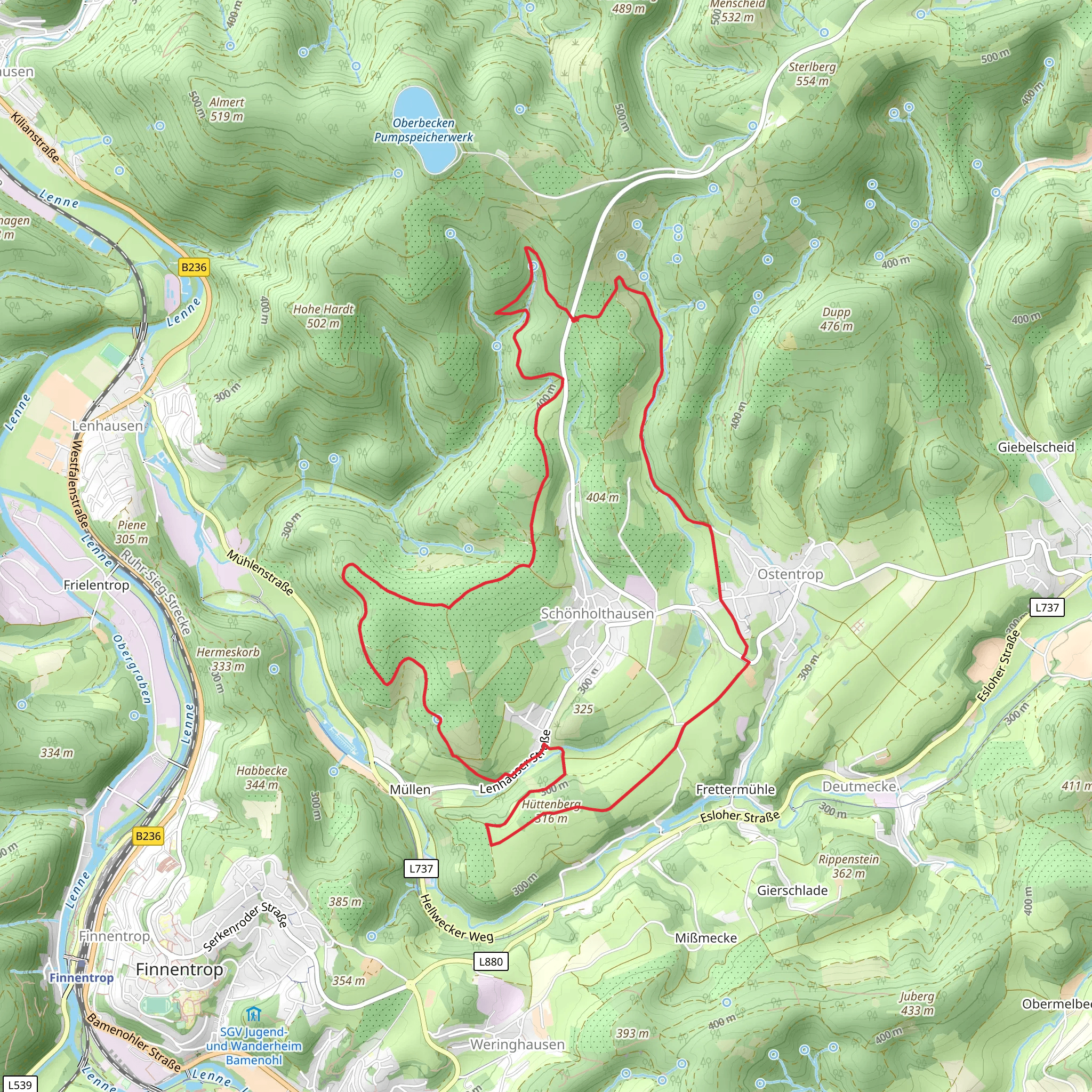
Starting near Kreis Olpe in Germany, the Rundwanderweg Ostentrop is a scenic loop trail that spans approximately 12 km (7.5 miles) with an elevation gain of around 300 meters (984 feet). This medium-difficulty trail offers a delightful mix of natural beauty, historical landmarks, and opportunities for wildlife spotting.
Getting There
To reach the trailhead, you can either drive or use public transport. If driving, set your GPS to Kreis Olpe, Germany, and look for parking options near the village of Ostentrop. For those using public transport, take a train to the nearest major station in Olpe and then a local bus to Ostentrop. The bus services are fairly regular, but it's advisable to check the latest schedules.
Trail Navigation
For navigation, the HiiKER app is highly recommended. It provides detailed maps and real-time updates, ensuring you stay on track throughout your hike.
Trail Highlights
Initial Ascent
The trail begins with a gentle ascent through mixed forests, where you can enjoy the shade of towering beech and oak trees. This section is relatively easy, making it a good warm-up for the more challenging parts ahead. After about 2 km (1.2 miles), you'll reach the first viewpoint, offering panoramic views of the surrounding countryside.
Historical Significance
Around the 4 km (2.5 miles) mark, you'll come across the remnants of an old watchtower. This tower dates back to the medieval period and was part of a network used for signaling and defense. Take a moment to explore the area and imagine the historical significance of this structure.
Wildlife and Flora
As you continue, the trail meanders through meadows and small clearings. Keep an eye out for local wildlife such as deer, foxes, and a variety of bird species. The flora is equally impressive, with seasonal wildflowers adding splashes of color to the landscape. This section is relatively flat, making it a good spot to take a break and enjoy a picnic.
Midpoint and Elevation Gain
At approximately 6 km (3.7 miles), you'll reach the midpoint of the trail. Here, the path begins to climb more steeply, gaining about 150 meters (492 feet) in elevation over the next 3 km (1.9 miles). This part of the hike can be challenging, but the effort is rewarded with stunning views from the top of the ridge.
Scenic Descent
The final 3 km (1.9 miles) of the trail involve a gradual descent back towards Ostentrop. This section offers more open views and passes through a series of picturesque farms and small villages. The descent is easier on the legs, allowing you to relax and take in the scenery.
Practical Tips
- Footwear: Sturdy hiking boots are recommended due to the varied terrain.
- Weather: Check the weather forecast before you go, as conditions can change rapidly.
- Supplies: Bring enough water and snacks, especially if you plan to picnic along the way.
- Safety: Always let someone know your hiking plans and estimated return time.
Final Stretch
As you approach the end of the loop, you'll find yourself back in Ostentrop. Take a moment to explore the village, perhaps visiting a local café for a well-deserved treat. The Rundwanderweg Ostentrop offers a perfect blend of natural beauty, historical intrigue, and physical challenge, making it a must-do for any hiking enthusiast.
Comments and Reviews
User comments, reviews and discussions about the Rundwanderweg Ostentrop, Germany.
4.0
average rating out of 5
2 rating(s)
