Unterer - Oberer Teich, Kleiner Rigi and Kartoffelberg Loop - Externsteine
Download
Preview
Add to list
More
8.9 km
~2 hrs 11 min
255 m
Loop
“Explore the scenic 9 km Externsteine Loop with historic landmarks, serene ponds, and panoramic views.”
Starting your hike near Kreis Lippe, Germany, the Unterer - Oberer Teich, Kleiner Rigi and Kartoffelberg Loop - Externsteine is a captivating 9 km (5.6 miles) loop trail with an elevation gain of around 200 meters (656 feet). This trail offers a medium difficulty rating, making it suitable for moderately experienced hikers.
Getting There
To reach the trailhead, you can drive or use public transport. If driving, set your GPS to Externsteiner Straße, 32805 Horn-Bad Meinberg, Germany. For public transport, take a train to Horn-Bad Meinberg station and then a bus to the Externsteine stop, which is a short walk from the trailhead.
Trail Highlights
Externsteine
One of the most significant landmarks on this trail is the Externsteine, a striking sandstone rock formation that dates back to the Cretaceous period. These towering rocks have been a site of human activity for thousands of years, with evidence of prehistoric carvings and medieval Christian reliefs. The Externsteine are located approximately 1 km (0.6 miles) from the trailhead and offer a fascinating glimpse into the region's geological and cultural history.
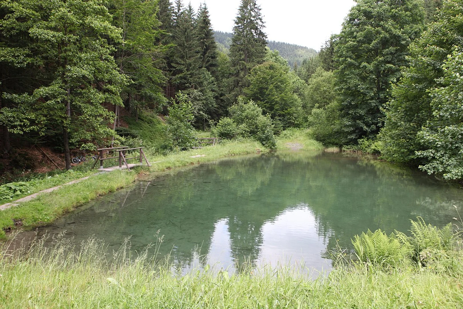
Unterer and Oberer Teich
As you continue, you'll encounter the Unterer and Oberer Teich, two serene ponds nestled within the forest. These ponds are about 2 km (1.2 miles) into the hike and provide a peaceful spot to rest and enjoy the natural surroundings. The area is rich in birdlife, so keep an eye out for various species of waterfowl and songbirds.
Kleiner Rigi
Around the 4 km (2.5 miles) mark, you'll reach Kleiner Rigi, a small hill that offers panoramic views of the surrounding landscape. The climb to the top is gradual but rewarding, with vistas that stretch across the Teutoburg Forest. This is an excellent spot for a picnic or a moment of reflection.
Kartoffelberg
Continuing on, you'll come to Kartoffelberg, another notable elevation on the trail. The ascent here is a bit steeper, but the trail is well-marked and manageable. At the summit, you'll find a small clearing that provides another opportunity for scenic views and a chance to catch your breath.
Navigation and Safety
For navigation, it's highly recommended to use the HiiKER app, which provides detailed maps and real-time updates. The trail is well-marked, but having a reliable navigation tool will ensure you stay on track.
Flora and Fauna
The trail traverses a variety of ecosystems, from dense forests to open meadows. You'll encounter a diverse range of plant life, including oak, beech, and pine trees. Wildlife is abundant, with chances to see deer, foxes, and a variety of bird species. In spring and summer, the meadows are alive with wildflowers, adding a splash of color to your hike.
Historical Significance
The region around Externsteine has a rich history, with archaeological findings indicating human activity dating back to the Paleolithic era. The Externsteine themselves have been a site of religious and cultural significance for centuries, serving as a pagan worship site before being Christianized in the Middle Ages.
Practical Tips
- Wear sturdy hiking boots, as the trail can be uneven in places.
- Bring plenty of water and snacks, especially if you plan to take your time exploring the various landmarks.
- Check the weather forecast before you go, as conditions can change rapidly in the forested areas.
- Be mindful of local wildlife and practice Leave No Trace principles to preserve the natural beauty of the area.
This trail offers a blend of natural beauty, historical intrigue, and moderate physical challenge, making it a rewarding experience for those who embark on it.

What to expect?
Activity types
Comments and Reviews
User comments, reviews and discussions about the Unterer - Oberer Teich, Kleiner Rigi and Kartoffelberg Loop - Externsteine, Germany.
4.6
average rating out of 5
10 rating(s)