Download
3D Flyover
Add to list
More
51.4 km
~2 days
431 m
Point-to-Point
“An unhurried Reichswald loop of sandy tracks, quiet lanes, and borderland history—best savoured slowly.”
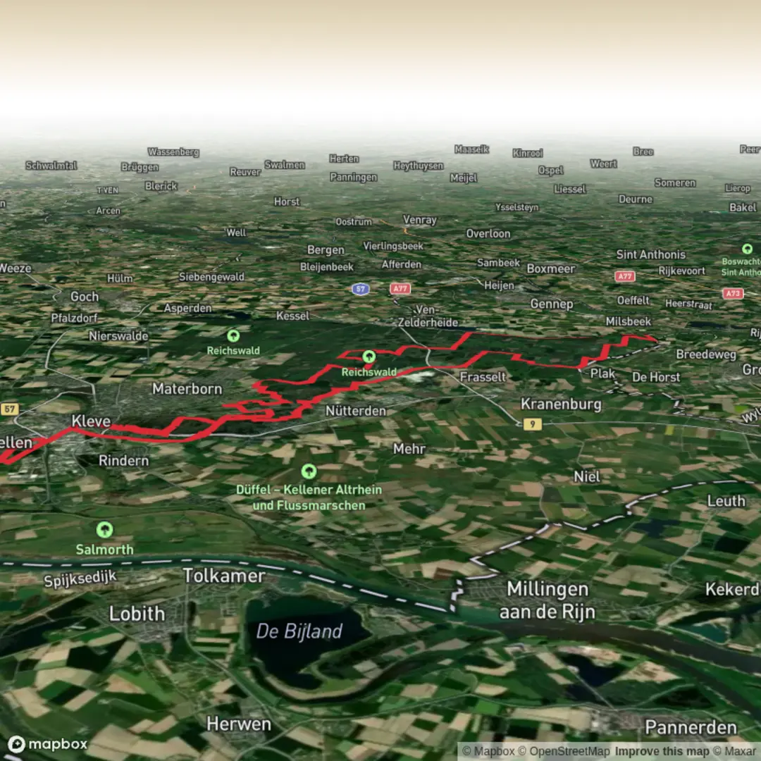
A long, mostly lowland loop through the Reichswald forest and the Kroonbeek valley area, this route is best thought of as an all-day (or very relaxed two-day) ramble on wide forestry tracks, sandy paths, and quiet lanes, with gentle, rolling elevation rather than sustained climbs. At around 51 km / 31.7 mi with roughly 500 m / 1,640 ft of total ascent, the effort comes more from time-on-feet and surface variety (sand can feel slow) than from steep gradients—so it can still feel “easy” for strong walkers, but it’s not “short.”
Getting to the start (car + public transport)
Because the start point is listed only as “near,” the most reliable way to plan is to anchor your arrival to a major, easy-to-find trail gateway on the edge of the Reichswald:
- Best practical landmark to navigate to: Reichswald Forest (Reichswald / Kleve area), near the forest entrances around Kleve–Kranenburg (Germany) and the nearby Dutch border.
- By car: Aim for parking at a signed Reichswald trailhead/forest car park on the Kleve/Kranenburg side (common access points are along the forest-edge roads and recreation pull-ins). Use HiiKER to confirm the exact trailhead pin and the closest legal parking to that pin before you set off.
- By public transport: The usual approach is to travel to Kleve (NRW) by regional rail/bus, then connect by local bus or taxi toward the forest edge (Kranenburg direction) depending on where HiiKER places the start. If you’re coming from the Netherlands, Nijmegen is a common rail hub, with onward buses toward the border towns; from there, you’ll still likely need a short taxi/bus hop to the exact trailhead.
If you share the route’s coordinates (or the HiiKER link), I can translate the start point to the nearest known address or named landmark precisely.
You’ll want to carry enough food and water for a full day: even though you’re never far from towns in a straight line, the loop spends long stretches in forest where services are sparse. Plan on 10–13 hours moving time for most hikers, plus breaks.
What the terrain feels like
Expect a classic borderland forest walk: long, straight forestry lines broken up by softer, meandering sections near streams and wet ground. Underfoot you’ll typically see: - Compacted forest roads (fast, easy navigation, but repetitive) - Sandy tracks in places (slower, more tiring on calves) - Leafy singletrack where the route threads between denser stands - Occasional paved farm lanes near the forest margins and settlements
The elevation gain is spread out in small increments—short rises and dips rather than any single “climb.” That makes pacing straightforward: settle into a sustainable rhythm early, because the distance is the real challenge.
Landmarks, nature, and what to look out for
Reichswald is one of the largest continuous woodland areas in this part of the Lower Rhine region, and it has a layered feel: managed forestry blocks, older mixed stands, and wetter pockets where drainage lines and small brooks shape the ground. As you move between forest interior and edges, you’ll notice the landscape opening into fields and hedgerows, then closing back into tall trunks and long sightlines.
Wildlife is often most active at the day’s edges: - Roe deer are common in forest margins and clearings—watch for them crossing tracks quietly. - Wild boar can be present in these forests; you’re unlikely to have issues, but give any animals space, keep dogs close, and avoid surprising them in dense undergrowth. - Birdlife tends to be rich: woodpeckers, buzzards, and songbirds in mixed woodland; near wetter ground you may see more water-associated species.
Seasonal notes: - Spring: muddy patches and high water in low areas; fresh green canopy can reduce long-distance visibility. - Summer: sand is driest and slowest; ticks are more active—long socks and checks help. - Autumn: leaf cover can hide roots and ruts; shorter daylight makes timing important. - Winter: exposed lanes can feel colder than the forest interior; freeze–thaw can make tracks slick.
Historical context of the region
This border forest has long been a strategic and working landscape—timber, hunting, and travel corridors have shaped it for centuries. The wider Reichswald area is also associated with major WWII operations in early 1945, when fighting and movement through the forested terrain formed part of the push toward the Rhine. Even when specific memorials aren’t directly on your line, the “feel” of the place—straight military-usable tracks, clearings, and the proximity to the border—often reflects that layered history. If your HiiKER line passes named memorials or cemeteries, it’s worth allowing a few minutes to stop respectfully and read any plaques.
Practical planning: pacing, resupply, and comfort
For a 51 km / 31.7 mi day, plan your breaks like checkpoints: - Every 8–12 km (5–7.5 mi): short stop to eat and adjust layers - Midpoint (around 25–28 km / 15.5–17.5 mi): longer break; swap socks if you’re prone to blisters
Water: carry enough to bridge long forest stretches. In temperate conditions, many hikers are comfortable with 2–3 L, more

Surfaces
Unknown
Asphalt
Sand
Unpaved
Gravel
Paved
Ground
Dirt
Wood
Comments and Reviews
User comments, reviews and discussions about the Reichswalde and Kroonbeek Loop, Germany.
average rating out of 5
0 rating(s)