Download
Preview
Add to list
More
11.5 km
~2 hrs 30 min
121 m
Loop
“Explore lush forests, ancient ruins, and panoramic views on the captivating 11 km Niesetalweg and Burgensteig Loop.”
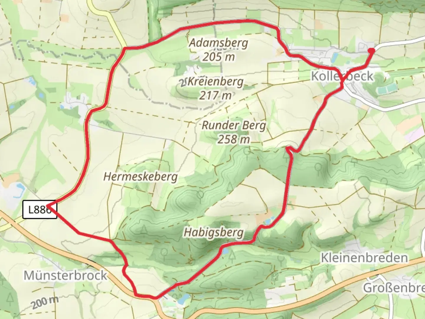
Starting near Kreis Höxter, Germany, the Niesetalweg and Burgensteig Loop is a captivating 11 km (approximately 6.8 miles) trail with an elevation gain of around 100 meters (328 feet). This loop trail is rated as medium difficulty, making it suitable for moderately experienced hikers.
Getting There
To reach the trailhead, you can drive or use public transport. If driving, set your GPS to Kreis Höxter, Germany. For those using public transport, the nearest significant landmark is the Höxter Rathaus, which is well-connected by local buses and trains. From there, it's a short walk to the trailhead.
Trail Overview
The trail begins with a gentle ascent, offering a gradual introduction to the elevation gain. As you start, you'll be surrounded by lush forests, which are home to a variety of wildlife including deer, foxes, and numerous bird species. The first 2 km (1.2 miles) are relatively easy, allowing you to acclimate to the surroundings.
Historical Significance
Around the 3 km (1.9 miles) mark, you'll encounter the first significant landmark: the ruins of an ancient castle. This area is steeped in history, dating back to the medieval period. The castle ruins offer a glimpse into the region's past and provide a perfect spot for a short break and some photography.
Mid-Trail Highlights
Continuing on, the trail meanders through open meadows and dense woodlands. At approximately 5 km (3.1 miles), you'll reach a scenic viewpoint that offers panoramic views of the Niesetal Valley. This is one of the highest points on the trail, and the elevation gain here is about 50 meters (164 feet) from the start.
Flora and Fauna
The trail is rich in biodiversity. In the spring and summer months, the meadows are adorned with wildflowers, while the forests are lush and green. Keep an eye out for local flora such as oak, beech, and pine trees. The area is also a haven for birdwatchers, with species like the European robin and the great spotted woodpecker frequently spotted.
Final Stretch
As you approach the 8 km (5 miles) mark, the trail begins to loop back towards the starting point. This section is relatively flat, making for a pleasant and leisurely end to your hike. You'll pass through more forested areas and cross a few small streams, which add to the trail's charm.
Navigation
For navigation, it's highly recommended to use the HiiKER app, which provides detailed maps and real-time updates. This will ensure you stay on track and can fully enjoy the trail without any worries.
Ending the Loop
The final 3 km (1.9 miles) bring you back to the trailhead near Kreis Höxter. This section is a mix of forest paths and open fields, offering a serene conclusion to your hike.

What to expect?
Activity types
Comments and Reviews
User comments, reviews and discussions about the Niesetalweg and Burgensteig Loop, Germany.
4.0
average rating out of 5
2 rating(s)