Download
3D Flyover
Add to list
More
9.9 km
~2 hrs 13 min
141 m
Loop
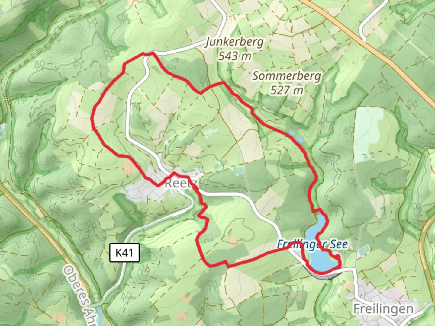
“Explore the scenic EifelSchleife Freilinger See Loop, a 10 km trail rich in nature and history.”
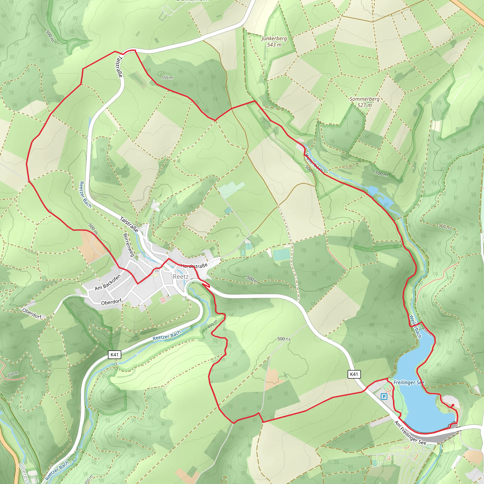
Starting near Kreis Euskirchen, Germany, the EifelSchleife Freilinger See Loop is a picturesque 10 km (6.2 miles) trail with an elevation gain of approximately 100 meters (328 feet). This loop trail offers a moderate challenge, making it suitable for hikers with some experience.
Getting There
To reach the trailhead, you can either drive or use public transport. If you're driving, set your GPS to Freilinger See, a well-known lake in the area. For those using public transport, take a train to Euskirchen station and then a bus to Blankenheim, from where you can catch a local bus or taxi to Freilinger See.
Trail Overview
The trail begins near the serene Freilinger See, a popular spot for swimming and picnicking. As you start your hike, you'll be greeted by the lush greenery of the Eifel region. The first 2 km (1.2 miles) are relatively flat, making for a gentle warm-up.
Nature and Wildlife
As you progress, the trail meanders through dense forests and open meadows. Keep an eye out for local wildlife such as deer, foxes, and a variety of bird species. The flora is equally captivating, with wildflowers dotting the landscape, especially in spring and summer.
Historical Significance
Around the 4 km (2.5 miles) mark, you'll come across remnants of ancient Roman roads, a testament to the region's rich history. The Eifel region was once a significant Roman settlement, and these roads were crucial for trade and military movements.
Mid-Trail Highlights
At approximately 5 km (3.1 miles), you'll reach the highest point of the trail, offering panoramic views of the surrounding Eifel hills. This is a great spot to take a break and soak in the scenery. The elevation gain here is about 50 meters (164 feet) from the start, making it the steepest section of the hike.
Navigation and Safety
The trail is well-marked, but it's always a good idea to have a reliable navigation tool. HiiKER is an excellent app for this purpose, providing detailed maps and real-time updates. Make sure to carry enough water and wear appropriate footwear, as some sections can be muddy, especially after rain.
Final Stretch
The last 3 km (1.9 miles) of the trail take you through more forested areas before looping back to Freilinger See. This section is mostly downhill, making for a pleasant and easy finish. As you approach the end, you'll pass by several small streams and ponds, adding to the trail's natural beauty.
Practical Tips
- Best Time to Hike: Late spring to early autumn for the best weather and scenery.
- Facilities: There are restrooms and picnic areas near Freilinger See.
- Local Cuisine: After your hike, consider visiting a local restaurant in Blankenheim to try traditional Eifel dishes like "Döppekooche" (potato cake).
This trail offers a perfect blend of natural beauty, historical intrigue, and moderate physical challenge, making it a rewarding experience for any hiker.
What to expect?
Activity types
Comments and Reviews
User comments, reviews and discussions about the EifelSchleife Freilinger See Loop, Germany.
4.43
average rating out of 5
7 rating(s)
