Download
Preview
Add to list
More
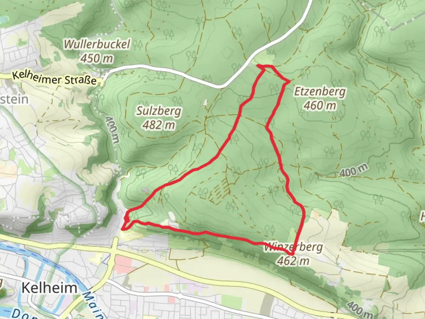
7.8 km
~1 hrs 54 min
207 m
Loop
“The Ortswanderweg Kelheim 4 trail blends natural beauty, historical landmarks, and serene landscapes for a rewarding hike.”
Starting near the picturesque town of Kelheim, Germany, the Ortswanderweg Kelheim 4 is an 8 km (approximately 5 miles) loop trail with an elevation gain of around 200 meters (656 feet). This medium-difficulty trail offers a delightful mix of natural beauty, historical landmarks, and serene landscapes, making it a rewarding experience for hikers of all levels.
Getting There
To reach the trailhead, you can either drive or use public transport. If you're driving, Kelheim is well-connected by road, and there are several parking options available near the trailhead. For those using public transport, Kelheim can be accessed via regional trains and buses. The nearest significant landmark to the trailhead is the Liberation Hall (Befreiungshalle), a prominent historical monument in the area.
Trail Highlights
As you embark on the Ortswanderweg Kelheim 4, you'll be greeted by a variety of landscapes, from dense forests to open meadows. The trail is well-marked, but it's always a good idea to have a reliable navigation tool like HiiKER to ensure you stay on track.
Historical Significance
One of the most notable landmarks along the trail is the Liberation Hall (Befreiungshalle), located near the trailhead. This impressive structure was commissioned by King Ludwig I of Bavaria to commemorate the victories over Napoleon during the Wars of Liberation. The hall's architecture and panoramic views of the surrounding countryside make it a must-see.
Nature and Wildlife
The trail meanders through the Altmühltal Nature Park, a region known for its rich biodiversity. Keep an eye out for various bird species, deer, and other wildlife that inhabit the area. The park is also home to a variety of plant species, including rare orchids and ancient beech trees.
Trail Sections
Initial Ascent: The first part of the trail involves a moderate ascent through a forested area. This section is about 2 km (1.2 miles) long and gains approximately 100 meters (328 feet) in elevation. The shaded path and the sound of rustling leaves create a peaceful atmosphere.
Mid-Section Meadows: After the initial climb, the trail levels out and opens up into scenic meadows. This section is relatively flat and stretches for about 3 km (1.9 miles). It's an excellent spot for a picnic or a short rest while enjoying the panoramic views of the Bavarian countryside.
Descent and Return: The final section of the trail involves a gentle descent back towards Kelheim. This part is around 3 km (1.9 miles) long and offers views of the Danube River as you make your way back to the starting point.
Practical Tips
- Footwear: Given the varied terrain, sturdy hiking boots are recommended.
- Weather: Check the weather forecast before you go, as conditions can change rapidly.
- Supplies: Bring enough water and snacks, especially if you plan to take breaks along the way.
- Navigation: Use HiiKER to keep track of your progress and ensure you stay on the correct path.
The Ortswanderweg Kelheim 4 offers a perfect blend of natural beauty, historical intrigue, and moderate physical challenge, making it an ideal choice for a day hike in the Bavarian region.

Comments and Reviews
User comments, reviews and discussions about the Ortswanderweg Kelheim 4, Germany.
4.0
average rating out of 5
1 rating(s)