Download
Preview
Add to list
More
4.3 km
~1 hrs 24 min
325 m
Point-to-Point
“Explore lush landscapes and historical relics on this moderately challenging 4 km trail near Kassel, Germany.”
Starting near the picturesque town of Kassel, Germany, this 4 km (approximately 2.5 miles) point-to-point trail offers a delightful mix of natural beauty and historical intrigue. With an elevation gain of around 300 meters (approximately 984 feet), the trail is rated as medium difficulty, making it suitable for moderately experienced hikers.
Getting There
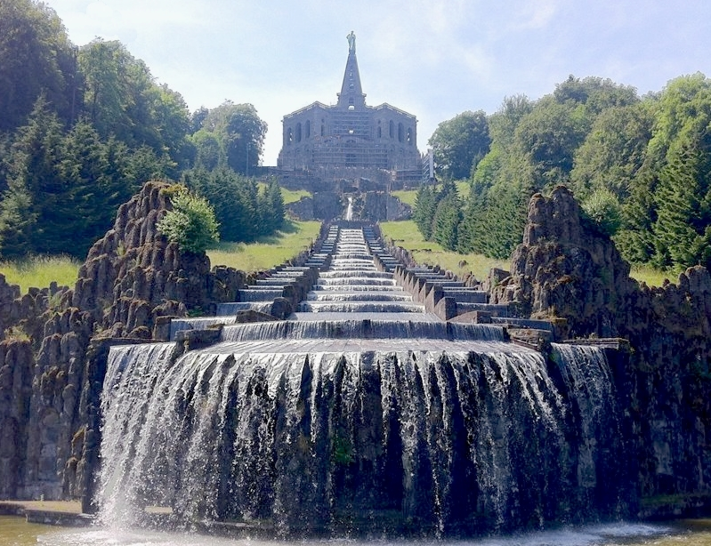
To reach the trailhead, you can either drive or use public transport. If driving, head towards Kassel and look for parking near the Bergpark Wilhelmshöhe, a UNESCO World Heritage site. For those using public transport, take a train to Kassel-Wilhelmshöhe station and then a bus or tram to the Bergpark Wilhelmshöhe stop. From there, it's a short walk to the trailhead.
Trail Highlights
As you begin your hike, you'll immediately notice the lush greenery that surrounds you. The trail meanders through dense forests and open meadows, offering a variety of landscapes to enjoy. Early on, you'll encounter the Wassertretstelle, a traditional German water-treading basin. This spot is perfect for a quick, refreshing break and is a nod to the region's spa culture.
Historical Significance
The trail passes through areas steeped in history. Kassel itself has a rich cultural heritage, having been a significant center during the Holy Roman Empire. As you hike, you'll come across remnants of old fortifications and possibly even some ancient Roman roads. Keep an eye out for informational plaques that provide context and historical background.
Flora and Fauna
The trail is a haven for nature lovers. You'll traverse through mixed forests dominated by beech and oak trees. In the spring and summer, the meadows burst into a riot of colors with wildflowers like daisies, poppies, and cornflowers. Birdwatchers will be delighted by the variety of species, including woodpeckers, owls, and various songbirds. Small mammals like foxes and deer are also commonly spotted.
Navigation
To ensure you stay on track, it's advisable to use the HiiKER app, which provides detailed maps and real-time navigation. The trail is well-marked, but having a reliable navigation tool can enhance your hiking experience.
Elevation and Terrain
The trail features a steady ascent, gaining approximately 300 meters (984 feet) in elevation. The terrain varies from well-trodden paths to rocky sections, so sturdy hiking boots are recommended. There are a few steep sections, but they are manageable with moderate fitness levels.
Points of Interest
About halfway through the hike, you'll come across the Kassel Rundweg, a circular route that offers panoramic views of the surrounding countryside. This is an excellent spot for a picnic or a rest. The views from here are particularly stunning in the early morning or late afternoon when the light casts a golden hue over the landscape.
Final Stretch
As you near the end of the trail, you'll descend gradually back towards civilization. The final section takes you through more open meadows and past small streams, offering a peaceful conclusion to your hike. The endpoint is conveniently located near public transport options, making it easy to return to Kassel or continue your journey.
This trail offers a perfect blend of natural beauty, historical significance, and moderate physical challenge, making it a rewarding experience for any hiker.

What to expect?
Activity types
Comments and Reviews
User comments, reviews and discussions about the Wassertretstelle and Kassel Rundweg, Germany.
4.25
average rating out of 5
4 rating(s)