Download
3D Flyover
Add to list
More
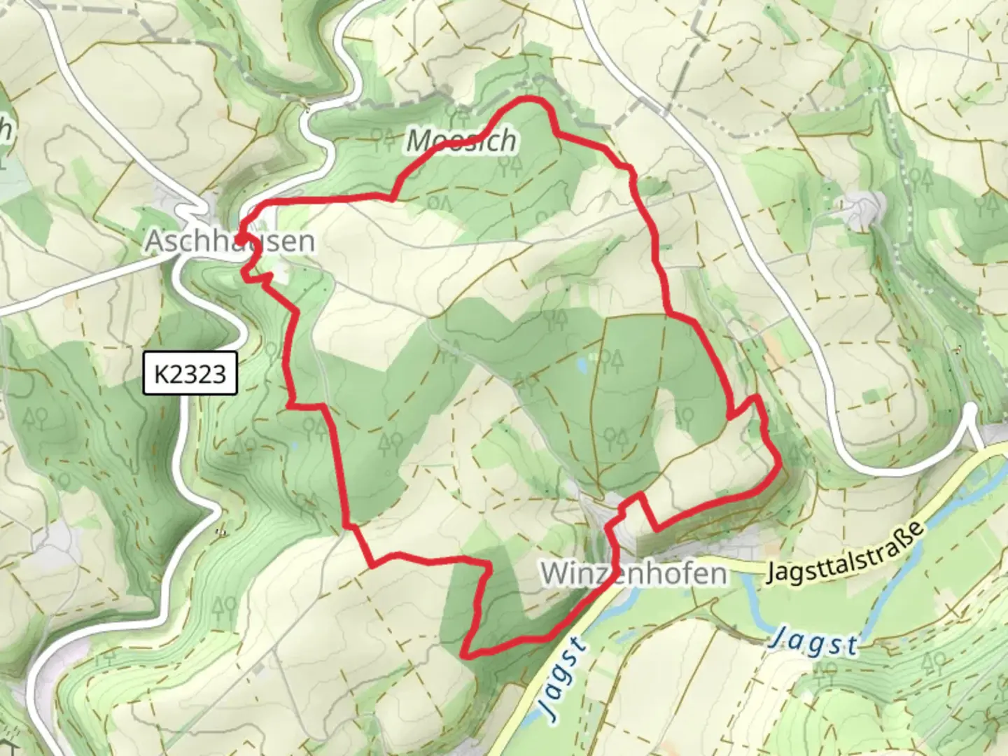
10.2 km
~2 hrs 31 min
298 m
Loop
“Explore lush forests, medieval ruins, and panoramic views on the moderately challenging Tannenbergweg and Bergweg Loop.”
Starting your hike near Hohenlohekreis, Germany, the Tannenbergweg and Bergweg Loop offers a delightful 10 km (6.2 miles) journey with an elevation gain of approximately 200 meters (656 feet). This loop trail is rated medium in difficulty, making it suitable for moderately experienced hikers.
Getting There
To reach the trailhead, you can drive or use public transport. If driving, set your GPS to the nearest significant landmark, which is the town of Öhringen. From there, follow local signage to the trailhead. For public transport, take a train to Öhringen Hauptbahnhof and then a local bus towards Hohenlohekreis. The bus stop closest to the trailhead is in the vicinity of the town center, from where you can walk to the starting point.
Trail Navigation
Using HiiKER for navigation is highly recommended. The app provides detailed maps and real-time updates, ensuring you stay on the correct path throughout your hike.
Trail Highlights
The trail begins with a gentle ascent through lush forests, offering a serene start to your journey. After about 2 km (1.2 miles), you'll reach a clearing with panoramic views of the Hohenlohekreis countryside. This is an excellent spot for a short break and some photography.
Historical Significance
Around the 4 km (2.5 miles) mark, you'll come across the ruins of an old castle, a remnant of medieval times. This site offers a glimpse into the region's rich history and is a perfect place to pause and reflect. Information boards provide historical context, making it an educational stop.
Flora and Fauna
As you continue, the trail meanders through mixed woodlands and open meadows. Keep an eye out for local wildlife such as deer, foxes, and a variety of bird species. The flora is equally diverse, with wildflowers blooming in the spring and summer months, adding vibrant colors to your hike.
Midpoint and Elevation Gain
The midpoint of the trail is marked by a steep ascent, contributing to the 200 meters (656 feet) of total elevation gain. This section can be challenging, but the effort is rewarded with stunning views from the top. Take your time and use trekking poles if needed.
Descending and Loop Completion
The descent begins around the 7 km (4.3 miles) mark, leading you back through dense forests and eventually to the starting point. The final stretch is relatively flat, allowing you to cool down and enjoy the last moments of your hike.
Practical Tips
- Wear sturdy hiking boots, as some sections can be rocky and uneven.
- Carry enough water and snacks, especially if you plan to take extended breaks.
- Check the weather forecast and dress in layers, as conditions can change rapidly.
- Use HiiKER for real-time navigation and updates.
This trail offers a balanced mix of natural beauty, historical landmarks, and moderate physical challenge, making it a rewarding experience for those who undertake it.

Comments and Reviews
User comments, reviews and discussions about the Tannenbergweg and Bergweg Loop, Germany.
5.0
average rating out of 5
1 rating(s)