Download
Preview
Add to list
More
6.9 km
~1 hrs 35 min
119 m
Loop
“Embark on the Eichenblatt Loop for a scenic 7 km hike through lush Taunus forests and Roman history.”
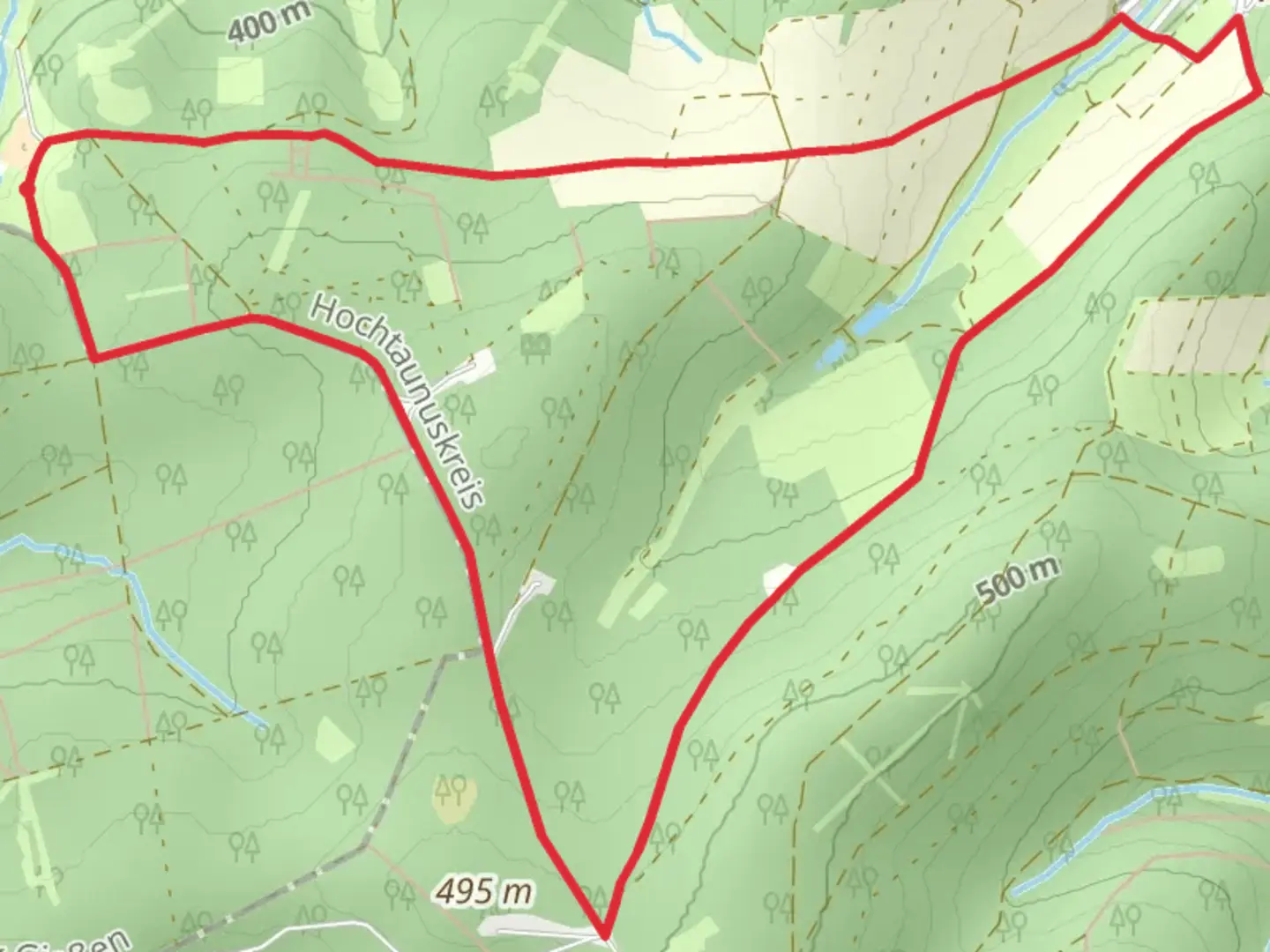
Starting near Hochtaunuskreis, Germany, the Eichenblatt Loop is a captivating 7 km (4.35 miles) trail with an elevation gain of approximately 100 meters (328 feet). This loop trail is rated as medium difficulty, making it suitable for moderately experienced hikers.
Getting There
To reach the trailhead, you can drive or use public transport. If driving, set your GPS to Hochtaunuskreis, and look for parking near the starting point. For public transport, take a train to Bad Homburg station, and from there, a local bus can take you closer to the trailhead. The nearest significant landmark is the Saalburg Roman Fort, which is a short distance away from the trail's starting point.
Trail Overview
The Eichenblatt Loop offers a diverse hiking experience through the lush forests of the Taunus mountain range. The trail is well-marked, but it's always a good idea to have a reliable navigation tool like HiiKER to ensure you stay on track.
Flora and Fauna
As you embark on the trail, you'll be surrounded by dense deciduous forests, primarily composed of oak and beech trees. In spring and summer, the forest floor is carpeted with wildflowers, adding a splash of color to your hike. Keep an eye out for local wildlife, including deer, foxes, and a variety of bird species. The area is also known for its rich insect life, so bringing insect repellent is advisable.
Significant Landmarks
Around the 2 km (1.24 miles) mark, you'll come across a small, serene pond, perfect for a short break. Continuing on, at approximately 4 km (2.48 miles), you'll encounter a historical site: the remnants of an old Roman road. This region has a deep historical significance, as it was once part of the Roman Empire's extensive network of roads. The Saalburg Roman Fort nearby is a testament to this history and worth a visit either before or after your hike.
Elevation and Terrain
The trail's elevation gain is gradual, making it manageable for most hikers. The highest point of the trail offers a modest but rewarding view of the surrounding Taunus mountains. The terrain varies from well-trodden paths to slightly rocky sections, so wearing sturdy hiking boots is recommended.
Navigation and Safety
While the trail is generally well-marked, using HiiKER can provide additional peace of mind. The app offers detailed maps and real-time tracking to ensure you stay on the correct path. Always carry enough water, especially during the warmer months, and consider packing a small first aid kit.
Final Stretch
As you near the end of the loop, the trail descends gently back towards the starting point. The final kilometer (0.62 miles) is a pleasant walk through a shaded forest, providing a cool and relaxing end to your hike.

What to expect?
Activity types
Comments and Reviews
User comments, reviews and discussions about the Eichenblatt Loop, Germany.
5.0
average rating out of 5
1 rating(s)