
Download
3D Flyover
Add to list
More
7.0 km
~1 hrs 53 min
296 m
Loop
“The Titmaringhausen Loop via Sauerland Höhenflug offers scenic beauty, historical intrigue, and a moderate hiking challenge.”
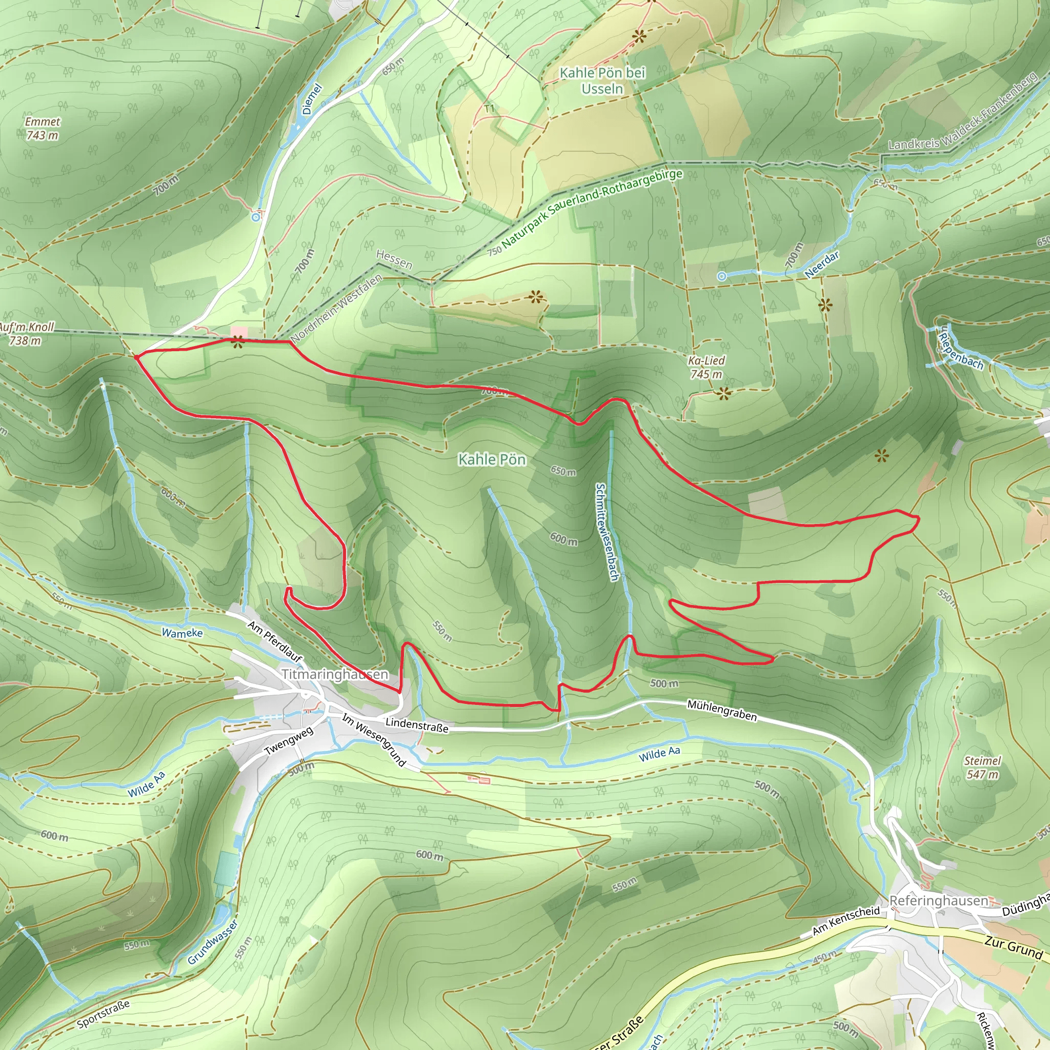
Starting near Hochsauerlandkreis, Germany, the Titmaringhausen Loop via Sauerland Höhenflug is a picturesque 7 km (4.35 miles) loop trail with an elevation gain of approximately 200 meters (656 feet). This medium-difficulty trail offers a delightful mix of natural beauty, historical significance, and moderate physical challenge, making it a rewarding experience for hikers.
Getting There
To reach the trailhead, you can drive or use public transport. If driving, set your GPS to Hochsauerlandkreis, Germany, and look for parking options near the village of Titmaringhausen. For public transport, take a train to Winterberg station, which is the nearest major station. From Winterberg, you can catch a local bus to Titmaringhausen. The bus ride offers scenic views of the Sauerland region, setting the mood for your hike.
Trail Overview
The trail begins in the charming village of Titmaringhausen, known for its traditional half-timbered houses and serene countryside. As you start your hike, you'll be greeted by lush meadows and dense forests, typical of the Sauerland region. The initial part of the trail is relatively flat, allowing you to ease into the hike while enjoying the tranquil surroundings.
Key Landmarks and Nature
About 2 km (1.24 miles) into the hike, you'll encounter the first significant elevation gain. The trail ascends through a mixed forest, where you can spot a variety of flora and fauna. Keep an eye out for native bird species like the European robin and the great spotted woodpecker. The forest floor is often carpeted with wildflowers in the spring and summer, adding a splash of color to your hike.
Historical Significance
As you reach the higher elevations, you'll come across remnants of historical significance. The Sauerland region has a rich history dating back to medieval times. Look for old boundary stones and markers that once delineated territories. These stones are a testament to the region's historical importance and offer a glimpse into its past.
Scenic Vistas
Around the 4 km (2.48 miles) mark, the trail opens up to offer panoramic views of the surrounding valleys and hills. This is an excellent spot to take a break and soak in the scenery. The Sauerland Höhenflug, or "Sauerland High-Flyer," is known for its breathtaking vistas, and this section of the trail does not disappoint. On a clear day, you can see for miles, with rolling hills and dense forests stretching out before you.
Final Stretch
The descent begins around the 5.5 km (3.42 miles) point, leading you back towards Titmaringhausen. This section of the trail is less steep but requires careful footing, especially if the ground is wet. As you make your way down, you'll pass through more open meadows and farmland, offering a different but equally charming perspective of the Sauerland landscape.
Navigation and Safety
For navigation, it's highly recommended to use the HiiKER app, which provides detailed maps and real-time updates. The trail is well-marked, but having a reliable navigation tool ensures you stay on track and can enjoy your hike without any worries.
Wildlife and Flora
The final kilometer (0.62 miles) brings you back into the village, where you can reflect on the diverse landscapes and rich history you've encountered. The Sauerland region is home to a variety of wildlife, including deer, foxes, and numerous bird species. The flora is equally diverse, with beech, oak, and spruce trees dominating the forests, and wildflowers like bluebells and daisies adding color to the meadows.
This loop trail offers a perfect blend of natural beauty, historical intrigue, and moderate physical challenge, making it an ideal choice for hikers looking to explore the scenic Sauerland region.
What to expect?
Activity types
Comments and Reviews
User comments, reviews and discussions about the Titmaringhausen Loop via Sauerland Höhenflug, Germany.
4.75
average rating out of 5
4 rating(s)
