Download
3D Flyover
Add to list
More
6.5 km
~1 hrs 37 min
194 m
Point-to-Point
“Experience a picturesque, moderately challenging 7 km hike from Petersborn to Langer Berg, highlighting Sauerland's natural beauty and historical intrigue.”
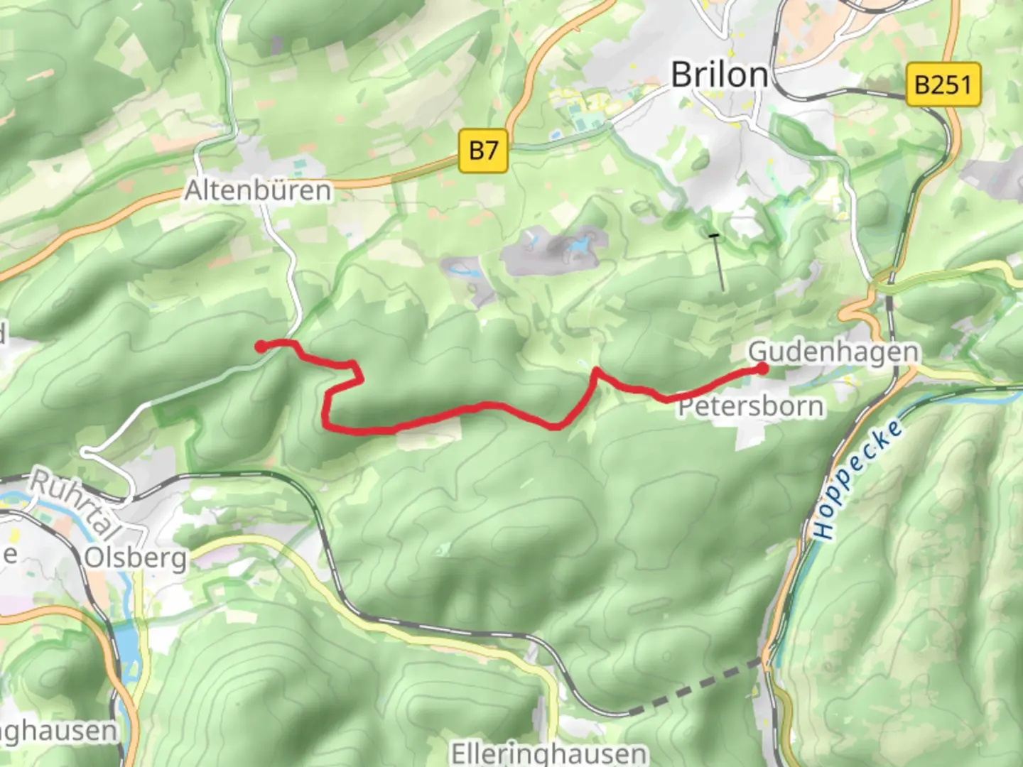
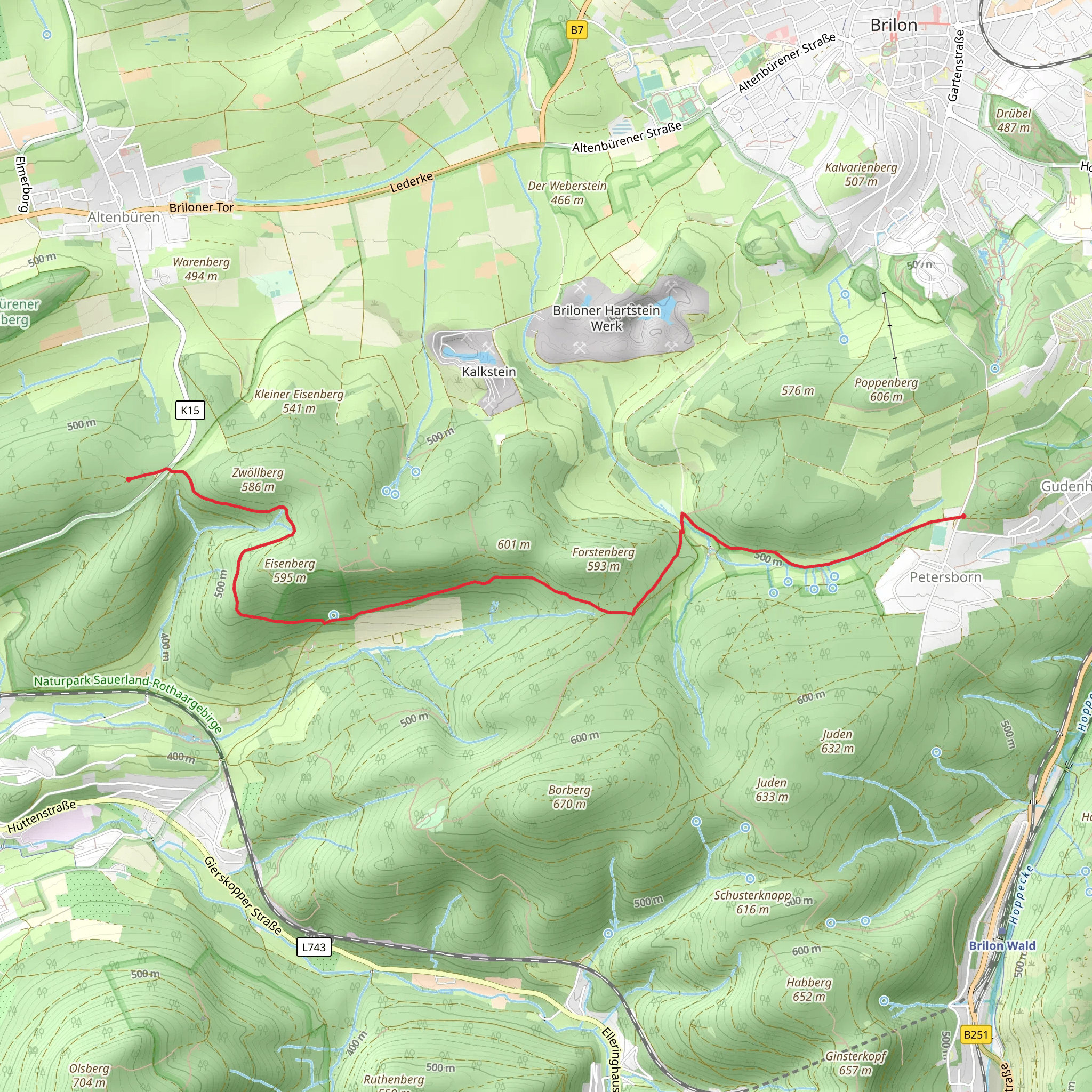
Starting near the picturesque region of Hochsauerlandkreis in Germany, this 7 km (approximately 4.35 miles) point-to-point trail offers a delightful mix of natural beauty and moderate challenge. With an elevation gain of around 100 meters (328 feet), the Petersborn to Langer Berg Walk is perfect for those looking to enjoy a scenic hike without overly strenuous climbs.
Getting There
To reach the trailhead, you can either drive or use public transport. If driving, set your GPS to the nearest known address: Petersborn, Hochsauerlandkreis, Germany. For those using public transport, the nearest major town is Winterberg. From Winterberg, you can take a local bus or taxi to Petersborn. The bus routes are well-connected, and schedules can be checked on local transit websites.
Trail Overview
The trail begins in the quaint village of Petersborn, nestled in the heart of the Sauerland region. As you set off, you'll be greeted by lush forests and rolling hills, characteristic of this part of Germany. The initial part of the trail is relatively flat, making it a good warm-up for the moderate inclines that follow.
Landmarks and Points of Interest
- Petersborn Chapel: About 1 km (0.62 miles) into the hike, you'll come across the Petersborn Chapel. This small, historic chapel is a serene spot for a quick rest and some reflection.
- Forests and Flora: As you continue, the trail meanders through dense forests of beech and oak trees. During spring and summer, the forest floor is carpeted with wildflowers, adding a splash of color to your hike.
- Wildlife: Keep an eye out for local wildlife, including deer, foxes, and a variety of bird species. Early morning or late afternoon hikes offer the best chances for wildlife sightings.
Mid-Trail Highlights
- Elevation Gain: Around the 3 km (1.86 miles) mark, you'll start to experience a gradual elevation gain. The trail ascends gently, offering panoramic views of the surrounding countryside. This section is particularly beautiful in autumn when the foliage turns vibrant shades of red and gold.
- Historical Significance: The Sauerland region has a rich history dating back to medieval times. As you hike, you'll notice remnants of old stone walls and pathways that were once used by traders and villagers.
Final Stretch
- Langer Berg: The trail culminates at Langer Berg, a hill offering stunning vistas of the Sauerland region. At approximately 6 km (3.73 miles), you'll reach the highest point of the trail. Take a moment to enjoy the view and perhaps have a snack before descending.
- Descent to Trail End: The final kilometer (0.62 miles) is a gentle descent, leading you to the endpoint near the village of Langer Berg. This section is shaded and offers a peaceful end to your hike.
Navigation and Safety
For navigation, it's recommended to use the HiiKER app, which provides detailed maps and real-time updates. The trail is well-marked, but having a reliable navigation tool ensures you stay on track. Always carry sufficient water, snacks, and a basic first-aid kit. Weather in the Sauerland region can be unpredictable, so check the forecast and dress in layers.
This hike offers a perfect blend of natural beauty, moderate physical challenge, and historical intrigue, making it a rewarding experience for hikers of all levels.
What to expect?
Activity types
Comments and Reviews
User comments, reviews and discussions about the Petersborn to Langer Berg Walk, Germany.
5.0
average rating out of 5
2 rating(s)
