Download
Preview
Add to list
More
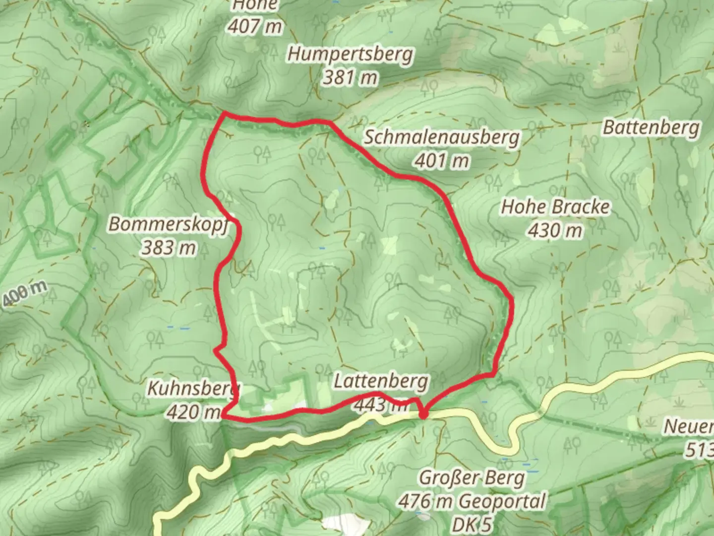
7.4 km
~1 hrs 43 min
147 m
Loop
“Experience a 7 km loop of natural beauty, historical landmarks, and wildlife in Hochsauerlandkreis, Germany.”
Starting near Hochsauerlandkreis, Germany, the Lattenberg Rundweg A2 and A3 is a picturesque loop trail that spans approximately 7 km (4.3 miles) with an elevation gain of around 100 meters (328 feet). This medium-difficulty trail offers a delightful mix of natural beauty, historical landmarks, and opportunities for wildlife spotting.
Getting There
To reach the trailhead, you can drive or use public transport. If driving, set your GPS to Hochsauerlandkreis, Germany, and look for parking near the trailhead. For those using public transport, take a train or bus to the nearest town, Winterberg, and then a local bus or taxi to the trailhead.
Trail Navigation
For navigation, it's highly recommended to use the HiiKER app, which provides detailed maps and real-time updates to ensure you stay on track.
Trail Highlights
Nature and Wildlife
The trail meanders through dense forests and open meadows, offering a rich tapestry of flora and fauna. Keep an eye out for deer, foxes, and a variety of bird species. The forested sections are particularly enchanting, with tall, ancient trees providing a canopy of green.
Historical Significance
The region around Hochsauerlandkreis has a rich history dating back to medieval times. As you hike, you'll come across remnants of old stone walls and possibly even ancient boundary markers. These historical elements add a layer of intrigue to your hike, making it not just a physical journey but also a walk through time.
Key Landmarks
Lattenberg Summit
Approximately 3 km (1.9 miles) into the hike, you'll reach the summit of Lattenberg. Although the elevation gain is modest, the views from the top are rewarding. On a clear day, you can see for miles, taking in the rolling hills and dense forests that characterize the Hochsauerland region.
Scenic Overlook
Around the 5 km (3.1 miles) mark, there's a scenic overlook that provides a perfect spot for a break. Here, you can enjoy panoramic views of the surrounding landscape, making it an ideal location for photography or simply soaking in the natural beauty.
Trail Conditions
The trail is well-marked and maintained, but it's always wise to be prepared for varying conditions. The forested sections can be muddy after rain, so waterproof hiking boots are recommended. The open meadows can be exposed to the sun, so bring a hat and sunscreen.
Safety Tips
While the trail is generally safe, always carry a basic first-aid kit and plenty of water. Mobile reception can be spotty in some areas, so download the trail map on HiiKER before you start.
Final Stretch
As you near the end of the loop, the trail descends gently back towards the starting point. This section is less strenuous, allowing you to cool down and reflect on the diverse landscapes and historical elements you've encountered.
By the time you complete the Lattenberg Rundweg A2 and A3, you'll have experienced a rich blend of natural beauty, historical intrigue, and moderate physical challenge, making it a rewarding hike for those looking to explore the heart of Germany's Hochsauerlandkreis region.

Comments and Reviews
User comments, reviews and discussions about the Lattenberg Rundweg A2 and A3, Germany.
5.0
average rating out of 5
1 rating(s)