Download
3D Flyover
Add to list
More
11.6 km
~2 hrs 55 min
359 m
Loop
“Discover the Hardtkopf via Berge Rundweg: a 12 km scenic hike blending nature, history, and moderate challenge.”
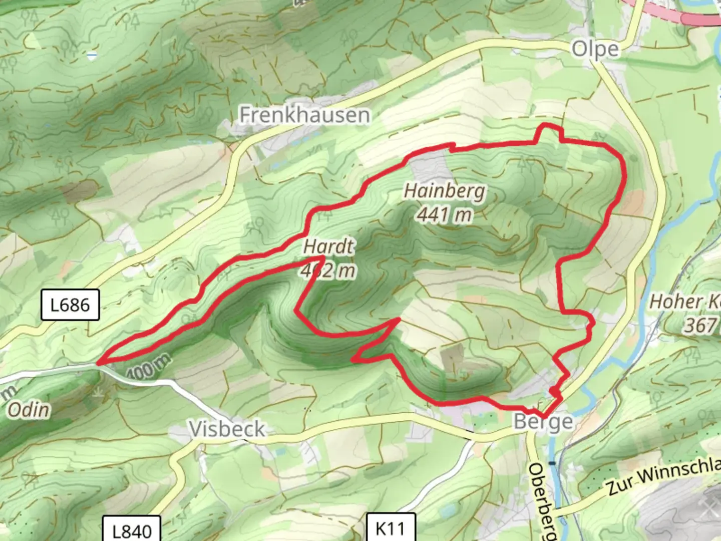
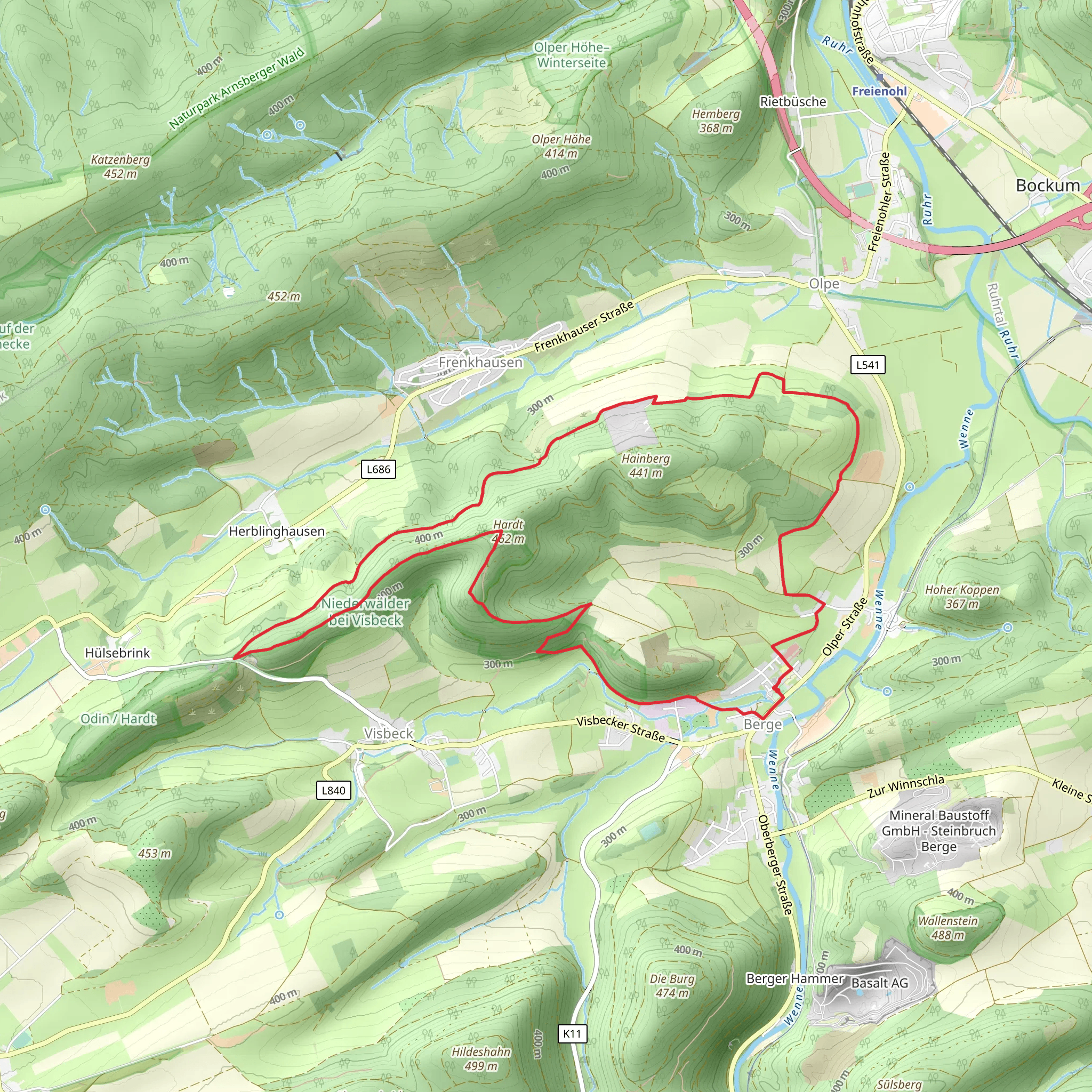
Starting near Hochsauerlandkreis, Germany, the Hardtkopf via Berge Rundweg is a 12 km (7.5 miles) loop trail with an elevation gain of approximately 300 meters (984 feet). This medium-difficulty hike offers a blend of natural beauty, historical significance, and a moderate challenge suitable for most hikers.
Getting There
To reach the trailhead, you can drive or use public transport. If driving, set your GPS to Hochsauerlandkreis, Germany, and look for parking near the village of Berge. For public transport, take a train to Meschede and then a local bus to Berge. The trailhead is conveniently located near the village, making it easily accessible.
Trail Overview
The trail begins with a gentle ascent through mixed forests, where you'll encounter a variety of flora and fauna. Keep an eye out for deer and various bird species that inhabit the area. The initial 2 km (1.2 miles) will take you through dense woodland, providing ample shade and a serene atmosphere.
Historical Significance
As you continue, you'll come across remnants of historical significance. Around the 4 km (2.5 miles) mark, you'll find an old stone marker, a relic from the medieval period when this region was a crucial trade route. This marker is a great spot to take a break and soak in the historical ambiance.
Scenic Views
The trail then opens up to a series of meadows, offering panoramic views of the surrounding Sauerland hills. The elevation gain becomes more noticeable here, with a steady climb that rewards you with breathtaking vistas. At approximately 6 km (3.7 miles), you'll reach the highest point of the trail, Hardtkopf, standing at 618 meters (2,028 feet) above sea level. This is an ideal spot for a picnic and some photography.
Wildlife and Flora
Descending from Hardtkopf, the trail meanders through a mix of coniferous and deciduous forests. This section is particularly rich in wildlife; you might spot foxes, wild boars, and a variety of bird species. The forest floor is often carpeted with wildflowers, especially in the spring and early summer months.
Navigation
For navigation, it's highly recommended to use the HiiKER app, which provides detailed maps and real-time updates. The trail is well-marked, but having a reliable navigation tool ensures you stay on track and can explore any interesting detours confidently.
Final Stretch
The last 3 km (1.9 miles) of the trail take you through rolling hills and farmland, gradually descending back towards Berge. This section is less strenuous, allowing you to enjoy the pastoral landscapes and perhaps even interact with local farmers.
Practical Tips
- Wear sturdy hiking boots, as some sections can be rocky and uneven.
- Carry enough water and snacks, especially if you plan to picnic at Hardtkopf.
- Check the weather forecast before heading out; the trail can be slippery after rain.
- Use the HiiKER app for navigation and to check for any trail updates or closures.
This trail offers a well-rounded hiking experience with its mix of natural beauty, historical landmarks, and moderate physical challenge. Whether you're a seasoned hiker or a casual walker, the Hardtkopf via Berge Rundweg provides a memorable outdoor adventure.
What to expect?
Activity types
Comments and Reviews
User comments, reviews and discussions about the Hardtkopf via Berge Rundweg, Germany.
4.33
average rating out of 5
3 rating(s)
