
Download
3D Flyover
Add to list
More
7.1 km
~1 hrs 46 min
217 m
Loop
“Explore the scenic, historical Liebesbuchen Weg trail, featuring ancient beech trees and medieval ruins.”
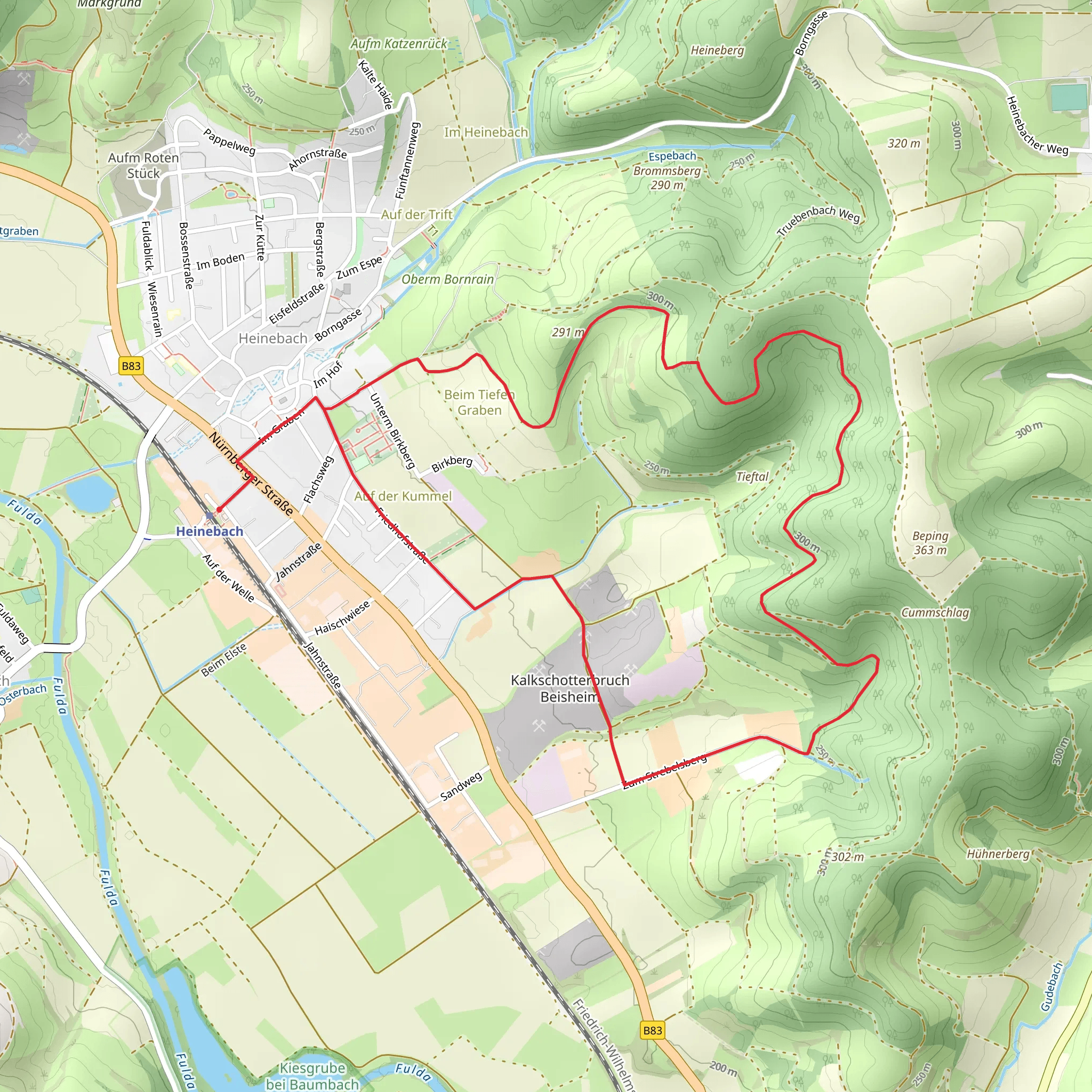
Starting near Hersfeld-Rotenburg in Germany, this 7 km (approximately 4.35 miles) loop trail offers a moderate challenge with an elevation gain of around 200 meters (656 feet). The trailhead is easily accessible by car or public transport. If driving, you can park near the town center of Hersfeld-Rotenburg. For those using public transport, the nearest train station is Bad Hersfeld, from where you can take a local bus or taxi to the trailhead.
Trail Navigation and Terrain
The Liebesbuchen Weg is well-marked and can be navigated using the HiiKER app, which provides detailed maps and real-time GPS tracking. The trail features a mix of forest paths, open meadows, and gentle inclines, making it suitable for hikers with a moderate level of fitness.
Flora and Fauna
As you embark on the trail, you'll be greeted by a lush forest canopy primarily composed of beech trees, which are particularly stunning in the autumn months. The trail is named after these "Liebesbuchen" or "Love Beeches," which are a significant feature of the landscape. Keep an eye out for local wildlife, including deer, foxes, and a variety of bird species. The forest floor is often carpeted with wildflowers in the spring, adding a splash of color to your hike.
Historical Significance
The region around Hersfeld-Rotenburg is steeped in history. The trail itself passes near several historical landmarks, including the ruins of the Hersfeld Abbey, a Benedictine monastery founded in the 8th century. Approximately 3 km (1.86 miles) into the hike, you will come across an old stone bridge that dates back to the medieval period. This bridge is a great spot for a short break and some photographs.
Points of Interest
- Liebesbuchen Trees: These ancient beech trees are a highlight of the trail, offering a serene and picturesque setting.
- Hersfeld Abbey Ruins: Located near the trail, these ruins provide a glimpse into the region's rich monastic history.
- Medieval Stone Bridge: A charming historical structure perfect for a rest stop.
Practical Information
- Water and Snacks: There are no facilities along the trail, so be sure to bring enough water and snacks for the hike.
- Footwear: Sturdy hiking boots are recommended due to the uneven terrain and occasional muddy patches.
- Weather: The trail can be slippery after rain, so check the weather forecast and dress accordingly.
Getting There
- By Car: Park near the town center of Hersfeld-Rotenburg. The trailhead is a short walk from the parking area.
- By Public Transport: Take a train to Bad Hersfeld station, then a local bus or taxi to the trailhead.
This trail offers a delightful mix of natural beauty and historical intrigue, making it a rewarding experience for any hiker.
Comments and Reviews
User comments, reviews and discussions about the Liebesbuchen Weg, Germany.
average rating out of 5
0 rating(s)
