Download
3D Flyover
Add to list
More
152.4 km
~6 days
852 m
Multi-Day
“Explore the Freudenthalweg's serene 152-kilometer journey through Hamburg's verdant heart, steeped in history and welcoming to all levels of hikers.”
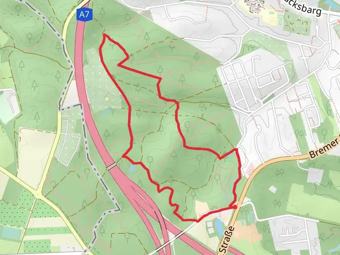
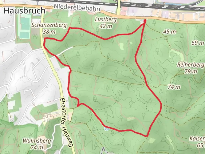
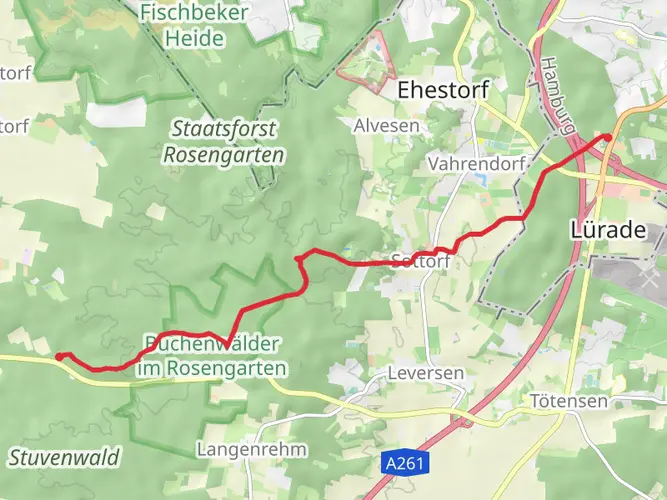
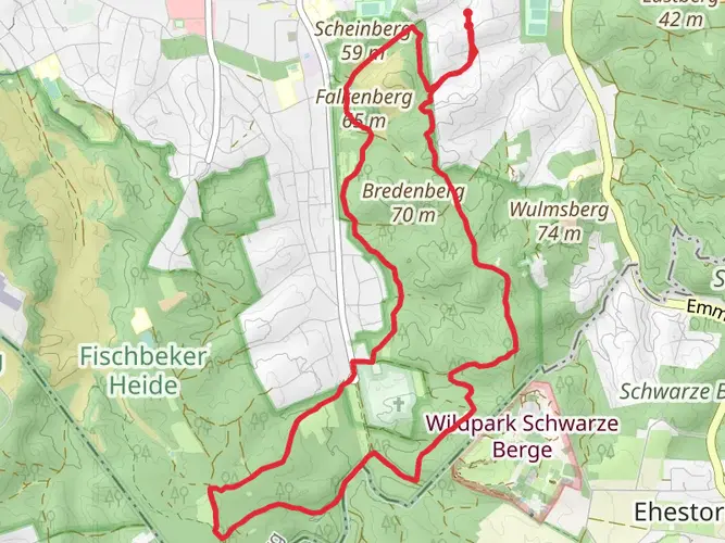
The Freudenthalweg is a scenic trail that stretches approximately 152 kilometers (about 94 miles) through the lush landscapes near Hamburg, Germany. With an elevation gain of around 800 meters (roughly 2625 feet), it is considered an easy hike, making it accessible for hikers of all skill levels.
Getting to the Trailhead
To reach the starting point of the Freudenthalweg, hikers can either drive or use public transportation. If driving, the trailhead is conveniently located near Hamburg, and parking can be found in the vicinity. For those opting for public transport, Hamburg has an extensive network of buses and trains that can get you close to the trail's beginning. From the central station (Hauptbahnhof), you can take regional trains to smaller towns near the trailhead.
Navigating the Trail
Hikers can rely on HiiKER to navigate the trail, as it provides detailed maps and waypoints that are helpful for staying on track. The Freudenthalweg is well-marked, with signage guiding you through the picturesque German countryside.
Landmarks and Nature
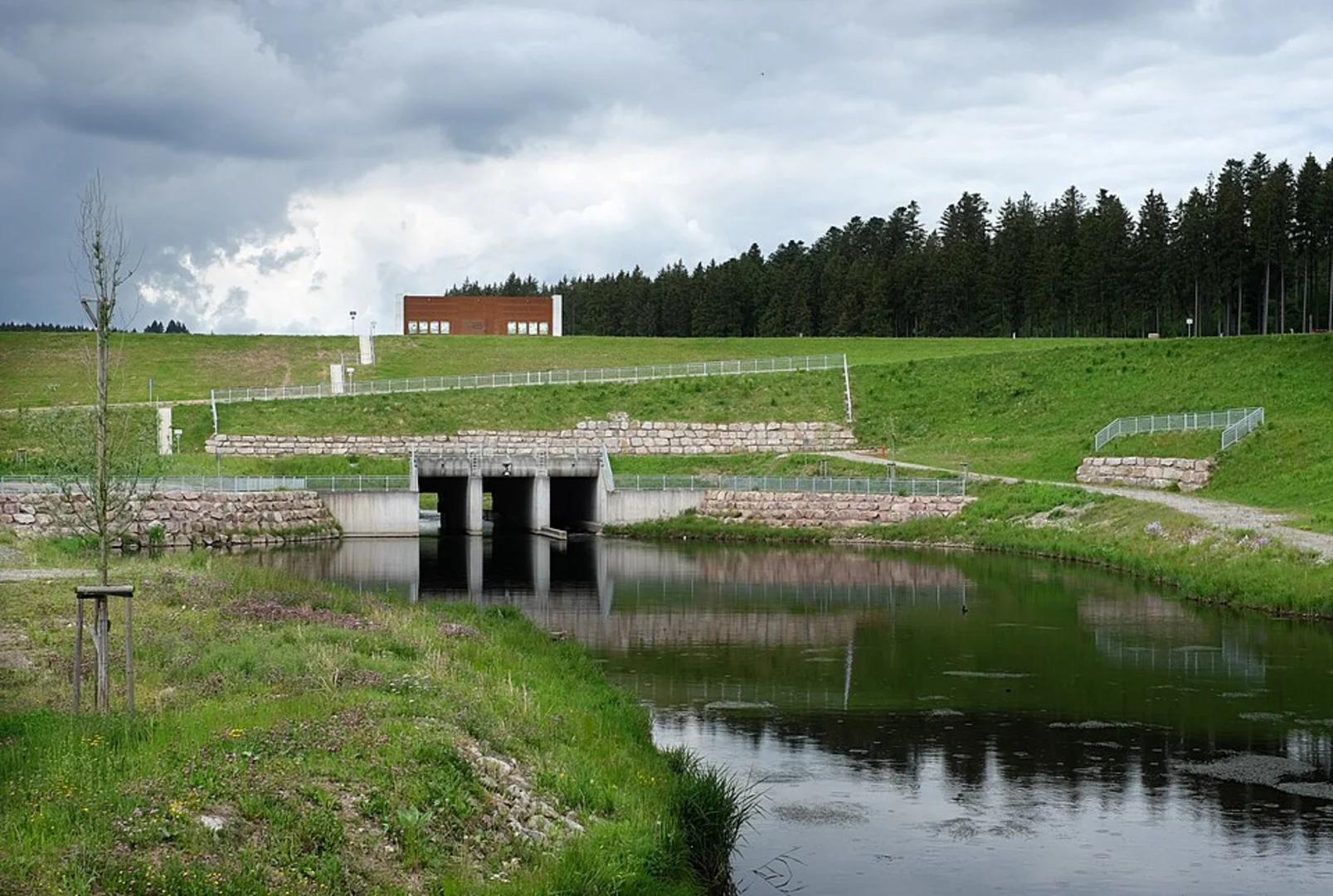
As you embark on the Freudenthalweg, you'll wander through a variety of landscapes, including dense forests, open meadows, and tranquil riverbanks. The trail offers an opportunity to observe the region's diverse flora and fauna. Birdwatchers will delight in the variety of species that can be spotted along the way.
Historical Significance
The area surrounding the Freudenthalweg is steeped in history. The trail itself may lead you past ancient ruins and through old villages where you can sense the rich past of the region. Take the time to appreciate the architecture of centuries-old buildings and the cultural heritage that has shaped this part of Germany.
Preparation and Planning
Before setting out, hikers should ensure they have adequate supplies, including water, snacks, and appropriate clothing for the weather. The trail can be completed in sections for those who prefer shorter hikes, or over several days for those who want to experience the full route. There are designated rest areas and shelters along the way, but it's wise to have a plan for overnight accommodations if you're embarking on a multi-day hike.
Wildlife and Safety
While the Freudenthalweg is an easy hike, it's still important to be prepared for encounters with local wildlife. Stick to the trail to minimize the impact on the natural environment and to keep safe. Always let someone know your hiking plan and expected return time, especially if hiking alone.
Seasonal Considerations
The trail is accessible year-round, but the experience can vary greatly depending on the season. Spring and summer offer blooming flowers and lush greenery, while autumn brings a spectacular display of fall foliage. Winter hikes can be magical with snow-covered paths, but hikers should be prepared for colder temperatures and shorter daylight hours.
By planning ahead and respecting the natural and historical significance of the Freudenthalweg, hikers can enjoy a memorable experience traversing this beautiful German landscape.

Frequently asked questions
How long is the Freudenthalweg and how many stages is the Freudenthalweg usually split into?
The Freudenthalweg is about 152.36 km long, so it is a true multi-day route rather than a single-day walk. It is commonly divided into 7 stages, with the first stage running from Harburg toward Seppensen, which makes stage planning manageable for most hikers on an easy long-distance trail.
Where does the Freudenthalweg start near Hamburg Harburg?
The Freudenthalweg starts in the Hamburg-Harburg area, with the route beginning around Marmstorf/Appelbüttel on the southern edge of Hamburg. A commonly cited access point is the Appelbütteler Weg bus stop, which links the trail start with Hamburg-Harburg station and makes the Harburg end practical for a point-to-point hike.
Is there a bus stop for the Freudenthalweg near the Hamburg trailhead?
Yes. One of the best-known public transport access points for the Freudenthalweg near Hamburg is the Appelbütteler Weg bus stop. That stop is used as a practical trailhead for the Harburg end of the route and connects back toward Hamburg-Harburg, which is useful for starting or finishing a long-distance walk without a car.
Does the Freudenthalweg pass through Wilstorf in Hamburg?
The Freudenthalweg is associated with the Harburg side of southern Hamburg, and Wilstorf is one of the nearby districts tied to access and local wayfinding for the route. The trail’s Hamburg approach begins in the Harburg area before heading south toward the Lüneburg Heath, so Wilstorf is relevant mainly as part of the urban access zone rather than the core heathland section.
What are the main highlights on the Freudenthalweg after leaving Hamburg?
After the Hamburg-Harburg start, the Freudenthalweg heads into the Lüneburg Heath and passes several standout landmarks. Frequently noted highlights include the Büsenbachtal, the car-free village of Wilsede, the Totengrund, and the Wilseder Berg, which at about 169 m is the highest point in the North German Plain.
Is the Freudenthalweg difficult, and how much climbing is on the route?
The Freudenthalweg is generally considered an easy long-distance hike. Over its 152.36 km length, the total elevation gain is about 852 m, so the route is far more about sustained distance over several days than steep mountain climbing.
Is Freudenthalweg 33 in Hamburg the trailhead for the Freudenthalweg?
No clear evidence links Freudenthalweg 33 in Hamburg to the hiking trail’s official trailhead. Freudenthalweg 33 is a street address in Hamburg-Wilstorf, while the hiking route is usually accessed from the Harburg/Marmstorf-Appelbüttel side, with Appelbütteler Weg commonly referenced as the practical starting point.
Comments and Reviews
User comments, reviews and discussions about the Freudenthalweg, Germany.
5.0
average rating out of 5
4 rating(s)