Download
Preview
Add to list
More
7.5 km
~1 hrs 49 min
200 m
Loop
“The Letmathe Rundweg 7 offers a scenic 7-kilometer hike with lush forests, historical landmarks, and wildlife spotting.”
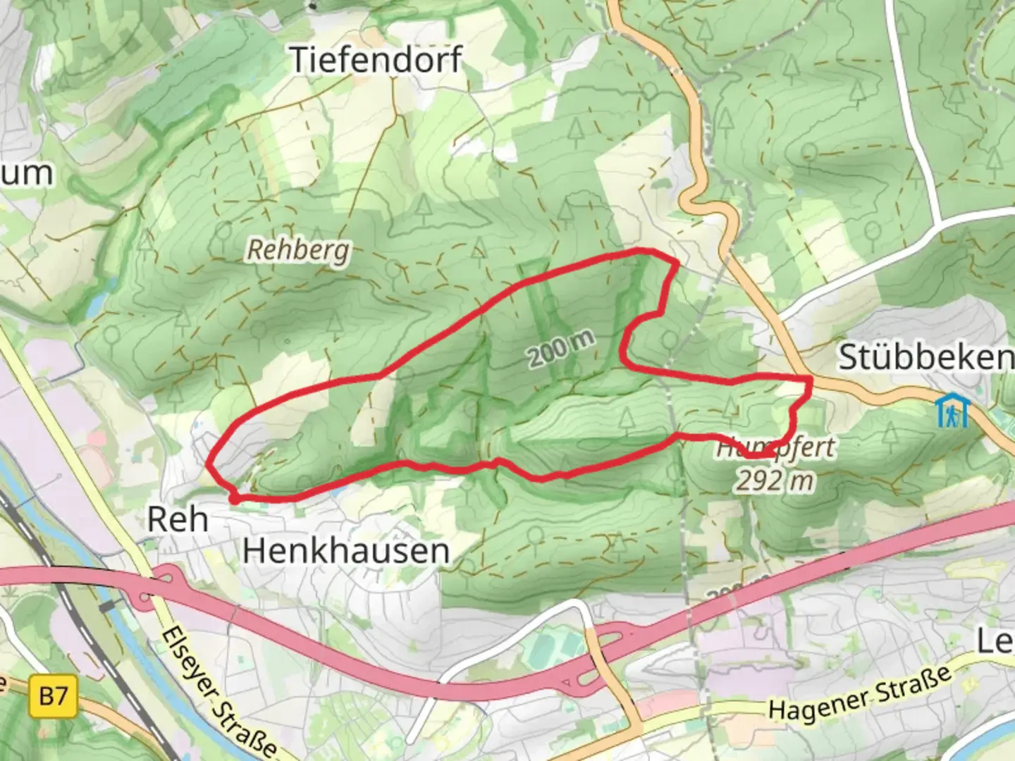
Starting near Hagen, Germany, the Letmathe Rundweg 7 is a scenic loop trail that spans approximately 7 kilometers (4.35 miles) with an elevation gain of around 200 meters (656 feet). This medium-difficulty trail offers a delightful mix of natural beauty, historical landmarks, and opportunities for wildlife spotting.
Getting There
To reach the trailhead, you can either drive or use public transportation. If driving, set your GPS to the nearest known address: Letmathe, Iserlohn, Germany. For those using public transport, take a train to Letmathe station, which is well-connected to major cities like Hagen. From the station, it's a short walk to the trailhead.
Trail Navigation
For navigation, it's highly recommended to use the HiiKER app, which provides detailed maps and real-time updates. The trail is well-marked, but having a reliable navigation tool ensures you stay on track.
Trail Highlights
Nature and Wildlife
The trail meanders through lush forests and open meadows, offering a diverse range of flora and fauna. Keep an eye out for native bird species and small mammals that inhabit the area. The forested sections provide ample shade, making it a pleasant hike even during warmer months.
Historical Significance
One of the notable landmarks along the trail is the Hohenlimburg Castle, located approximately 3 kilometers (1.86 miles) from the trailhead. This medieval fortress dates back to the 13th century and offers a glimpse into the region's rich history. The castle is perched on a hill, providing panoramic views of the surrounding landscape.
Trail Sections
Initial Ascent
The first section of the trail involves a gradual ascent through dense woodland. This part of the hike covers about 2 kilometers (1.24 miles) and gains approximately 100 meters (328 feet) in elevation. The path is well-trodden but can be slippery after rain, so sturdy hiking boots are recommended.
Mid-Trail Plateau
After the initial climb, the trail levels out onto a plateau, offering a more relaxed walk for the next 3 kilometers (1.86 miles). This section is characterized by open meadows and occasional viewpoints where you can take in the scenic vistas. There are several benches along this stretch, perfect for a short rest or a picnic.
Final Descent
The last part of the trail involves a descent back towards the starting point. This section is about 2 kilometers (1.24 miles) long and drops around 100 meters (328 feet) in elevation. The path here is rocky in places, so watch your footing.
Practical Information
- Best Time to Hike: Spring and autumn are ideal, offering mild weather and vibrant foliage.
- Facilities: There are no restrooms or water sources along the trail, so come prepared with sufficient water and snacks.
- Wildlife Precautions: While wildlife encounters are rare, it's advisable to keep a safe distance from any animals you may come across.
By following these guidelines and using the HiiKER app for navigation, you'll be well-prepared to enjoy the Letmathe Rundweg 7 trail.

Comments and Reviews
User comments, reviews and discussions about the Letmathe Rundweg 7, Germany.
4.67
average rating out of 5
3 rating(s)