Download
3D Flyover
Add to list
More
14.3 km
~3 hrs 9 min
175 m
Loop
“Discover the Obernfelder Rundwanderweg, a 14 km scenic loop with stunning views and historical gems.”
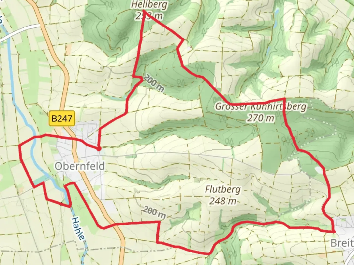
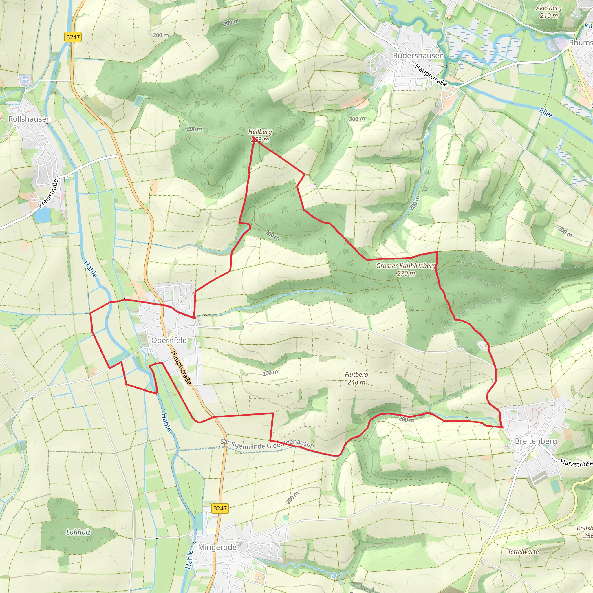
Starting near Göttingen, Germany, the Obernfelder Rundwanderweg is a scenic loop trail that spans approximately 14 kilometers (8.7 miles) with an elevation gain of around 100 meters (328 feet). This trail offers a moderate challenge, making it suitable for hikers with some experience.
Getting There
To reach the trailhead, you can either drive or use public transport. If you're driving, head towards Göttingen and follow the signs to Obernfeld. There is ample parking available near the starting point. For those using public transport, take a train to Göttingen and then a local bus towards Obernfeld. The nearest significant landmark to the trailhead is the Obernfeld village center.
Trail Overview
The trail begins in the charming village of Obernfeld, known for its picturesque half-timbered houses and serene countryside. As you set off, you'll quickly find yourself immersed in lush forests and rolling hills. The first section of the trail is relatively flat, allowing you to ease into the hike while enjoying the natural beauty around you.
Key Landmarks and Points of Interest
- Obernfeld Village: Starting in Obernfeld, take a moment to explore the village. The local church, St. Peter and Paul, is a historical gem dating back to the 12th century.
- Forests and Meadows: As you progress, you'll traverse through dense forests and open meadows. Keep an eye out for local wildlife such as deer, foxes, and a variety of bird species.
- Elevation Gain: Around the 5-kilometer (3.1-mile) mark, you'll encounter a gentle ascent. The elevation gain is gradual, making it manageable for most hikers. This section offers stunning views of the surrounding countryside.
- Panoramic Views: Approximately halfway through the hike, you'll reach a vantage point that provides panoramic views of the Göttingen region. This is an excellent spot for a break and some photography.
- Historical Sites: The trail also passes by several historical sites, including remnants of old farmhouses and ancient boundary stones that date back to medieval times.
Navigation and Safety
The trail is well-marked with signs and markers, but it's always a good idea to have a reliable navigation tool. HiiKER is an excellent app for this purpose, providing detailed maps and real-time tracking to ensure you stay on course.
Flora and Fauna
The Obernfelder Rundwanderweg is rich in biodiversity. The forests are home to oak, beech, and pine trees, while the meadows burst with wildflowers in the spring and summer months. Birdwatchers will be delighted by the variety of species, including woodpeckers, owls, and songbirds.
Practical Tips
- Footwear: Wear sturdy hiking boots, as some sections can be muddy, especially after rain.
- Weather: Check the weather forecast before you go. The trail can be slippery in wet conditions.
- Supplies: Bring enough water and snacks. There are no facilities along the trail, so it's essential to be self-sufficient.
- Respect Nature: As always, follow Leave No Trace principles. Carry out all trash and respect the local wildlife.
The Obernfelder Rundwanderweg offers a delightful mix of natural beauty, historical intrigue, and moderate physical challenge, making it a rewarding experience for any hiker.
Comments and Reviews
User comments, reviews and discussions about the Obernfelder Rundwanderweg, Germany.
average rating out of 5
0 rating(s)
