Download
3D Flyover
Add to list
More
7.2 km
~2 hrs 37 min
713 m
Out and Back
“Experience Bavarian Alps' beauty on the rewarding 7 km Osterfeuerspitze trail near Garmisch-Partenkirchen.”
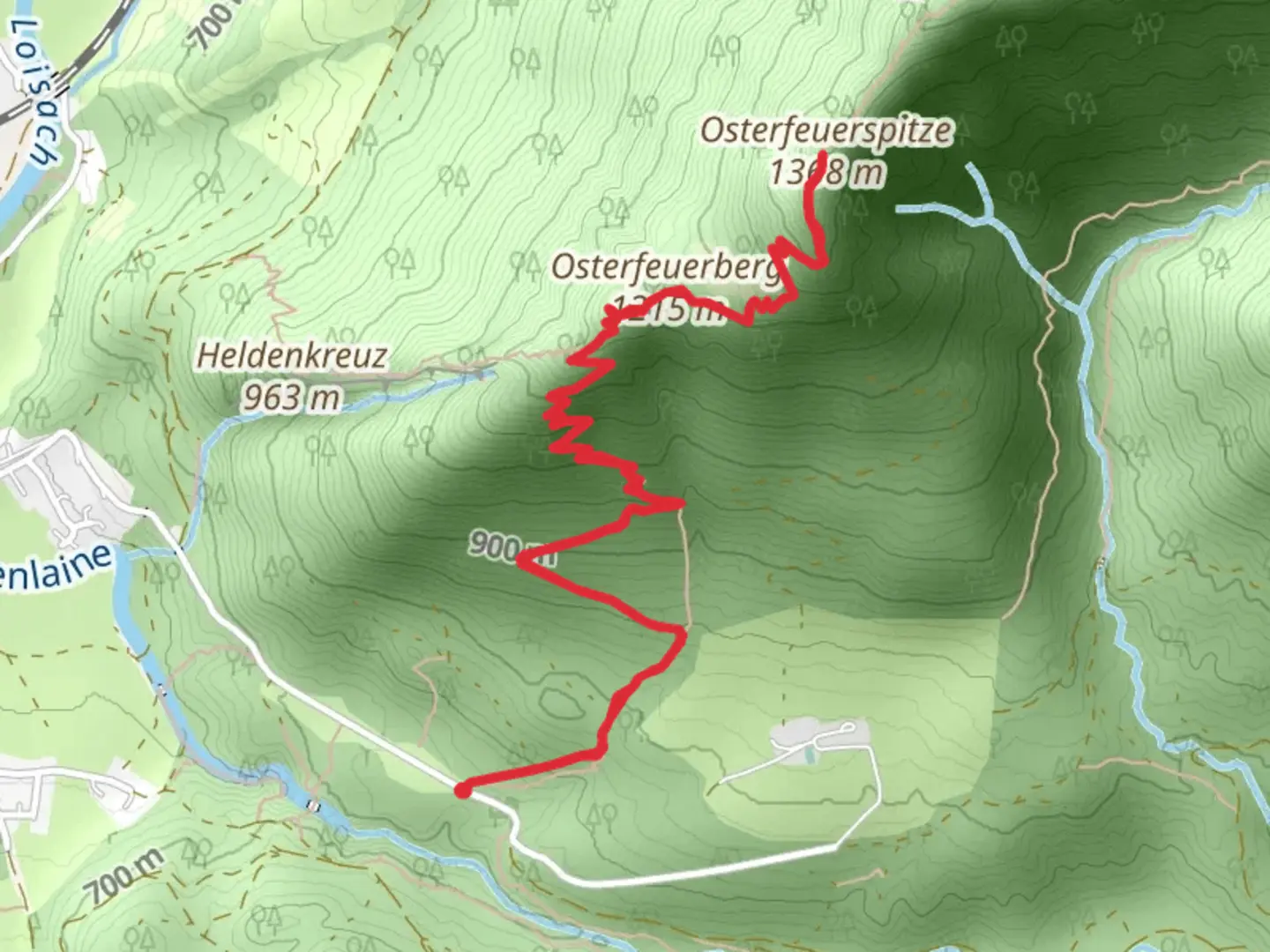
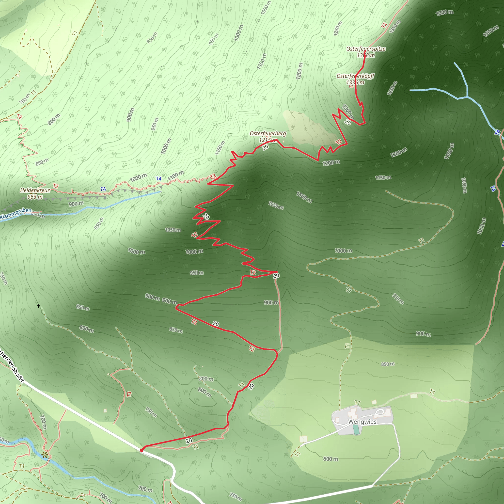
Starting near the picturesque town of Garmisch-Partenkirchen, Germany, the Osterfeuerspitze trail offers a rewarding out-and-back hike that spans approximately 7 km (4.3 miles) with an elevation gain of around 700 meters (2,297 feet). This medium-difficulty trail is perfect for those looking to experience the beauty of the Bavarian Alps without committing to a full-day trek.
Getting There
To reach the trailhead, you can either drive or use public transportation. If driving, head towards Garmisch-Partenkirchen and look for parking near the trailhead, which is conveniently located close to the town center. For those using public transport, take a train to Garmisch-Partenkirchen station. From there, local buses or a short taxi ride will get you to the starting point.
Trail Overview
The trail begins with a gentle ascent through lush forests, offering a serene start to your hike. As you progress, the path becomes steeper, and the forest gives way to more open terrain, providing stunning views of the surrounding mountains. Keep an eye out for the diverse flora and fauna that inhabit this region, including various species of alpine flowers and birds.
Significant Landmarks
At approximately 2 km (1.2 miles) into the hike, you'll come across a charming alpine meadow. This is a great spot to take a short break and enjoy the panoramic views. Continuing on, the trail becomes more challenging as you approach the 4 km (2.5 miles) mark, where you'll encounter a series of switchbacks that lead you up to the summit.
Historical Significance
The region around Garmisch-Partenkirchen is steeped in history. The town itself was the site of the 1936 Winter Olympics, and remnants of this historical event can still be seen today. Additionally, the area has a rich cultural heritage, with traditional Bavarian architecture and customs that have been preserved over the centuries.
Wildlife and Nature
As you near the summit, the landscape becomes more rugged, and you may spot marmots or even chamois if you're lucky. The summit of Osterfeuerspitze offers breathtaking views of the surrounding peaks and valleys, making the challenging ascent well worth the effort.
Navigation
For navigation, it's highly recommended to use HiiKER, which provides detailed maps and real-time updates to ensure you stay on the right path. The trail is well-marked, but having a reliable navigation tool can enhance your hiking experience and provide peace of mind.
Return Journey
The descent follows the same path, allowing you to revisit the beautiful landscapes and perhaps notice details you missed on the way up. Make sure to pace yourself, as the steep sections can be tough on the knees.
This hike is a fantastic way to experience the natural beauty and historical richness of the Bavarian Alps, offering a perfect blend of physical challenge and scenic reward.
What to expect?
Activity types
Comments and Reviews
User comments, reviews and discussions about the Osterfeuerspitze, Germany.
4.4
average rating out of 5
5 rating(s)
