Download
3D Flyover
Add to list
More
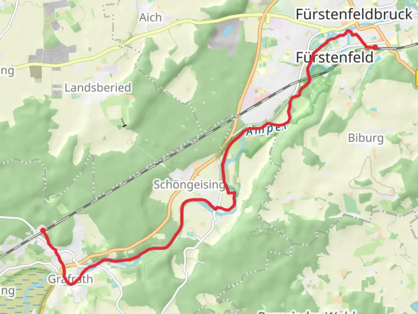
14.5 km
~3 hrs 2 min
94 m
Point-to-Point
“Explore Bavaria's serene landscapes on a gentle, historic trail from Grafrath to Weiherhaus.”
Nestled in the picturesque region of Bavaria, Germany, the trail from Grafrath to Weiherhaus offers a serene and leisurely hiking experience. Spanning approximately 14 kilometers (about 8.7 miles) with virtually no elevation gain, this point-to-point trail is perfect for those seeking a gentle walk through the countryside. The trailhead is conveniently located near Fürstenfeldbruck, making it accessible for both locals and visitors.
Getting There
To reach the starting point in Grafrath, you can take advantage of the efficient public transport system. From Munich, take the S-Bahn S4 line towards Geltendorf and alight at the Grafrath station. The trailhead is a short walk from the station, making it an ideal choice for those relying on public transport. If you prefer to drive, Grafrath is approximately a 40-minute drive from Munich. Parking is available near the trailhead, but it's advisable to arrive early, especially on weekends, to secure a spot.
Trail Highlights
As you embark on this easy hike, you'll be greeted by the lush Bavarian landscape, characterized by rolling fields and dense woodlands. The trail meanders through a mix of open countryside and shaded forest paths, offering a delightful variety of scenery. Keep an eye out for the diverse flora and fauna that inhabit the area. Depending on the season, you might spot wildflowers, deer, and a variety of bird species.
Historical Significance
The region around Fürstenfeldbruck is steeped in history. As you walk, consider the historical significance of the area, which has been inhabited since Roman times. The nearby town of Fürstenfeldbruck itself is home to the Fürstenfeld Abbey, a former Cistercian monastery founded in the 13th century. While the trail does not pass directly by the abbey, it's worth a visit if you have time before or after your hike.
Navigation and Safety
The trail is well-marked, but it's always wise to have a reliable navigation tool at hand. The HiiKER app is an excellent choice for this purpose, providing detailed maps and real-time location tracking to ensure you stay on course. Given the easy nature of the trail, it's suitable for hikers of all ages and fitness levels. However, it's always important to wear comfortable walking shoes and carry sufficient water, especially during warmer months.
Ending the Hike
The trail concludes at Weiherhaus, a quaint area that offers a peaceful end to your journey. From here, you can either retrace your steps back to Grafrath or arrange for transportation back to your starting point. If you're using public transport, local buses can connect you to nearby towns or back to the S-Bahn network for your return journey.
This gentle hike from Grafrath to Weiherhaus is a delightful way to explore the Bavarian countryside, offering a blend of natural beauty and historical intrigue. Whether you're a seasoned hiker or a casual walker, this trail promises a rewarding experience.

Comments and Reviews
User comments, reviews and discussions about the Grafrath to Weiherhaus Walk, Germany.
average rating out of 5
0 rating(s)