Download
3D Flyover
Add to list
More
14.6 km
~3 hrs 56 min
615 m
Point-to-Point
“Experience historical trails, scenic vistas, and diverse wildlife on this rewarding 15 km Bavarian Forest hike.”
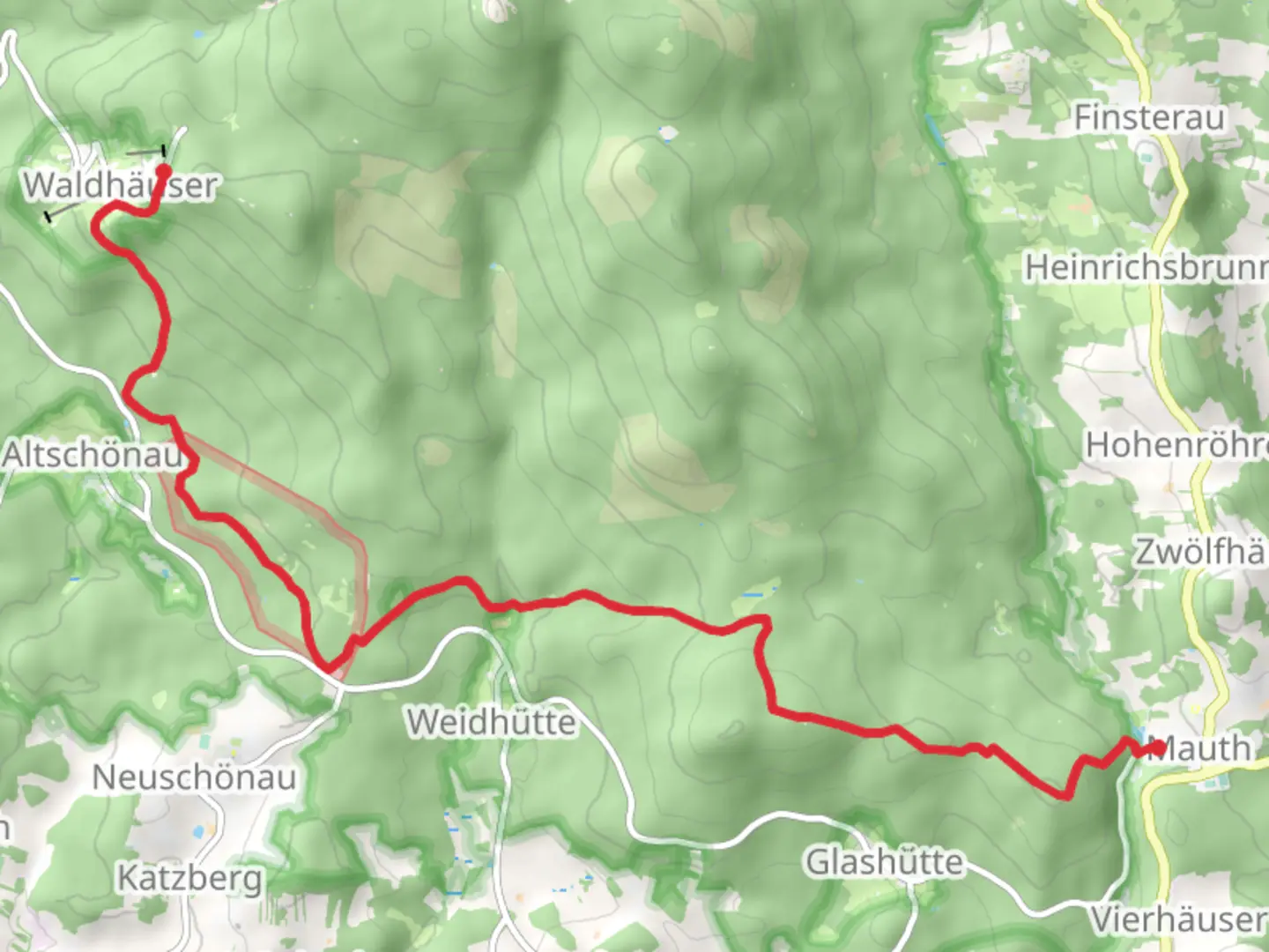
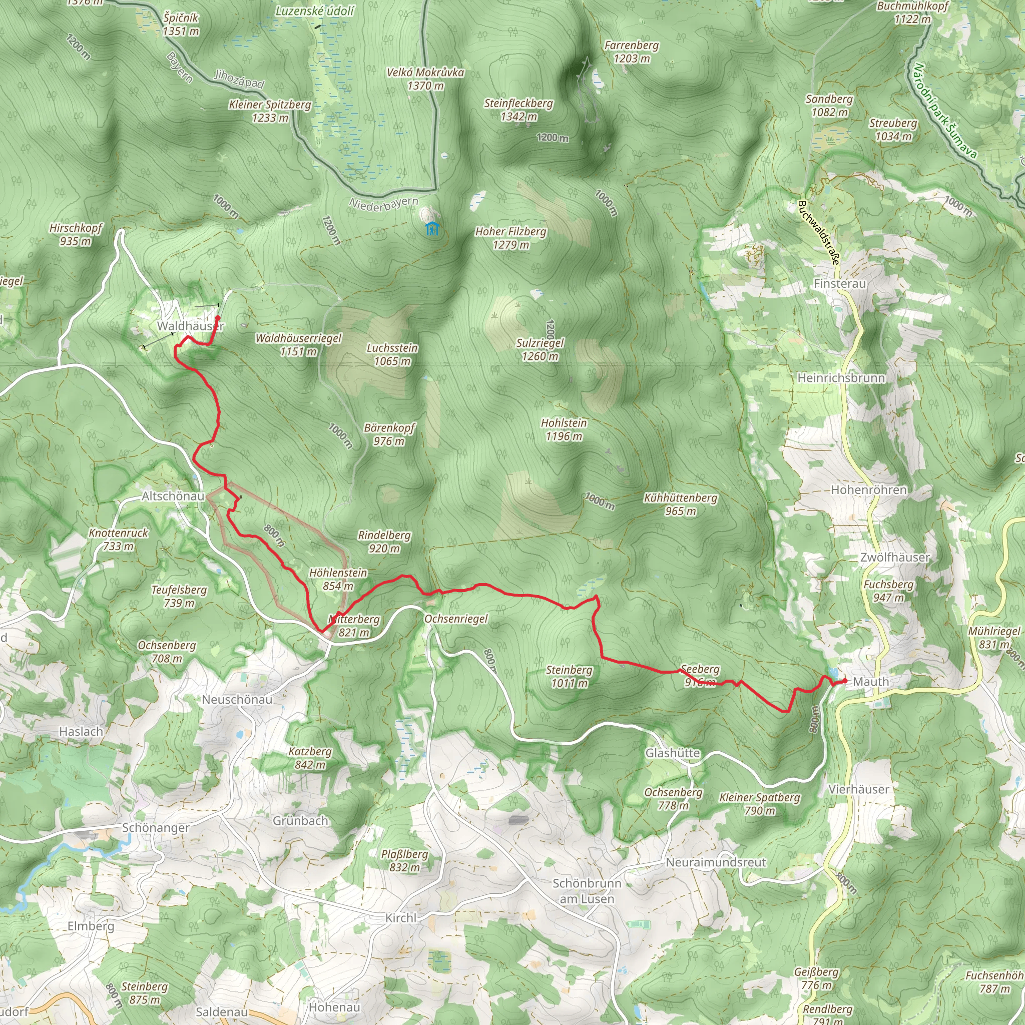
Starting near Freyung-Grafenau in Germany, this 15 km (approximately 9.3 miles) point-to-point trail offers a medium difficulty hike with an elevation gain of around 600 meters (about 1,970 feet). The trailhead is accessible by car or public transport, with the nearest significant landmark being the town of Mauth. If you're driving, you can park in Mauth and start your hike from there. For those using public transport, buses from Freyung or Grafenau will get you to Mauth, where the trail begins.
Initial Ascent and Forested Pathways
The hike starts with a gradual ascent through dense forests, typical of the Bavarian Forest region. The first 3 km (1.9 miles) will take you through a mix of coniferous and deciduous trees, providing ample shade and a serene atmosphere. The forest floor is often covered with a thick layer of moss, and you might spot various species of fungi and small woodland creatures like squirrels and birds.
Reaching Tanne and Historical Significance
Around the 5 km (3.1 miles) mark, you'll reach the area known as Tanne. This section of the trail is historically significant as it was once a part of the ancient trade routes used during the medieval period. The remnants of old stone markers and pathways can still be seen, offering a glimpse into the past. The elevation gain here is moderate, and the trail is well-marked, making navigation straightforward.
Midpoint and Scenic Views
As you continue, the trail opens up to more elevated terrain, providing stunning views of the surrounding Bavarian Forest. At approximately 8 km (5 miles) in, you'll find a scenic viewpoint that offers panoramic vistas of the rolling hills and dense forests below. This is a great spot to take a break, have a snack, and enjoy the natural beauty.
Wildlife and Flora
The latter part of the trail, from around 10 km (6.2 miles) onwards, takes you through areas rich in wildlife. Keep an eye out for deer, foxes, and a variety of bird species. The flora also changes as you gain elevation, with more alpine plants and wildflowers dotting the landscape. This section is particularly beautiful in the spring and early summer when the flowers are in full bloom.
Final Descent to Waldhaeuser
The final 3 km (1.9 miles) involve a descent into the village of Waldhaeuser. This part of the trail is less forested and more open, offering different types of scenery. The descent is relatively gentle, making it a pleasant end to your hike. Waldhaeuser is a quaint village with traditional Bavarian architecture, and it's a great place to explore after your hike.
Navigation and Safety
For navigation, it's recommended to use the HiiKER app, which provides detailed maps and real-time updates. The trail is generally well-marked, but having a reliable navigation tool can be very helpful, especially in the more remote sections.
Getting Back
Once you reach Waldhaeuser, you can either arrange for a pick-up or take public transport back to your starting point. Buses run regularly between Waldhaeuser and Mauth, making it convenient to return to your car or continue your journey.
This trail offers a mix of historical significance, natural beauty, and moderate physical challenge, making it a rewarding experience for hikers of all levels.
Comments and Reviews
User comments, reviews and discussions about the Mauth to Waldhaeuser via Tanne, Germany.
5.0
average rating out of 5
1 rating(s)
