
Download
3D Flyover
Add to list
More
8.6 km
~2 hrs 27 min
444 m
Loop
“The Teckberg via Dettingen Teck trail is a 9 km loop of natural beauty, history, and panoramic views.”
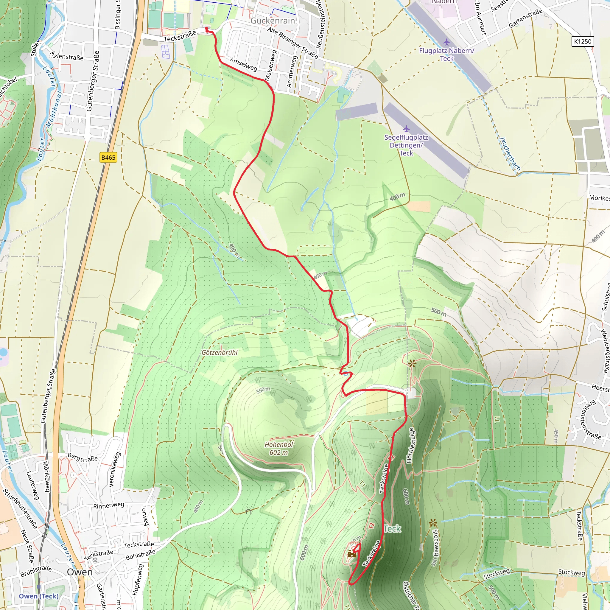
Starting near Esslingen, Germany, the Teckberg via Dettingen Teck and Hochgehadelt trail is a captivating 9 km (5.6 miles) loop with an elevation gain of approximately 400 meters (1,312 feet). This medium-difficulty trail offers a blend of natural beauty, historical landmarks, and panoramic views, making it a rewarding experience for hikers.
Getting There
To reach the trailhead, you can either drive or use public transport. If driving, head towards Dettingen unter Teck, where you can find parking near the town center. For those using public transport, take a train to Kirchheim unter Teck and then a local bus to Dettingen unter Teck. The trailhead is conveniently located near the town, making it easily accessible.
Trail Overview
The trail begins in the charming town of Dettingen unter Teck, where you can explore the local architecture and perhaps grab a snack before setting off. As you start your hike, you'll gradually ascend through mixed forests and open meadows, offering a variety of flora and fauna. Keep an eye out for deer, foxes, and a variety of bird species that inhabit the area.
Significant Landmarks
Dettingen Teck Castle Ruins
Approximately 3 km (1.9 miles) into the hike, you'll come across the ruins of Dettingen Teck Castle. This historical site dates back to the 12th century and offers a glimpse into the region's medieval past. The ruins are perched on a hill, providing stunning views of the surrounding landscape.
Teckberg Summit
Continuing your ascent, you'll reach the summit of Teckberg around the 5 km (3.1 miles) mark. At an elevation of 775 meters (2,543 feet), the summit offers panoramic views of the Swabian Alps and the surrounding valleys. This is an excellent spot for a break and some photography.
Navigation and Safety
The trail is well-marked, but it's always a good idea to have a reliable navigation tool. HiiKER is highly recommended for its detailed maps and real-time updates. The trail can be steep in sections, so sturdy hiking boots are essential. Also, be prepared for changing weather conditions, as the elevation can bring cooler temperatures and sudden rain.
Flora and Fauna
As you descend from Teckberg, you'll pass through dense forests and open fields. The area is rich in biodiversity, with wildflowers blooming in the spring and summer months. You might also spot various species of butterflies and insects that thrive in this habitat.
Historical Significance
The region around Teckberg has a rich history, with evidence of human settlement dating back to the Roman era. The castle ruins and ancient pathways you encounter along the trail are a testament to the area's historical importance. Local legends and folklore add an extra layer of intrigue to your hike.
Final Stretch
The final part of the loop takes you through the picturesque village of Hochgehadelt before returning to Dettingen unter Teck. This section is relatively flat and offers a relaxing end to your hike. Take some time to explore the village and perhaps enjoy a meal at a local restaurant.
This trail offers a perfect blend of natural beauty, historical landmarks, and moderate physical challenge, making it an ideal choice for hikers looking to explore the Swabian Alps.
What to expect?
Activity types
Comments and Reviews
User comments, reviews and discussions about the Teckberg via Dettingen Teck and Hochgehadelt, Germany.
4.33
average rating out of 5
6 rating(s)
