Download
Preview
Add to list
More
8.2 km
~1 hrs 54 min
160 m
Loop
“Discover history and nature on the 8 km Tabakstanne and Talsperre Stollberg Loop in Erzgebirgskreis, Germany.”
Starting your hike near Erzgebirgskreis, Germany, the Tabakstanne and Talsperre Stollberg Loop offers a delightful 8 km (approximately 5 miles) journey with an elevation gain of around 100 meters (328 feet). This loop trail is rated as medium difficulty, making it suitable for moderately experienced hikers.
Getting There
To reach the trailhead, you can drive or use public transport. If driving, set your GPS to Erzgebirgskreis, Germany, and look for parking near the starting point. For public transport, take a train or bus to the nearest station in Stollberg, and from there, you can either walk or take a short taxi ride to the trailhead.
Trail Overview
The trail begins in a lush forested area, providing a serene start to your hike. As you proceed, you'll encounter a mix of well-maintained paths and more rugged terrain, so sturdy hiking boots are recommended. The initial part of the trail is relatively flat, allowing you to ease into the hike.
Significant Landmarks
Around the 2 km (1.2 miles) mark, you'll come across the Tabakstanne, a notable landmark in the region. This area is known for its historical significance, as it was once a site for tobacco cultivation. The remnants of old tobacco barns can still be seen, offering a glimpse into the area's agricultural past.
Nature and Wildlife
As you continue, the trail meanders through dense forests and open meadows, providing ample opportunities to spot local wildlife. Keep an eye out for deer, foxes, and a variety of bird species. The flora is equally impressive, with a mix of deciduous and coniferous trees, wildflowers, and ferns lining the path.
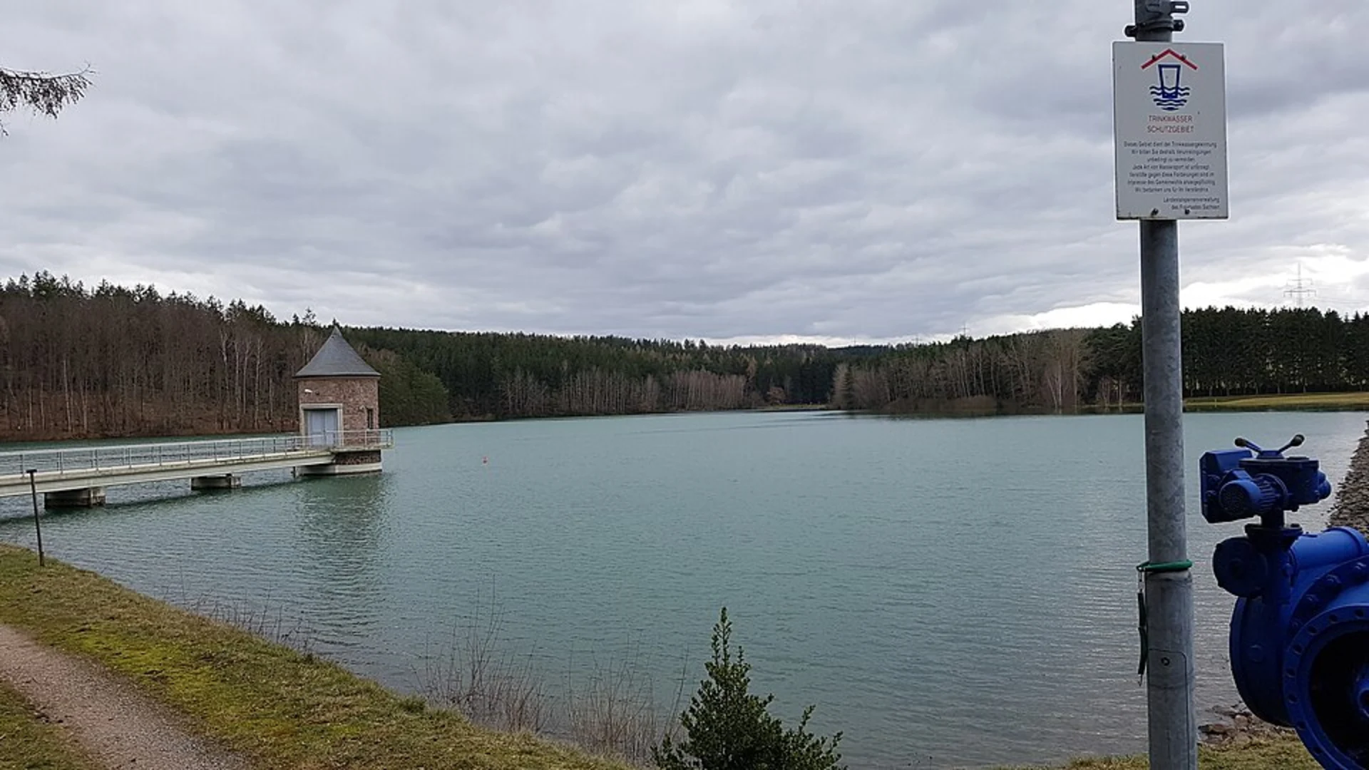
Talsperre Stollberg
At approximately 5 km (3.1 miles), you'll reach the Talsperre Stollberg, a picturesque reservoir that serves as a perfect spot for a break. The reservoir is surrounded by lush greenery and offers stunning views, making it a great place for photography. The area around the reservoir is also ideal for a picnic, so consider packing some snacks.
Elevation Gain
The trail features a gradual elevation gain of about 100 meters (328 feet), with the most significant ascent occurring as you approach the reservoir. This section can be a bit challenging, but the panoramic views from the top are well worth the effort.
Navigation
To ensure you stay on track, it's advisable to use the HiiKER app, which provides detailed maps and real-time navigation. The trail is well-marked, but having a reliable navigation tool can enhance your hiking experience.
Final Stretch
The final 3 km (1.9 miles) of the loop take you through a mix of forested areas and open fields, gradually descending back to the starting point. This section is relatively easy, allowing you to enjoy the natural beauty of the Erzgebirgskreis region as you complete your hike.
This trail offers a perfect blend of natural beauty, historical significance, and moderate physical challenge, making it a rewarding experience for any hiker.

What to expect?
Activity types
Comments and Reviews
User comments, reviews and discussions about the Tabakstanne and Talsperre Stollberg Loop, Germany.
4.0
average rating out of 5
1 rating(s)