Download
Preview
Add to list
More
12.5 km
~3 hrs 8 min
386 m
Loop
“Explore the 12 km Rund um Neudorf Loop for stunning views, historical sites, and moderate hiking challenges.”
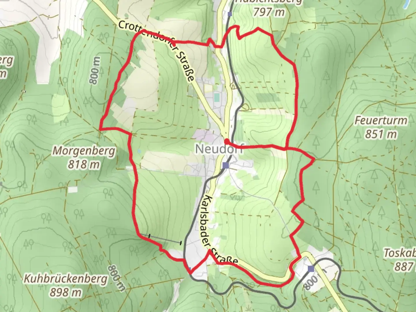
Starting near Erzgebirgskreis, Germany, the Rund um Neudorf Loop is a captivating 12 km (7.5 miles) trail with an elevation gain of approximately 300 meters (984 feet). This loop trail offers a medium difficulty rating, making it suitable for moderately experienced hikers.
Getting There
To reach the trailhead, you can drive or use public transport. If driving, head towards the town of Neudorf in the Erzgebirgskreis district. For those using public transport, the nearest significant landmark is the Neudorf train station, which is well-connected by regional trains. From the station, it's a short walk to the trailhead.
Trail Overview
The trail begins near Neudorf and quickly immerses you in the lush, dense forests characteristic of the Erzgebirge region. The initial section is relatively flat, allowing you to ease into the hike. As you progress, the trail starts to ascend gradually, offering panoramic views of the surrounding landscape.
Key Landmarks and Points of Interest
- Neudorf Village: At the start and end of your hike, take some time to explore Neudorf. This quaint village is known for its traditional Erzgebirge architecture and charming local shops.
- Fichtelberg Views: Around the 4 km (2.5 miles) mark, you'll reach a vantage point that offers stunning views of Fichtelberg, the highest mountain in the region. This is a great spot for a short break and some photography.
- Historic Mining Sites: The Erzgebirge region has a rich mining history. Around the halfway point, you'll come across remnants of old mining operations. Informational plaques provide insights into the area's historical significance.
- Wildlife and Flora: The trail is home to diverse wildlife, including deer, foxes, and various bird species. The forest is also rich with native flora, particularly during spring and summer when wildflowers are in full bloom.
Navigation and Trail Conditions
The trail is well-marked, but it's always a good idea to have a reliable navigation tool. HiiKER is an excellent app for this purpose, providing detailed maps and real-time location tracking. The path can be muddy and slippery after rain, so appropriate footwear is essential.
Elevation and Terrain
The total elevation gain is around 300 meters (984 feet), with the most significant ascent occurring between the 5 km (3.1 miles) and 8 km (5 miles) marks. The terrain varies from well-trodden forest paths to rocky sections, requiring careful footing in some areas.
Practical Tips
- Weather: The weather in the Erzgebirge can be unpredictable. Check the forecast before heading out and dress in layers.
- Supplies: Carry enough water and snacks, as there are no facilities along the trail. A small first-aid kit is also advisable.
- Respect Nature: Stick to the marked paths to protect the local ecosystem and avoid disturbing wildlife.
This trail offers a perfect blend of natural beauty, historical intrigue, and moderate physical challenge, making it a rewarding experience for those who venture out to explore it.

What to expect?
Activity types
Comments and Reviews
User comments, reviews and discussions about the Rund um Neudorf Loop, Germany.
4.0
average rating out of 5
1 rating(s)