Download
3D Flyover
Add to list
More
5.3 km
~1 hrs 16 min
125 m
Loop
“Explore the lush Black Forest on the challenging Büchenbronner Höhe Loop, rich in history and natural beauty.”
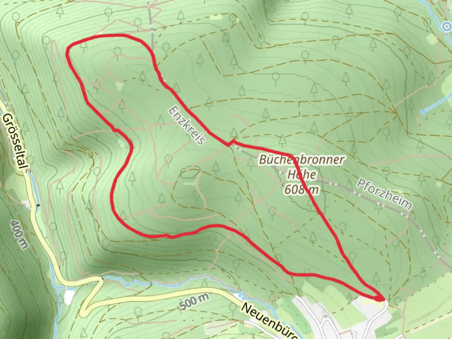
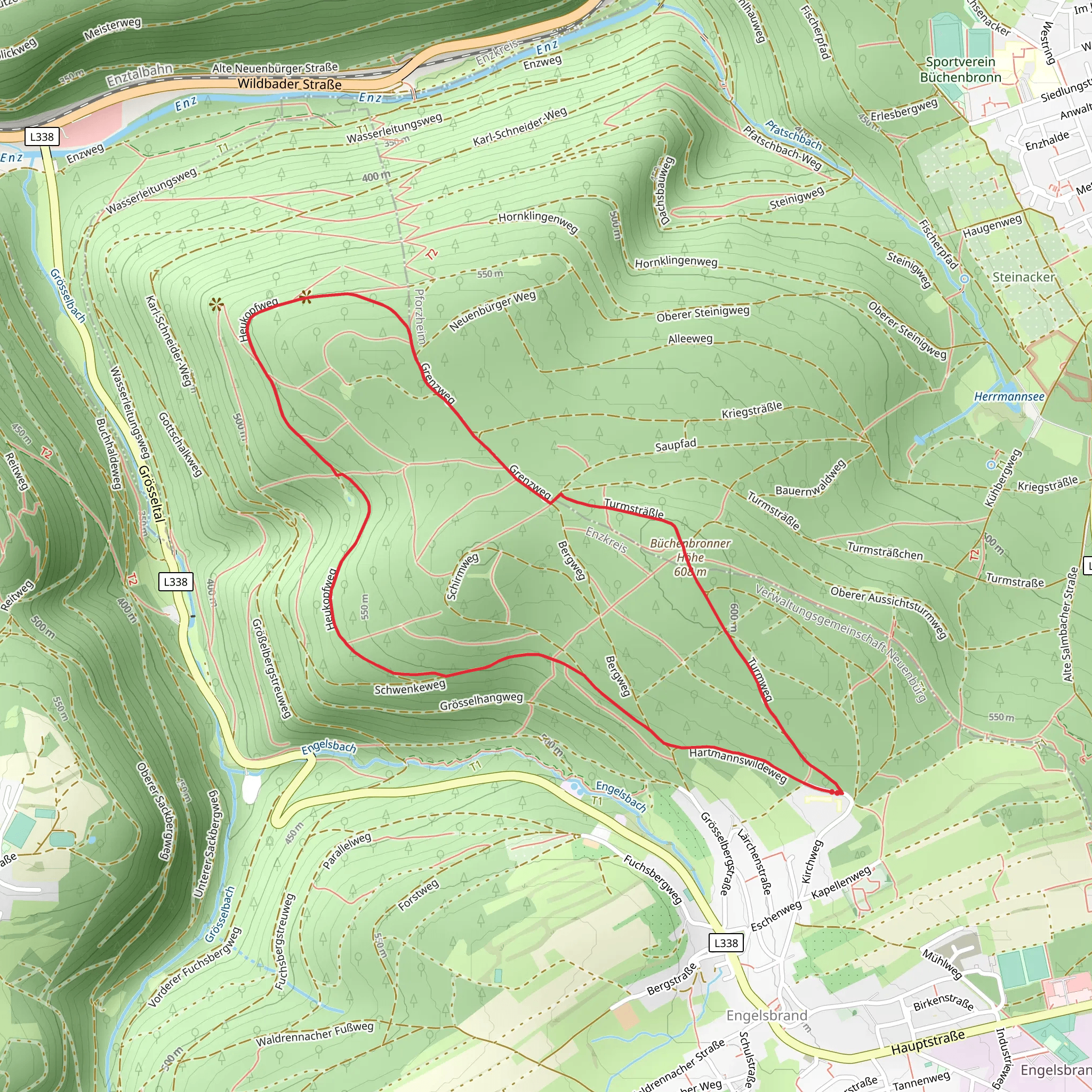
Nestled in the scenic landscapes of Enzkreis, Germany, the Büchenbronner Höhe Loop offers a challenging yet rewarding hiking experience. This loop trail spans approximately 5 kilometers (about 3.1 miles) with an elevation gain of around 100 meters (328 feet), making it a demanding trek for those seeking adventure. The trailhead is conveniently located near the town of Pforzheim, a gateway to the Black Forest region.
Getting There
For those traveling by public transport, Pforzheim is well-connected by train, with regular services from major cities like Stuttgart and Karlsruhe. From Pforzheim's main train station, local buses can take you closer to the trailhead. If you prefer to drive, the trailhead is accessible via the A8 motorway, with parking available near the start of the loop.
Trail Highlights
As you embark on the Büchenbronner Höhe Loop, prepare to be immersed in the lush greenery of the Black Forest. The trail meanders through dense woodlands, offering a serene escape from urban life. Keep an eye out for the diverse flora and fauna that call this region home, including deer, foxes, and a variety of bird species.
Historical Significance
The area surrounding the Büchenbronner Höhe is steeped in history. Pforzheim, known as the "Gateway to the Black Forest," has a rich heritage dating back to Roman times. The town was a significant center for the watch and jewelry industry, earning it the nickname "Goldstadt" or "Golden City." As you hike, consider the historical significance of the land beneath your feet, once traversed by traders and craftsmen.
Navigational Tips
The loop is well-marked, but it's always wise to have a reliable navigation tool. HiiKER is an excellent resource for ensuring you stay on track, providing detailed maps and real-time updates. The trail's difficulty rating is estimated to be difficult, so prepare accordingly with sturdy hiking boots and sufficient water.
Points of Interest
Approximately halfway through the loop, you'll encounter a scenic viewpoint offering panoramic vistas of the surrounding forest and distant hills. This is an ideal spot to pause, take in the natural beauty, and perhaps enjoy a packed lunch. The trail also passes by several small streams, adding to the tranquil ambiance with the gentle sound of flowing water.
Wildlife and Nature
The Black Forest is renowned for its biodiversity. As you hike, be mindful of the delicate ecosystems around you. The forest floor is carpeted with moss and ferns, while towering pines and firs provide a canopy overhead. In spring and summer, wildflowers add vibrant splashes of color to the landscape.
The Büchenbronner Höhe Loop is a testament to the natural and historical richness of the Black Forest region. Whether you're a seasoned hiker or a nature enthusiast, this trail promises an unforgettable journey through one of Germany's most picturesque landscapes.
What to expect?
Activity types
Comments and Reviews
User comments, reviews and discussions about the Büchenbronner Höhe Loop, Germany.
average rating out of 5
0 rating(s)
