Download
Preview
Add to list
More
7.7 km
~1 hrs 48 min
155 m
Loop
“Explore Dresden’s 8 km Malte and Lugberg Loop for scenic views, historical landmarks, and vibrant wildlife.”
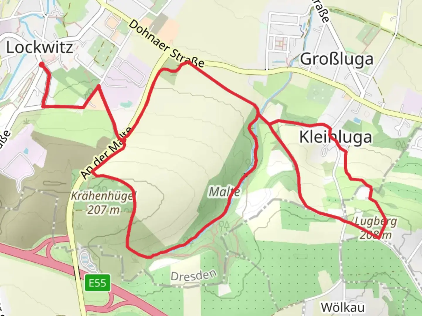
Starting near Dresden, Germany, the Malte and Lugberg Loop via Am Krähenhügel is an 8 km (approximately 5 miles) loop trail with an elevation gain of around 100 meters (328 feet). This trail is rated as medium difficulty, making it suitable for hikers with some experience.
Getting There
To reach the trailhead, you can either drive or use public transport. If driving, head towards the village of Weißig, located just outside Dresden. There is parking available near the Weißiger Straße, which is the closest significant landmark. For those using public transport, take the S-Bahn to Dresden-Neustadt and then transfer to bus number 61 towards Weißig. Get off at the Weißiger Straße stop, which is a short walk from the trailhead.
Trail Overview
The trail begins with a gentle ascent through a mixed forest, offering a serene start to your hike. As you progress, you'll encounter the first significant landmark, the Krähenhügel, approximately 2 km (1.2 miles) into the hike. This small hill provides a modest elevation gain and offers a panoramic view of the surrounding countryside.
Flora and Fauna
The trail is rich in biodiversity. You'll pass through sections of deciduous and coniferous forests, home to a variety of bird species, including woodpeckers and songbirds. Keep an eye out for deer and foxes, which are commonly spotted in the area. In the spring and summer months, the trail is adorned with wildflowers, adding a splash of color to your hike.
Historical Significance
The region around Dresden has a rich history, and this trail is no exception. As you hike, you'll come across remnants of old stone walls and foundations, evidence of historical settlements dating back to the medieval period. About 4 km (2.5 miles) into the hike, you'll reach the Lugberg, a hill that was historically used as a lookout point. The views from here are particularly stunning, offering a glimpse into the region's past and its strategic importance.
Navigation
The trail is well-marked, but it's always a good idea to have a reliable navigation tool. HiiKER is recommended for its detailed maps and real-time updates. Make sure to download the trail map before you start, as cell service can be spotty in some areas.
Points of Interest
- Krähenhügel: A small hill with panoramic views, located 2 km (1.2 miles) from the start.
- Lugberg: A historical lookout point with stunning views, situated about 4 km (2.5 miles) into the hike.
- Old Stone Walls: Remnants of medieval settlements scattered along the trail.
Final Stretch
The last 2 km (1.2 miles) of the trail take you through a picturesque valley, gradually descending back towards the trailhead. This section is particularly beautiful in the autumn when the leaves change color, creating a vibrant tapestry of reds, oranges, and yellows.
Preparation Tips
- Footwear: Sturdy hiking boots are recommended due to uneven terrain.
- Water: Carry at least 1-2 liters of water, especially in the warmer months.
- Weather: Check the weather forecast before you go, as conditions can change rapidly.
- Wildlife: Be respectful of the local wildlife; maintain a safe distance and do not feed the animals.
This trail offers a perfect blend of natural beauty, historical intrigue, and moderate physical challenge, making it a rewarding experience for any hiker.

What to expect?
Activity types
Comments and Reviews
User comments, reviews and discussions about the Malte and Lugberg Loop via Am Krähenhügel, Germany.
4.0
average rating out of 5
1 rating(s)