Download
3D Flyover
Add to list
More
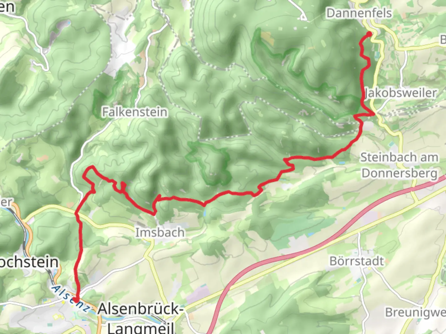
16.6 km
~4 hrs 41 min
822 m
Point-to-Point
“Explore lush landscapes and rich history on the captivating Winnweiler to Dannenfels Walk adventure.”
Nestled in the picturesque region of Donnersbergkreis, Germany, the Winnweiler to Dannenfels Walk offers a captivating journey through lush landscapes and historical sites. This point-to-point trail stretches approximately 17 kilometers (about 10.5 miles) with an elevation gain of around 800 meters (approximately 2,625 feet), making it a moderately challenging hike suitable for those with a reasonable level of fitness.
Getting There
The trailhead is conveniently located near the town of Winnweiler. For those traveling by public transport, Winnweiler is accessible via regional trains from major cities like Kaiserslautern and Mainz. From the train station, it's a short walk to the start of the trail. If you're driving, you can reach Winnweiler via the A63 motorway, with ample parking available in the town.
Trail Highlights
Scenic Landscapes
As you embark on this hike, you'll traverse a variety of terrains, from dense forests to open meadows, each offering its own unique charm. The trail meanders through the heart of the Palatinate Forest, a UNESCO Biosphere Reserve, where you can immerse yourself in the tranquility of nature. Keep an eye out for native wildlife, including deer and a variety of bird species, which are often spotted along the way.
Historical Significance
The region is steeped in history, with the trail passing near several sites of interest. One notable landmark is the ruins of Falkenstein Castle, perched on a hilltop and offering panoramic views of the surrounding countryside. This medieval fortress dates back to the 12th century and provides a fascinating glimpse into the area's past.
Donnersberg Mountain
As you approach the midpoint of the hike, you'll encounter the majestic Donnersberg Mountain, the highest peak in the Palatinate region. Standing at 687 meters (2,254 feet), it offers breathtaking vistas and is a popular spot for a rest and picnic. The mountain is also rich in Celtic history, with archaeological sites that hint at its ancient significance.
Navigation and Safety
To ensure a smooth journey, it's advisable to use the HiiKER app for navigation, which provides detailed maps and real-time updates on trail conditions. The trail is well-marked, but having a reliable navigation tool can enhance your hiking experience.
Final Stretch to Dannenfels
The final leg of the hike descends gently towards the charming village of Dannenfels. This quaint settlement is known for its traditional German architecture and welcoming atmosphere. It's an ideal place to relax and reflect on your journey, perhaps with a visit to a local café or restaurant to sample regional delicacies.
Whether you're drawn by the natural beauty, historical intrigue, or the challenge of the hike itself, the Winnweiler to Dannenfels Walk promises an enriching adventure through one of Germany's most captivating landscapes.

Comments and Reviews
User comments, reviews and discussions about the Winnweiler to Dannenfels Walk, Germany.
average rating out of 5
0 rating(s)