Download
3D Flyover
Add to list
More
8.2 km
~1 hrs 56 min
185 m
Loop
“The Monheim Loop is an 8 km trail offering scenic views, historical landmarks, and moderate difficulty.”
Starting near Donau-Ries, Germany, the Monheim Loop is an 8 km (approximately 5 miles) trail with an elevation gain of around 100 meters (328 feet). This loop trail is rated as medium difficulty, making it suitable for hikers with some experience.
Getting There
To reach the trailhead, you can drive or use public transport. If you're driving, set your GPS to the town of Monheim in the Donau-Ries district. There are parking facilities available near the starting point. For those using public transport, take a train to Donauwörth and then a local bus to Monheim. The bus stop is conveniently located near the trailhead.
Trail Overview
The Monheim Loop offers a diverse hiking experience, winding through picturesque landscapes, dense forests, and open meadows. The trail is well-marked, but it's always a good idea to have a reliable navigation tool like HiiKER to ensure you stay on track.
Key Landmarks and Points of Interest
- Monheim Town Center (0 km / 0 miles): The trail begins in the charming town center of Monheim. Take a moment to explore the historic buildings and local shops before you start your hike.
- Monheimer Alb (2 km / 1.2 miles): As you progress, you'll enter the Monheimer Alb, a region known for its rolling hills and scenic beauty. The elevation gain here is gradual, making it a pleasant ascent.
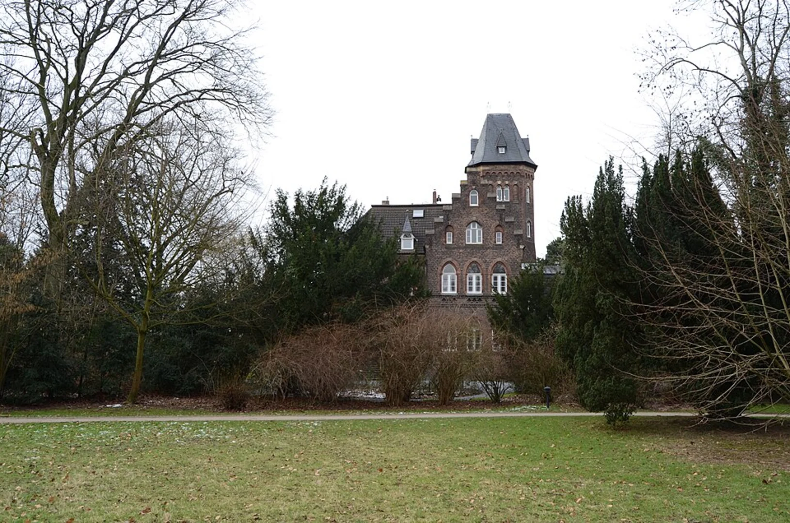
- Schloss Leitheim (4 km / 2.5 miles): Midway through the hike, you'll come across Schloss Leitheim, a baroque castle with stunning architecture. This is a great spot for a break and some photos.
- Danube River Overlook (6 km / 3.7 miles): One of the highlights of the trail is the overlook point offering panoramic views of the Danube River. The elevation gain to this point is about 80 meters (262 feet), providing a rewarding vista.
- Return to Monheim (8 km / 5 miles): The loop brings you back to Monheim, completing the circuit. The descent is gentle, allowing you to enjoy the final stretch without much effort.
Flora and Fauna
The Monheim Loop is rich in biodiversity. In the forests, you might spot deer, foxes, and a variety of bird species. The meadows are home to wildflowers, butterflies, and bees, especially vibrant in the spring and summer months.
Historical Significance
The region around Monheim has a deep historical significance. The town itself dates back to the medieval period, and the nearby Schloss Leitheim has been a landmark since the 18th century. The trail also passes through areas that were once part of ancient trade routes, adding a layer of historical intrigue to your hike.
Preparation Tips
- Footwear: Given the mixed terrain, sturdy hiking boots are recommended.
- Weather: Check the weather forecast before you go. The trail can be muddy after rain.
- Water and Snacks: Carry enough water and some snacks, especially if you plan to take breaks at the key landmarks.
- Navigation: Use HiiKER for real-time navigation and to stay updated on any trail changes.
This trail offers a balanced mix of natural beauty, historical landmarks, and moderate physical challenge, making it a rewarding experience for those who embark on it.

What to expect?
Activity types
Comments and Reviews
User comments, reviews and discussions about the Monheim Loop, Germany.
average rating out of 5
0 rating(s)