
Download
3D Flyover
Add to list
More
6.8 km
~1 hrs 51 min
299 m
Loop
“The Wasserscheidenweg Loop weaves through lush forests and scenic viewpoints, offering a rewarding 7 km hike.”
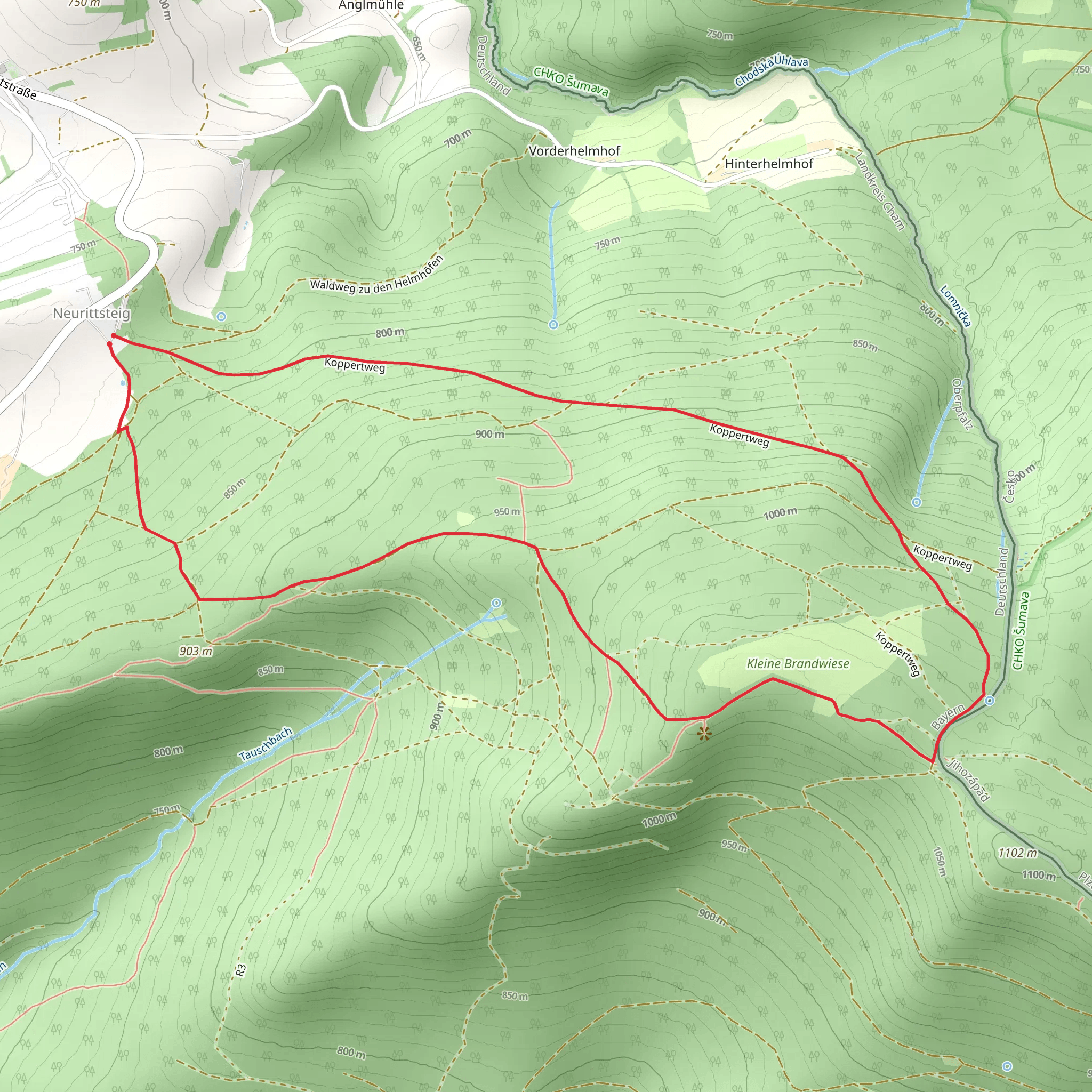
Starting near the charming town of Cham in Germany, the Wasserscheidenweg Loop offers a delightful 7 km (4.35 miles) journey with an elevation gain of approximately 300 meters (984 feet). This loop trail is rated as medium difficulty, making it suitable for moderately experienced hikers.
Getting There
To reach the trailhead, you can either drive or use public transport. If driving, set your GPS to Cham, Germany, and follow the signs to the trailhead near the town. For those using public transport, take a train to Cham station. From there, local buses or a short taxi ride will get you to the starting point.
Trail Overview
The trail begins with a gentle ascent through lush forests, offering a serene start to your hike. As you progress, the path becomes steeper, leading you to higher elevations where panoramic views of the Bavarian countryside await. The first significant landmark you'll encounter is the Aussichtspunkt, a scenic viewpoint approximately 2 km (1.24 miles) into the hike. Here, you can take a moment to enjoy the sweeping vistas of rolling hills and dense woodlands.
Flora and Fauna
The Wasserscheidenweg Loop is rich in biodiversity. Keep an eye out for native wildlife such as deer, foxes, and a variety of bird species. The trail is also adorned with a mix of deciduous and coniferous trees, including oak, beech, and spruce. During spring and summer, the forest floor is carpeted with wildflowers, adding a splash of color to your hike.
Historical Significance
This region is steeped in history. The trail itself follows ancient routes that have been used for centuries. Around the 4 km (2.48 miles) mark, you'll come across remnants of old boundary stones, which historically marked territorial limits. These stones are a testament to the area's rich past and offer a glimpse into the lives of those who once traversed these paths.
Navigation and Safety
Given the trail's moderate difficulty, it's advisable to use a reliable navigation tool like HiiKER to stay on track. The trail is well-marked, but having a digital map can provide extra assurance. Wear sturdy hiking boots, as the terrain can be uneven and slippery, especially after rain.
Final Stretch
As you descend back towards Cham, the trail winds through picturesque meadows and small streams. The final 1 km (0.62 miles) is relatively flat, allowing for a leisurely end to your hike. This section is perfect for spotting butterflies and other insects that thrive in the meadow environment.
Practical Tips
- Water and Snacks: Carry enough water and some high-energy snacks, as there are no facilities along the trail.
- Weather: Check the weather forecast before you set out. The trail can be quite exposed in certain sections, so sun protection is essential on clear days.
- Timing: Allocate around 2-3 hours to complete the loop, depending on your pace and how often you stop to take in the scenery.
The Wasserscheidenweg Loop offers a perfect blend of natural beauty, historical intrigue, and moderate physical challenge, making it a rewarding experience for any hiker.
What to expect?
Activity types
Comments and Reviews
User comments, reviews and discussions about the Wasserscheidenweg Loop, Germany.
4.33
average rating out of 5
3 rating(s)
