Download
3D Flyover
Add to list
More
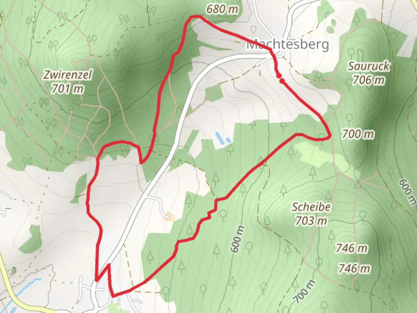
5.4 km
~1 hrs 27 min
222 m
Loop
“Discover the Machtesberg Loop: a scenic, moderately challenging 5 km hike near Cham, Germany.”
Starting near the charming town of Cham in Germany, the Machtesberg Loop offers a delightful 5 km (approximately 3.1 miles) journey with an elevation gain of around 200 meters (656 feet). This loop trail is rated as medium difficulty, making it suitable for moderately experienced hikers.
Getting There
To reach the trailhead, you can either drive or use public transport. If driving, set your GPS to Cham, Germany, and follow local signage to the trailhead. For those using public transport, take a train or bus to Cham and then a local bus or taxi to the starting point near the town.
Trail Overview
The trail begins with a gentle ascent through lush forests, providing a serene atmosphere right from the start. As you progress, the path becomes steeper, offering a moderate challenge that rewards you with stunning views of the surrounding Bavarian landscape.
Key Landmarks and Points of Interest
- Machtesberg Summit: At approximately 2 km (1.2 miles) into the hike, you'll reach the summit of Machtesberg. Here, you'll find panoramic views of the Bavarian countryside, making it an excellent spot for a rest and some photos.
- Historical Significance: The region around Cham has a rich history dating back to medieval times. Keep an eye out for ancient stone markers and remnants of old fortifications that hint at the area's past strategic importance.
- Flora and Fauna: The trail is home to a variety of wildlife, including deer, foxes, and numerous bird species. The forested sections are particularly rich in biodiversity, with a mix of deciduous and coniferous trees providing a habitat for many creatures.
Navigation and Safety
Using HiiKER for navigation is highly recommended to ensure you stay on the correct path. The trail is well-marked, but having a reliable navigation tool can help you track your progress and avoid any potential detours.
Final Stretch
The descent begins around the 4 km (2.5 miles) mark, leading you back through dense forest and eventually opening up to meadows as you approach the trailhead. This section is less strenuous, allowing you to enjoy the natural beauty at a more relaxed pace.
Practical Tips
- Footwear: Sturdy hiking boots are recommended due to the varied terrain.
- Weather: Check the weather forecast before you go, as conditions can change rapidly in this region.
- Supplies: Bring enough water and snacks, especially if you plan to take breaks and enjoy the scenery.
The Machtesberg Loop is a rewarding hike that combines natural beauty, historical intrigue, and a moderate physical challenge, making it a must-visit for hikers in the Cham area.

What to expect?
Activity types
Comments and Reviews
User comments, reviews and discussions about the Machtesberg Loop, Germany.
5.0
average rating out of 5
1 rating(s)