
Download
3D Flyover
Add to list
More
12.1 km
~2 hrs 43 min
178 m
Loop
“Explore Bonn's scenic 12 km Annaberger Weg Loop, blending natural beauty, historic landmarks, and moderate challenge.”
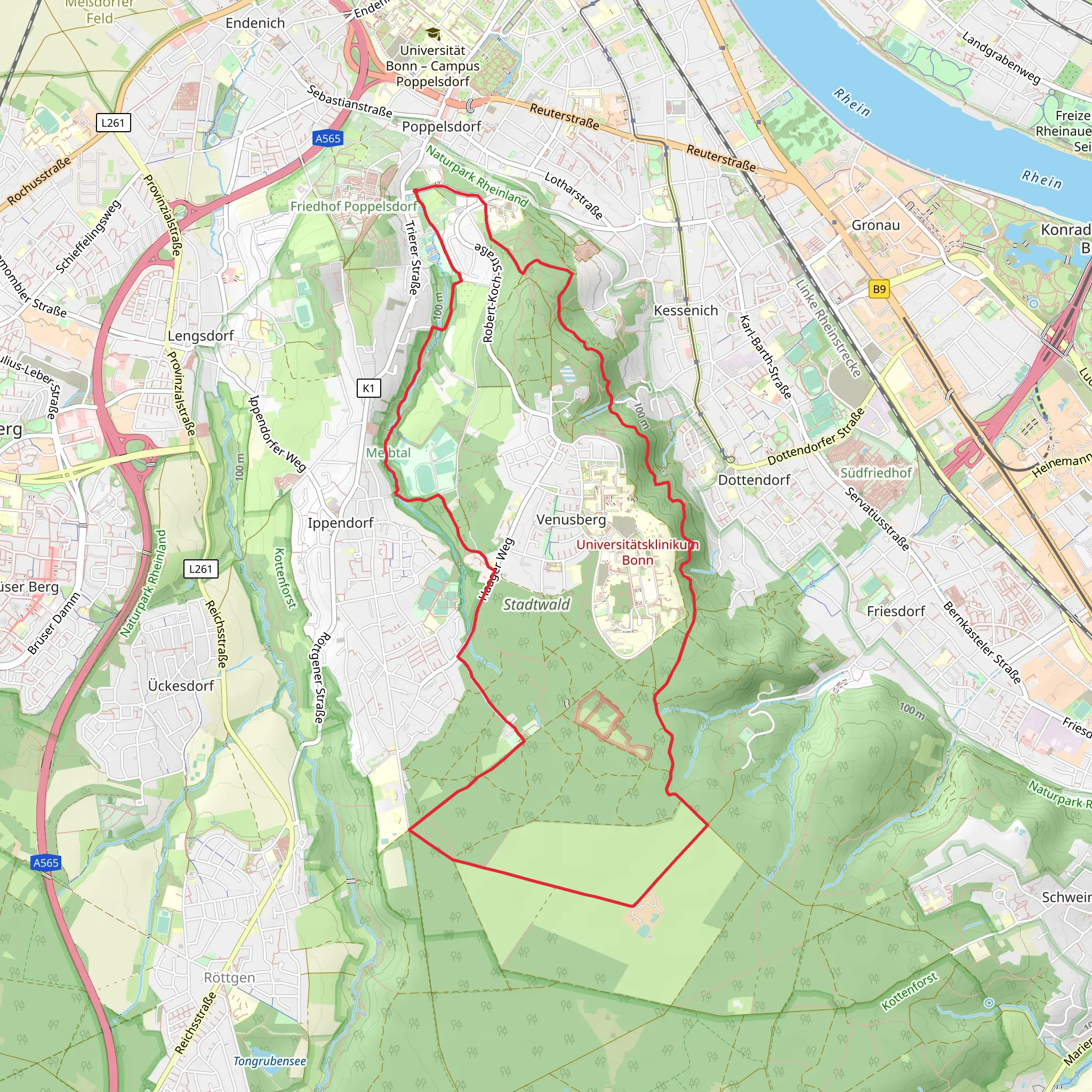
Starting your hike near Bonn, Germany, the Annaberger Weg and Gieveningsweg Loop offers a delightful 12 km (7.5 miles) journey with an elevation gain of around 100 meters (328 feet). This loop trail is rated medium in difficulty, making it suitable for moderately experienced hikers.
Getting There
To reach the trailhead, you can either drive or use public transport. If driving, set your GPS to the nearest known address: Annaberger Straße, 53175 Bonn, Germany. For those using public transport, take a train to Bonn Hauptbahnhof (Bonn Central Station) and then a bus to the Annaberger Straße stop. From there, it's a short walk to the trailhead.
Trail Overview
The trail begins with a gentle ascent, allowing you to ease into the hike. As you progress, you'll encounter a mix of forested paths and open meadows, offering a variety of landscapes. The initial part of the trail is well-marked, but it's always a good idea to have the HiiKER app handy for navigation.
Significant Landmarks
Around the 3 km (1.9 miles) mark, you'll come across the historic Annaberger Hof, a former monastery with roots dating back to the 12th century. This site offers a glimpse into the region's rich history and is a great spot for a short break.
Continuing on, you'll reach the highest point of the trail at approximately 5 km (3.1 miles), where you'll gain the majority of the 100 meters (328 feet) in elevation. From here, you'll be rewarded with panoramic views of the surrounding countryside, including the Rhine River in the distance.
Flora and Fauna
The trail is home to a diverse range of flora and fauna. In the spring and summer months, you'll find wildflowers in full bloom, adding vibrant colors to the landscape. Keep an eye out for local wildlife such as deer, foxes, and a variety of bird species. The forested sections are particularly rich in birdlife, so bringing a pair of binoculars could enhance your experience.
Trail Conditions and Safety
The trail is generally well-maintained, but sections can become muddy after rain, so waterproof hiking boots are recommended. There are a few steep sections, but they are manageable with proper footwear and caution. Always check the weather forecast before heading out and carry enough water and snacks for the journey.
Historical Significance
The region around Bonn has a deep historical significance, with roots tracing back to Roman times. The Annaberger Weg and Gieveningsweg Loop itself passes through areas that have been inhabited for centuries, offering a unique blend of natural beauty and historical intrigue. The Annaberger Hof, in particular, serves as a reminder of the area's monastic past and its role in the religious and cultural development of the region.
Final Stretch
As you make your way back towards the trailhead, the path descends gently, allowing for a relaxed finish to your hike. The loop nature of the trail ensures that you end up where you started, making logistics simple and straightforward.
This trail offers a well-rounded hiking experience with a mix of natural beauty, historical landmarks, and moderate physical challenge. Whether you're a local or a visitor, the Annaberger Weg and Gieveningsweg Loop is a rewarding hike that showcases the best of what the Bonn region has to offer.
What to expect?
Activity types
Comments and Reviews
User comments, reviews and discussions about the Annaberger Weg and Gieveningsweg Loop, Germany.
3.5
average rating out of 5
4 rating(s)

