
Download
3D Flyover
Add to list
More
10.9 km
~2 hrs 13 min
19 m
Loop
“The Wuhlebecken via Wuhletalweg trail near Berlin offers an accessible 11 km hike through picturesque urban and natural landscapes.”
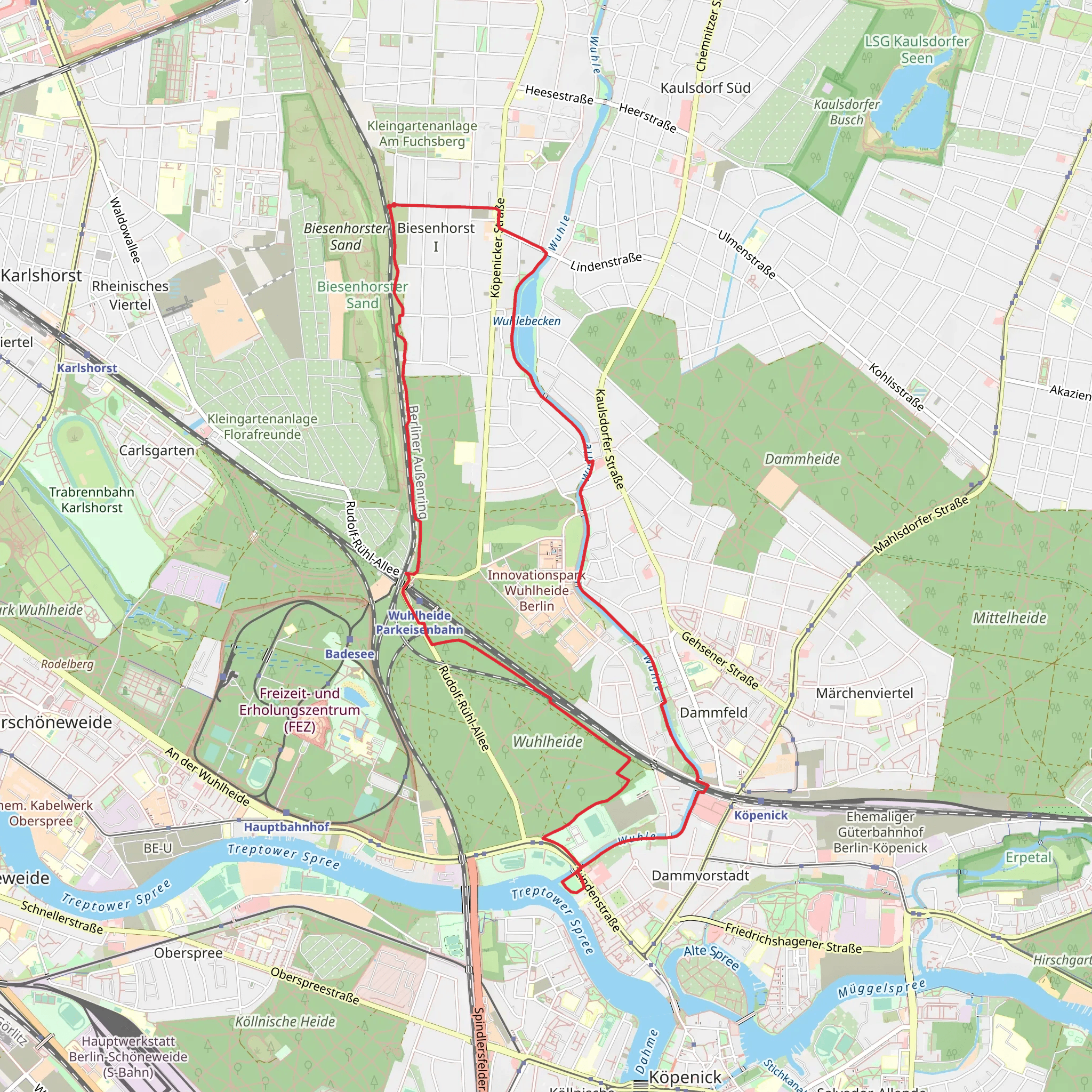
Starting near Berlin, Germany, the Wuhlebecken via Wuhletalweg trail is a delightful loop that spans approximately 11 km (6.8 miles) with virtually no elevation gain, making it an accessible yet engaging hike for many. The trailhead is conveniently located near the Wuhletal S-Bahn station, which can be reached easily by public transport from central Berlin. If you prefer to drive, there are parking facilities available near the station.
Trail Overview
The Wuhlebecken via Wuhletalweg trail offers a mix of urban and natural landscapes, providing a unique hiking experience. The trail meanders along the Wuhle River, offering picturesque views of the waterway and surrounding greenery. As you walk, you'll encounter a variety of flora and fauna, making it a great spot for nature enthusiasts and bird watchers.
Key Landmarks and Points of Interest
Wuhle River: The trail closely follows the Wuhle River for a significant portion, offering serene views and the soothing sound of flowing water. Keep an eye out for ducks, swans, and other waterfowl that frequent the area.
Wuhlebecken: This large basin is a central feature of the trail. It's a great spot to take a break and enjoy the scenery. The basin is also a habitat for various aquatic plants and animals, adding to the trail's biodiversity.
Gardens and Allotments: As you continue, you'll pass by several community gardens and allotments. These areas are often bursting with colorful flowers and well-tended vegetable plots, providing a charming contrast to the natural surroundings.
Historical Significance
The Wuhletalweg has historical roots dating back to the early 20th century when the area was developed to manage the water flow of the Wuhle River. The trail itself has been a popular local route for decades, offering a glimpse into the region's efforts to balance urban development with natural preservation.
Navigation and Safety
Given the trail's proximity to urban areas, navigation is relatively straightforward. However, it's always a good idea to have a reliable navigation tool like HiiKER to ensure you stay on track. The trail is well-marked, but having a digital map can provide additional peace of mind.
Getting There
Public Transport: From central Berlin, take the S-Bahn to Wuhletal station. The trailhead is just a short walk from the station, making it an easy and convenient option for those relying on public transport.
By Car: If you're driving, head towards Wuhletal station where you can find parking facilities. The trailhead is easily accessible from the parking area.
Wildlife and Nature
The Wuhlebecken via Wuhletalweg trail is home to a variety of wildlife. Bird watchers will be delighted by the presence of species such as kingfishers, herons, and various songbirds. The riverbanks and surrounding meadows are also rich in plant life, including wildflowers and native grasses.
Final Tips
Footwear: Given the flat terrain, comfortable walking shoes are sufficient. However, if it's been raining, some sections might be muddy, so waterproof footwear could be beneficial.
Weather: Check the weather forecast before heading out. While the trail is accessible year-round, certain sections might be less enjoyable in heavy rain.
Amenities: There are several spots along the trail where you can find benches and picnic areas, perfect for a rest or a snack break.
This trail offers a perfect blend of natural beauty and urban convenience, making it a must-visit for anyone looking to explore the outskirts of Berlin.
What to expect?
Activity types
Comments and Reviews
User comments, reviews and discussions about the Wuhlebecken via Wuhletalweg, Germany.
4.67
average rating out of 5
3 rating(s)

