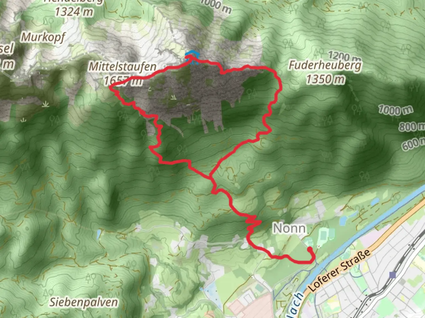
Hochstaufen via Steinerne Jaeger and Bartlmahd
Download
Preview
Add to list
More
13.6 km
~5 hrs 12 min
1491 m
Loop
“Embark on a thrilling adventure through Germany's stunning alpine landscapes, uncovering history and breathtaking views.”
Nestled in the stunning Berchtesgadener Land region of Germany, the Hochstaufen via Steinerne Jaeger and Bartlmahd trail offers an exhilarating loop hike that challenges even the most seasoned adventurers. Spanning approximately 14 kilometers (about 8.7 miles) with an elevation gain of around 1,400 meters (4,593 feet), this trail is rated as extra difficult and demands both physical endurance and mental fortitude.
Getting There
The trailhead is conveniently located near the town of Bad Reichenhall, which is accessible by both car and public transport. If you're driving, you can park at the Padinger Alm, a popular starting point for many hikes in the area. For those relying on public transport, take a train to Bad Reichenhall station and then a local bus or taxi to the Padinger Alm. The journey offers a scenic introduction to the region's breathtaking landscapes.
Trail Overview
The hike begins with a steep ascent through dense forests, where the trail is well-marked but requires careful navigation. Using HiiKER can be particularly helpful to ensure you stay on track. As you climb, the forest gradually gives way to rocky terrain, and the path becomes more rugged and challenging.
Steinerne Jaeger
One of the first significant landmarks you'll encounter is the Steinerne Jaeger, a series of jagged rock formations that have been shaped by centuries of natural erosion. This section of the trail is particularly steep and requires a good level of fitness and sure-footedness. The views from here are spectacular, offering a panoramic vista of the surrounding mountains and valleys.
Bartlmahd
Continuing on, you'll reach the Bartlmahd, a high alpine meadow that provides a brief respite from the strenuous climb. This area is rich in alpine flora, and during the warmer months, it's not uncommon to spot marmots and chamois. The meadow is an ideal spot for a short break, allowing you to soak in the serene beauty of the landscape.
Summit and Descent
The final push to the summit of Hochstaufen is demanding, with a series of switchbacks that test your endurance. Upon reaching the peak, at an elevation of 1,771 meters (5,810 feet), you're rewarded with breathtaking views of the Berchtesgaden Alps and beyond. On clear days, you can see as far as Salzburg, Austria.
The descent follows a different route, looping back towards the trailhead. This section is equally challenging, with steep and rocky paths that require careful attention. Trekking poles can be particularly useful here to help maintain balance and reduce strain on the knees.
Historical Significance
The Berchtesgadener Land region is steeped in history, with its roots tracing back to the early Celtic and Roman periods. The area was historically significant as a salt mining region, which played a crucial role in the local economy. As you hike, you'll pass remnants of old mining trails and structures, offering a glimpse into the region's rich past.
Wildlife and Nature
The trail traverses diverse ecosystems, from dense forests to alpine meadows, each teeming with unique flora and fauna. Birdwatchers may spot golden eagles soaring above, while the forests are home to deer and other wildlife. The changing landscapes provide a dynamic backdrop, making each section of the trail a new adventure.
This hike is not for the faint-hearted, but for those who are prepared, it offers an unforgettable journey through one of Germany's most beautiful alpine regions.

Comments and Reviews
User comments, reviews and discussions about the Hochstaufen via Steinerne Jaeger and Bartlmahd, Germany.
4.29
average rating out of 5
7 rating(s)