Download
Preview
Add to list
More
11.0 km
~2 hrs 56 min
441 m
Loop
“Explore the scenic 11 km Mittelweg trail near Bayreuth, featuring forests, rock formations, and a serene lake.”
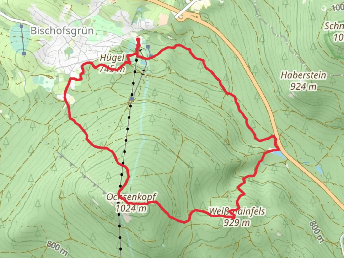
Starting near Bayreuth, Germany, the Schneeloch, Weissmainfels, and Karchessee via Mittelweg trail offers a captivating 11 km (approximately 6.8 miles) loop with an elevation gain of around 400 meters (about 1,312 feet). This medium-difficulty trail is perfect for those looking to immerse themselves in the natural beauty and historical richness of the Franconian Switzerland region.
Getting There
To reach the trailhead, you can drive or use public transport. If driving, head towards the town of Bayreuth and follow signs to the starting point near the village of Bischofsgrün. For those using public transport, take a train to Bayreuth Hauptbahnhof and then a bus to Bischofsgrün. The trailhead is conveniently located near the village center, making it easily accessible.
Trail Highlights
Schneeloch
The trail begins with a gentle ascent through dense forests, leading you to Schneeloch. This area is known for its unique geological formations and lush greenery. As you hike through this section, keep an eye out for various species of birds and small mammals that inhabit the forest.
Weissmainfels
Approximately 4 km (2.5 miles) into the hike, you'll reach Weissmainfels, a striking rock formation that offers panoramic views of the surrounding landscape. This is a great spot to take a break and enjoy the scenery. The elevation gain to this point is about 200 meters (656 feet), making it a moderate climb.
Karchessee
Continuing on, the trail descends slightly before leading you to Karchessee, a serene lake nestled in the forest. This is around the 7 km (4.3 miles) mark. The lake is a perfect spot for a picnic or a quick rest. The area around Karchessee is rich in flora, including various types of ferns and wildflowers, especially in the spring and summer months.
Historical Significance
The region around Bayreuth has a rich history dating back to medieval times. The trail itself follows parts of the Mittelweg, an ancient trade route that has been used for centuries. Along the way, you may come across old stone markers and remnants of historical structures, offering a glimpse into the past.
Navigation and Safety
Given the moderate difficulty of the trail, it's advisable to use a reliable navigation tool like HiiKER to stay on track. The trail is well-marked, but having a digital map can be very helpful, especially in the denser forest sections. Make sure to wear sturdy hiking boots and bring plenty of water, as some parts of the trail can be quite steep and challenging.
Wildlife and Nature
The trail is home to a variety of wildlife, including deer, foxes, and numerous bird species. The forested areas are particularly vibrant in the spring and fall, offering a stunning display of colors. Be mindful of your surroundings and respect the natural habitat by sticking to the marked paths.
This 11 km loop offers a perfect blend of natural beauty, historical intrigue, and moderate physical challenge, making it an ideal choice for hikers looking to explore the Franconian Switzerland region.

What to expect?
Activity types
Comments and Reviews
User comments, reviews and discussions about the Schneeloch, Weissmainfels and Karchessee via Mittelweg, Germany.
5.0
average rating out of 5
1 rating(s)