Download
3D Flyover
Add to list
More
12.4 km
~3 hrs 12 min
435 m
Point-to-Point
“Explore the Pottenstein-Baernfels trail: a 12-km hike through history, nature, and panoramic Franconian vistas.”
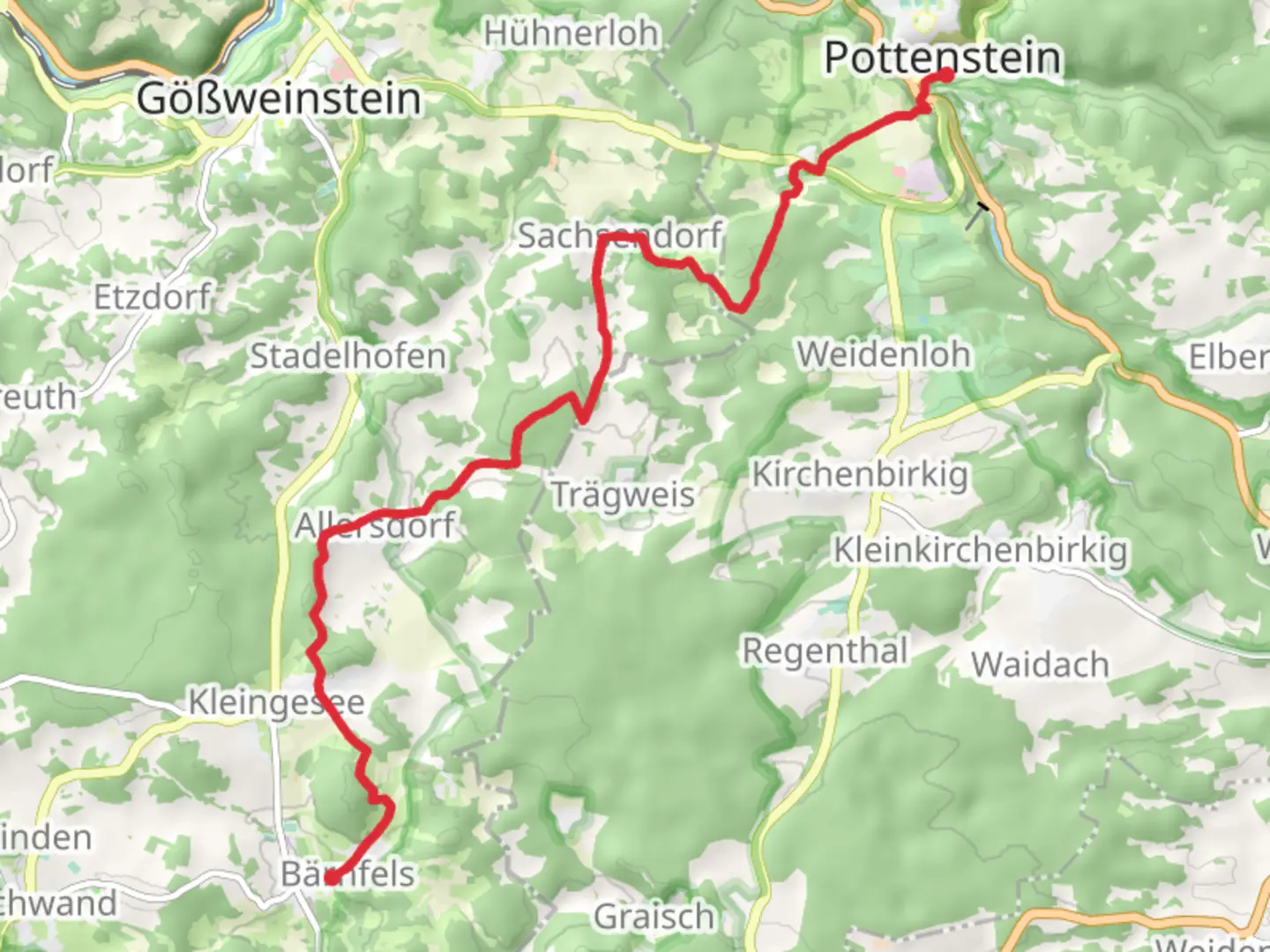
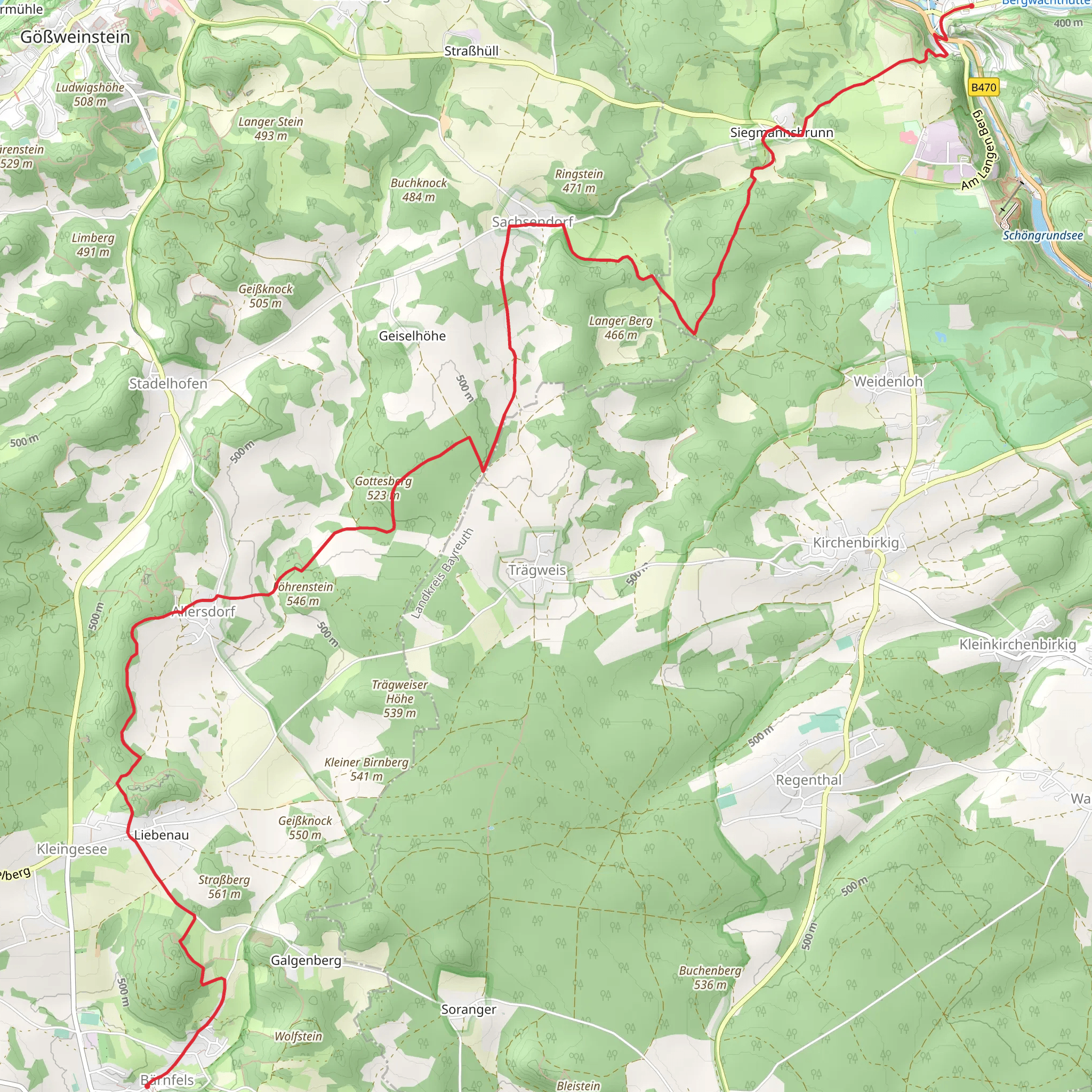
Starting near Bayreuth, Germany, the Pottenstein-Baernfels trail stretches approximately 12 kilometers (7.5 miles) with an elevation gain of around 400 meters (1,312 feet). This point-to-point trail is estimated to be of medium difficulty, making it suitable for moderately experienced hikers.
Getting There
To reach the trailhead, you can either drive or use public transport. If driving, head towards Bayreuth and follow signs to Pottenstein. There are parking facilities available near the trailhead. For those using public transport, take a train to Bayreuth Hauptbahnhof and then a bus towards Pottenstein. The nearest significant landmark to the trailhead is the Pottenstein Castle, a historical site worth visiting before you start your hike.
Trail Overview
The trail begins near Pottenstein Castle, a medieval fortress that offers a glimpse into the region's rich history. As you start your hike, you'll be greeted by a mix of dense forests and open meadows. The first few kilometers are relatively flat, allowing you to ease into the hike.
Significant Landmarks and Nature
Around the 3-kilometer (1.9-mile) mark, you'll encounter the Devil's Cave (Teufelshöhle), one of the largest and most famous show caves in Germany. It's worth taking a short detour to explore the cave's impressive stalactites and stalagmites. Continuing on, the trail begins to ascend, offering panoramic views of the Franconian Switzerland region.
At approximately 6 kilometers (3.7 miles) in, you'll reach the highest point of the trail, gaining about 200 meters (656 feet) in elevation. This section provides stunning vistas of the surrounding valleys and hills. Keep an eye out for local wildlife, including deer and various bird species.
Historical Significance
The region is steeped in history, with numerous castles and ruins dotting the landscape. The trail itself passes by several historical landmarks, including the ruins of Baernfels Castle. This castle dates back to the 12th century and offers a fascinating glimpse into medieval life. The ruins are located around the 9-kilometer (5.6-mile) mark, making it a perfect spot for a rest and some exploration.
Navigation and Safety
Given the trail's moderate difficulty, it's advisable to use a reliable navigation tool like HiiKER to ensure you stay on track. The trail is well-marked, but having a digital map can be invaluable, especially in the more remote sections. Make sure to carry enough water and snacks, as there are limited facilities along the route.
Final Stretch
The last few kilometers of the trail descend gradually towards Baernfels. This section is less strenuous, allowing you to enjoy the serene beauty of the Franconian landscape. The endpoint is near the village of Baernfels, where you can find local inns and restaurants to relax and refuel.
This trail offers a perfect blend of natural beauty, historical landmarks, and moderate physical challenge, making it a rewarding experience for any hiker.
Comments and Reviews
User comments, reviews and discussions about the Pottenstein-Baernfels, Germany.
4.4
average rating out of 5
5 rating(s)
