Download
Preview
Add to list
More
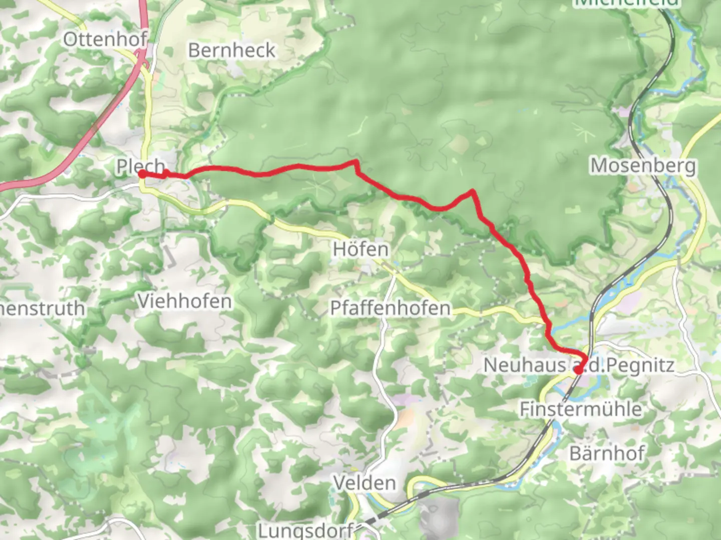
8.6 km
~1 hrs 57 min
147 m
Point-to-Point
“The Neuhaus-Plech trail offers scenic views, historical landmarks, and moderate difficulty for experienced hikers.”
Starting near Bayreuth, Germany, the Neuhaus - Plech trail spans approximately 9 km (5.6 miles) with an elevation gain of around 100 meters (328 feet). This point-to-point trail is estimated to be of medium difficulty, making it suitable for moderately experienced hikers.
Getting There
To reach the trailhead, you can take public transport or drive. If you're using public transport, Bayreuth is well-connected by train and bus services. From Bayreuth, you can take a regional bus to Neuhaus, which is the starting point of the trail. If you prefer to drive, there are parking facilities available in Neuhaus.
Trail Overview
The trail begins in the quaint village of Neuhaus, known for its charming half-timbered houses and serene countryside. As you set off, you'll be greeted by rolling hills and lush forests, typical of the Franconian landscape. The initial part of the trail is relatively flat, allowing you to ease into the hike.
Significant Landmarks and Nature
Around the 2 km (1.2 miles) mark, you'll come across the first significant landmark, the ruins of a medieval castle. This site offers a glimpse into the region's historical significance and provides a great spot for a short break and some photography.
Continuing on, the trail gradually ascends, offering panoramic views of the surrounding valleys and forests. At approximately 4 km (2.5 miles), you'll reach a dense forest area. This section is particularly rich in wildlife, so keep an eye out for deer, foxes, and a variety of bird species. The forest canopy provides ample shade, making this part of the hike quite pleasant even on warmer days.
Mid-Trail Highlights
Around the halfway point, you'll encounter a small, picturesque stream. This is an ideal spot to rest and enjoy a snack while listening to the soothing sounds of flowing water. The elevation gain becomes more noticeable here, but the trail remains manageable with well-marked paths.
Historical Significance
As you approach the 7 km (4.3 miles) mark, you'll pass through a region that played a significant role during the medieval period. The area is dotted with ancient stone markers and remnants of old trade routes, offering a fascinating glimpse into the past.
Final Stretch
The final stretch of the trail leads you through open meadows and farmland, gradually descending towards the village of Plech. The descent offers sweeping views of the Franconian countryside, making for a picturesque end to your hike.
Navigation and Safety
For navigation, it's recommended to use the HiiKER app, which provides detailed maps and real-time updates. The trail is well-marked, but having a reliable navigation tool ensures you stay on track.
Ending Point
The trail concludes in the village of Plech, where you can find local eateries and small shops to relax and refuel. Public transport options are available from Plech to return to Bayreuth or other nearby towns.
This trail offers a balanced mix of natural beauty, historical landmarks, and moderate physical challenge, making it a rewarding experience for hikers.

Comments and Reviews
User comments, reviews and discussions about the Neuhaus - Plech, Germany.
4.5
average rating out of 5
2 rating(s)